Carpathian Biosphere Reserve
There are many interesting places in Ukraine, but the Carpathian Biosphere Reserve, which is located in the heart of the Carpathians, is undoubtedly worthy of special attention for its attractiveness and uniqueness.The Carpathian BiosphereReserve is a protected area in Ukraine, a biosphere reserve of international importance. It is located within the Rakhiv, Tyachiv, Khust, and Vynohradiv districts of the Zakarpattia region.
Here you can conquer the largest peaks of Ukraine and see alpine lakes, endangered species of animals and plants. Therefore, if you like vacationing in the mountains, you should definitely visit this place.
The Carpathian Nature Reserve was established in 1968 in the Zakarpattia region to preserve wildlife areas unique to Europe, including especially valuable beech virgin forests. The task of the reserve is to protect and restore endangered flora and fauna, including endemics of the Ukrainian part of the Carpathians.
The idea of protecting the nature of this part of the Carpathians appeared in the early 20th century. Over time, several forest reserves were created in the Chornohora and Marmoroska areas. In 1958, the Ugolsky Forest Reserve was established on the southern slopes of the Krasna massif with an area of 4,600 hectares. In 1969, the Shyroko-Luzhanka Floristic Reserve was established in the Luzhanka River basin with an area of 5644 hectares. In 1968, the Carpathian Biosphere Reserve was organized on the basis of the existing protected areas, with an area of 12600 hectares. In 1997 and 2010, the President of Ukraine adopted decrees on expanding the territory of the biosphere reserve. As of 2019, the area of the reserve is 58,035.8 hectares. And since 1992, the reserve has been included in the international list of UNESCO biosphere reserves.
The Carpathian Biosphere Reserve includes six separate massifs, as well as two botanical reserves of national importance. These massifs are located at altitudes ranging from 180 (Narcissus Valley) to 2061 (Hoverla) meters above sea level:
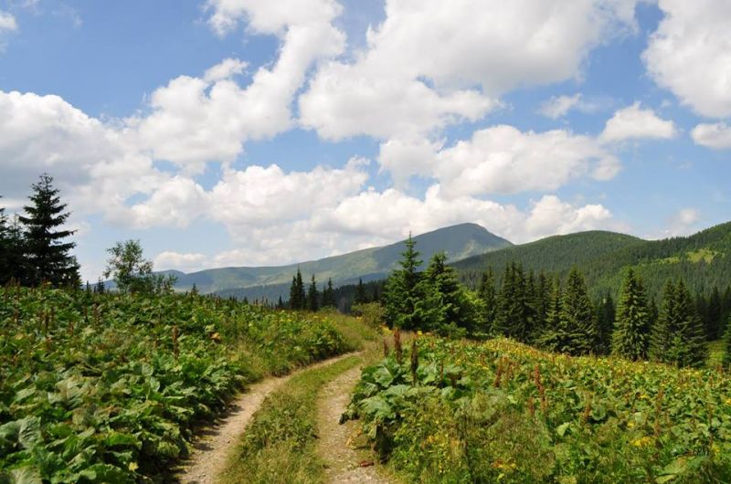
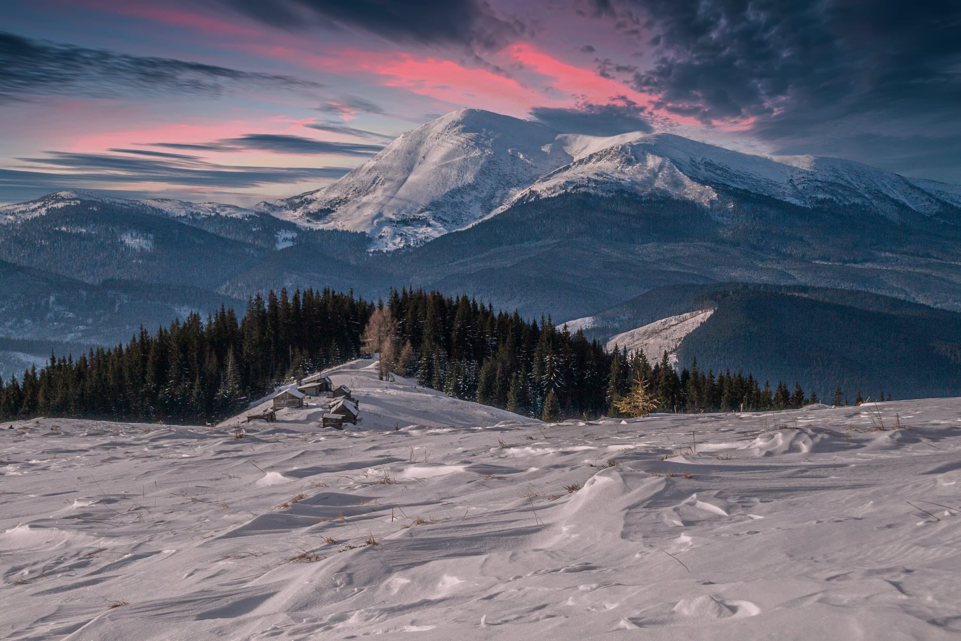
- The Chornohora reserve is located on the southern slope of the Chornohora ridge (700-2061 m). Its area is 16375 hectares. It is here that the highest peak of the Ukrainian Carpathians, Mount Hoverla (2061 m), is located. The main ridge of Chornohora is formed by flysch rocks. The relief of the highlands has traces of ancient glaciation. The climate of the Chornohora massif is temperate continental. With increasing altitude, the air temperature decreases and the amount of precipitation increases. The average temperature in January is -6.8°C, in July - +15.7°C, and the average annual temperature is +5.4°C. The annual precipitation is 1001 mm. The White Tisza River has its source on the territory of the massif. The flora here is diverse, dominated by forests. Mixed and deciduous coniferous forests grow up to an altitude of 1200 m, with spruce forests above. The subalpine zone is characterized by crooked forests, where large areas are covered by grassy areas. The vertebrate fauna is characterized by taiga and alpine species. In the highlands (about 1800 m in altitude), snow voles and alpine shrews are found, which are listed in the Red Book of Ukraine. The typical inhabitants of coniferous and mixed forests are the three-toed woodpecker, yellow-headed kingfisher, white-throated blackbird, grouse, lynx, bear, etc.
- The Svydovets reserve covers an area of 6580 hectares (600-1883 m). The mountains of Svydovets, like most of the Ukrainian Carpathians, have a fleche-like structure. The main ridge has well-preserved glacier traces. The climate of Svydovets is humid, cool and moderately cold. The average temperature in January is -3.4°C, in July - +18.4°C, and the average annual temperature is +8°C. Annual precipitation is 930 mm. The climate of the highlands is cold. The soil and climatic conditions of the southern part of the slope are optimal for beech - forests with this tree rise to an altitude of 1380 m, which is the highest limit in the Ukrainian Carpathians. Beech and sycamore and beech and ash and sycamore forests are also common on rocky areas. The herbaceous cover of the forests includes scolopendra, lunaria reviving, reddish skullcap, and green asplenium. Fir grows on the northern slopes, and spruce grows near the upper border of the forest. Above the forest belt, there is a widespread crooked forest of green doucetia and Siberian juniper. The highlands of Svydovets near the peaks of Mala Bliznytsia (1778 m) and Velyka Bliznytsia (1883 m) are particularly interesting from a floristic point of view: here grow such rare arcto-alpine species as alpine bartsia, eight-petaled dryad, alpine diphasiastrum, chestnut sytnyk, late lloydia, alpine aster, pink rhodiola, and spear willow. In the Ukrainian Carpathians, only on the territory of this massif grow aizo-like croup, Salzburg's eye, saxifrage perelomnikovyi and others. Alpine squirrels, blackened eagles, alpine swifts, etc. are also rare.
- TheMaramorosky reserve is located on the northern slope of the Rakhiv Mountains (750-1940 m) on the territory of 8990 hectares. The main mountain is Pip Ivan Maramorosky (1940 m). The massif is formed by hard crystalline rocks, which determines the specific features of the relief, soil cover and vegetation. The relief of Marmoroshchyna is characterized by deep intermountain valleys, numerous rocky ridges and peaks. Within the massif there are the basins of the Bilyi and Kvasnyi streams, which are, respectively, tributaries of the Tisa and the White Tisa. The Kvasnyi basin is characterized by a cool climate. The White Stream basin is characterized by a warmer climate. The average temperature in January is -4°C, in July - +18.5°C, and the average annual temperature is +7.9°C. The average annual rainfall is 1087 mm. The climate is cold in the highlands. The Marmaros massif is characterized by a peculiar vegetation cover. This is due to its geological structure. At lower levels, mixed deciduous-coniferous and deciduous forests are common. Beech forests are found on the southern slopes and on calcium-rich soils. Mixed forests occupy the largest areas. In cold climates, pure spruce forests are common at the upper forest boundary (at an altitude of 1600-1700 m). Higher up, there are subalpine and alpine meadows with fragments of crooked woodland. The fauna of the Marmarosh region is similar to that of Chornohora, but has its own peculiarities. Due to the rocky landscape, the inhabitants of rocky placers, such as snow voles and alpine shrews, are better represented here. Only this massif is home to the peregrine falcon, which prefers rocks.
- TheKuziy-Trybushansky protected area is located in the south of the Svydovets ridge (350-1409 m) in the forest zone on an area of 4925 hectares. The highest peak is Mount Lysyna (1409 m). In the south, there are Jurassic marble-like limestones that form numerous rocky outcrops. This area is characterized by both climate and vegetation. Under the influence of warm air from the Marmarosh Valley, conditions were created here for the spread of heat-loving plants in the highlands. For example, petiolate (common) oak and rock oak grow at an altitude of 1090 m (their highest habitat in Ukraine). Plants such as the berry yew deserve special attention, as they have been preserved on limestone cliffs under the protection of sycamore-beech forests. Beech forests cover a significant area here. Sometimes you can also find spruce forests. The fauna is typical for the forests of the Ukrainian Carpathians. Amphibians are represented by the spotted salamander, Carpathian newt, grass frog, and mountain toad. Predatory mammals include foxes and martens, and sometimes bears, lynxes, forest cats, and badgers. Caves and abandoned adits have become shelters for 8 species of bats, four of which are rare - the long-eared and broad-eared bats.
- TheUholsko-Shyrokoluzhanskyi protected area is located on the southern slopes of the Krasna valley and its powerful branch, the Menchil valley, at altitudes of 400-1280 m. The total area of the protected area is 15580 hectares. The geological foundation of the massif is formed by thick layers of flysch. The Uholska area of the massif is characterized by large limestone blocks with well-developed karst formations. The height of some limestone cliffs reaches seventy meters. There are more than thirty caves here, including the largest cave in the Carpathians, Druzhba, with a total length of about 1 km. A late Paleolithic site of an ancient man was found in the Molochnyi Kamen cave. The highest peaks of the protected massif are Uholska Plesha (1108 m), Poganska Kichera (1092 m), and Vydnozhanska Kichera (1072 m). The massif is located in the zone of beech forests, which form the upper boundary of the forest at an altitude of 1200-1300 m. The climate of the area is warm, moderate and humid in the foothills, cool and very humid in the highlands. A powerful ridge protects the massif from northerly winds - winds from the west and southwest prevail. The average monthly temperature in January is -4.5 degrees, in July - +17.2 degrees, and the average annual temperature is +7.1 degrees. The average annual rainfall is 1390 mm. The flora of the massif includes more than 700 species. The greatest floristic richness is inherent in limestone outcrops, where Cossack juniper (the only place of growth in the Carpathians), rock oak, laxative, broadleaf linden, berry yew (about 1.5 thousand specimens), and specimens), as well as more than ten rare herbaceous species, including alpine arum, red mace, common bindweed, slender elm, Carpathian bells, dog's tooth erythronium, triple-cut corkscrew, Mattioli's cortex, false-twitch cocksfoot, Preuss's bearded broom, panicle saxifrage, and Spanish stonecrop. The fauna of the beech virgin forests of the massif is very peculiar. Here you can find both purely "taiga" species - lynx, long-tailed owl, black woodpecker, bullfinch, and species characteristic of broadleaf forests. 3 rare animals listed in the Red Data Book of Ukraine have been spotted: lesser cutthroat trout, ermine, otter, owl, black stork, forest snake, Carpathian newt, etc. The bat fauna is very diverse, most of which are associated with karst caves. In total, there are 20 species, 8 of which are rare. In winter, the accumulations of bats in underground shelters number about 1,500 individuals, the bulk of which are big and sharp-eared nights. More than 1000 bats belonging to 14 species hibernate in the Druzhba cave alone. Rare species of mollusks listed in the Red Book of Ukraine, such as grain granaria, serulina toothed, and oat chondrina, were found in Zakarpattia only on the territory of this massif. The rivers are home to trout, grayling, river dace, and the Hungarian lamprey, which is not a true fish but a roundhead.
- The Narcissus Valley Reserve is a protected area located at an altitude of 180-200 m in the Kireshi tract, 4 km from the city of Khust in Zakarpattia region. The area is 256.5 hectares. This is a unique botanical site, which protects the largest (total area - 85 hectares) in Central Europe center of narrow-leaved daffodil. This Central European alpine species is distributed in the Alps, Balkans and Carpathians at altitudes of 1100-2060 meters. The population in this lowland locality has been preserved since the post-glacial period and is relict in nature. In 1980, the narrow-leaved narcissus was included in the Red Data Book of Ukraine. The vegetation of the massif is 90% represented by herbaceous and grass-grass communities, among which red fescue, bunchgrass, meadow foxtail, and soft bromus predominate. Sedge species are common in areas with high humidity. In total, 498 species of various plants are represented in the Narcissus Valley, including 15 species of flowers listed in the Red Data Book of Ukraine and 16 species of orchids. In terms of its faunal composition, the Narcissus Valley differs sharply from other protected areas of the Carpathian Biosphere Reserve. Animals of the floodplain meadows of the Zakarpattia Plain are represented here. The mammalian fauna is represented by the common vole, field mouse, small mouse, muskrat, hare and other species not typical for the mountain ranges of the reserve. In total, there are 104 species of birds in the Narcissus Valley. Among them, meadow warblers, common buntings, and gray wagtails predominate. In the more humid areas, goldfinches and meadow warblers are common. Pheasant can be found in the shrubs along the Khustets River. Very rarely you can find a remez here.
- The Chorna Hora Botanical Reserve is a botanical reserve. It is located in the Vynohradiv district of Zakarpattia region, between the town of Vynohradiv and the village of Mala. Vynohradiv and the village of Mala Kopanya. The area is 823 hectares. Within the reserve there is a mountain of the same name, a volcanic remnant - Chorna Hora (565 m). The mountain belongs to the so-called island mountains, that is, it is not part of any mountain range or massif (some sources refer the mountain to the Vygorlat-Gutyn volcanic range). On three sides, Chorna Hora is surrounded by a plain (the Zakarpattia Lowland), and only its northern slopes turn into a gentle hilly rise that extends northeast to the Tupy massif. The Tysa River flows along the eastern slopes of the mountain, which in several places has formed high rocky cliffs. The geological base is formed by andesites, liparites, and tuffs, which in some places come to the surface as cliffs. On these volcanic rocks, brown soils of various thicknesses were formed. Floristically, the areas of steppe, rocky and Mediterranean phytocoenoses on the steep southern slopes are particularly interesting. Rare species for the Ukrainian Carpathians grow here, such as steppe cherry, laxative acorn, pinnate broom, Austrian zinnow, beautiful feather grass, viper's onion, bunchy onion, crested corn, fescue, Transylvanian pearlwort, Hungarian cockscomb, and others. In total, about 400 species of higher plants grow on the territory of the reserve. The fauna of Chorna Hora is characterized by the presence of specific heat-loving species, including invertebrates. In 1997, it became part of the Carpathian Biosphere Reserve.
- The Yulivska Hora Botanical Reserve is the smallest area of the Carpathian Reserve, located in the Tisa River valley on the southwestern spurs of the Hutyn massif (part of the Vyhorlat-Hutyn ridge) and bounded in the east by the state border with Romania. The reserve covers an area of 176 hectares. The location in the area with the warmest climate in the Ukrainian Carpathians played a significant role in the formation of vegetation cover. Rocky oak groves, oak-beech forests, and Dalecamp oak are widespread. There are also unique for Ukraine massifs of silver linden. The reserve is the only natural habitat of Burgundy oak in Ukraine. The grass cover is dominated by forest-steppe species. In 1997, it became part of the Carpathian Biosphere Reserve.
All six two-thousanders are located on the territory of this massif: Hutyn Tomnatyk (2016 m), Petros (2020 m), Pip Ivan Chornohirsky (2028 m), Brebeneskul (2035 m), Rebra (2001 m), and the highest peak of Ukraine - Hoverla. The massif is known for its alpine lakes, one of which is Nesamovyte. It is home to Lake Brebeneskul, the highest alpine lake formed at an altitude of 1801 meters.
A very rich flora and fauna is represented in this area, which is why it has received the status of a nature reserve. Here you can see animals and plants that are listed as endangered species. The natural flora is represented by 2864 species, 131 of which are included in the Red Book of Ukraine.
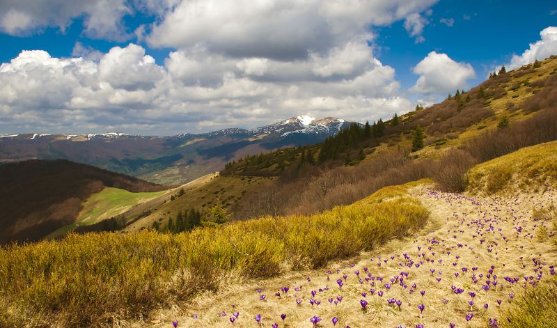
The forests in the mountains are mostly beech, coniferous, spruce, oak, and hornbeam. Flowers create a unique beauty in spring, namely alpine bells, dumbweed, sugainia, golden grasshopper, asters, and violets. In June, the bright red flowers of the East Carpathian rhododendron (popularly known as red rue) bloom.
The fauna is striking in its diversity, with 4383 species in total. The Red Book includes 75 species and 20 species are included in the European Red List. You can meet the following animals: snow mole, alpine mole, deer, lynx, brown bear, roe deer, wolf, forest cat, gray owl.
Aninteresting fact: there are as many as 21 species of bats in the mountains.
Often, the declaration of a national park or reserve is preceded by the creation of one or more objects of the nature reserve fund of local importance. However, their status is usually preserved. The territory of the Carpathian Biosphere Reserve includes the following objects of the nature reserve fund of Ukraine:
- Chorna Hora National Nature Reserve, botanical;
- Botanical reserve of the national importance "Yulivska Gora";
- Botanical reserve of national importance "Zatinky and Teresyanka";
- Botanical natural monument of national importance "Twin Rocks";
- Nature monument of national importance "Long Stream", botanical;
- Local nature reserve "Smerekovi Karpaty" (partially), forest;
- Local Nature Reserve "Weymouth Pine", forest;
- Kisva Local Nature Reserve, ichthyological;
- Local Nature Monument "European Cedar", botanical;
- Local Nature Monument "Mountain Pine Zherep", botanical;
- Local Nature Monument "Mountain Pine Zherep", botanical;
- Local Nature Monument "Trofanets Waterfall", hydrological;
- Local natural monument "Lake Brebeneskul", hydrological;
- Local natural monument "Svydovets Waterfall", hydrological;
- Local natural monument "Dzherelo №1", hydrological;
- Local natural monument "Dzherelo №2", hydrological;
- Local natural monument "Dzherelo №3", hydrological;
- Local natural monument "Dzherelo №1", hydrological;
- Local natural monument "Dzherelo b/n", hydrological;
- Local natural monument "Trostyanets Rocks", geological;
- Svydovetski rocks, geological natural monument of local importance;
- Geological natural monument of local importance "Druzhba Cave";
- Local natural monument "Stalactite cave Chur", geological;
- Local natural monument "Pearl Cave", geological;
- Local natural monument "Stalactite cave under the Hreben", geological;
- Local natural monument "Stalactite cave (Viv Cave)", geological;
- Local natural monument "Stalactite cave Molochnyi Kamen", geological;
- Local natural monument "Strychak-rock Kamianni Vorota", geological;
- Local natural monument "Leaky rock cliff", geological;
- Local natural monument "Bare rocks on the bank of the Kvasna River", geological;
- Local natural monument "Top of Velykyi Kamin mountain", geological;
- Local natural monument "Rock-stream above Bilyi Potok", geological.
The Carpathian Biosphere Reserve (CBR) is located on the territory of Rakhiv, Tyachiv, Khust and Vynohradiv districts of Zakarpattia region, with the administration of the reserve located in Rakhiv. The protected area can be reached from Kyiv, Lviv, and Ivano-Frankivsk by train to Rakhiv. Then you need to change to buses that depart from the bus station. They will take you to the part of the reserve that interests you the most.
Visit this extraordinary place of nature in Ukraine, which is the pearl of the Carpathians. Enjoy your vacation!
Accommodation around Carpathian Biosphere Reserve:


Які маршрути проходять повз Carpathian Biosphere Reserve?
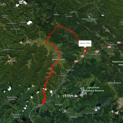
Пропонуємо пройти такі туристичні (пішохідні) маршрути через/біля Carpathian Biosphere Reserve: Драгобрат, через г. Близниця до м. Рахів, с. Ділове, через г. Піп Іван Мармароський до с. Костилівка, м. Рахів, через г. Близниця до с. Кваси, м. Рахів, через г. Близниця, г. Трояска, г. Братківська до с. Осмолода, м. Рахів, через г. Близниця, г. Трояска, г. Татарука, г. Братківська, г. Чорна Клева, с. Чорна Тиса до смт. Ясіня, с. Ділове, через г. Жербан, г. Піп Іван Мармароський до м. Рахів


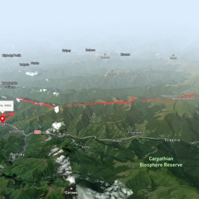
Драгобрат, через г. Близниця до м. Рахів
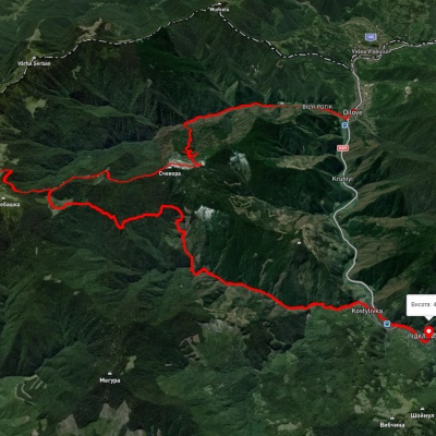
с. Ділове, через г. Піп Іван Мармароський до с. Костилівка
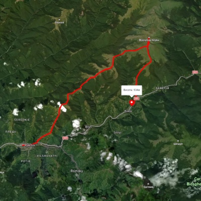
м. Рахів, через г. Близниця до с. Кваси
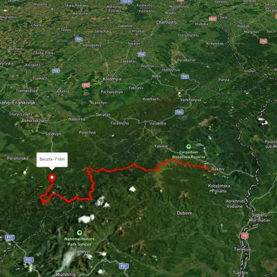
м. Рахів, через г. Близниця, г. Трояска, г. Братківська до с. Осмолода