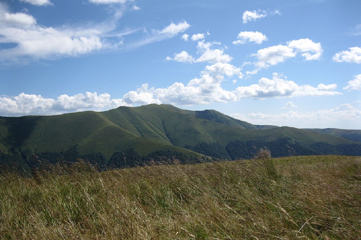
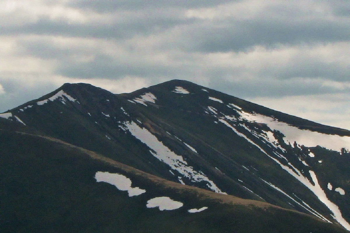
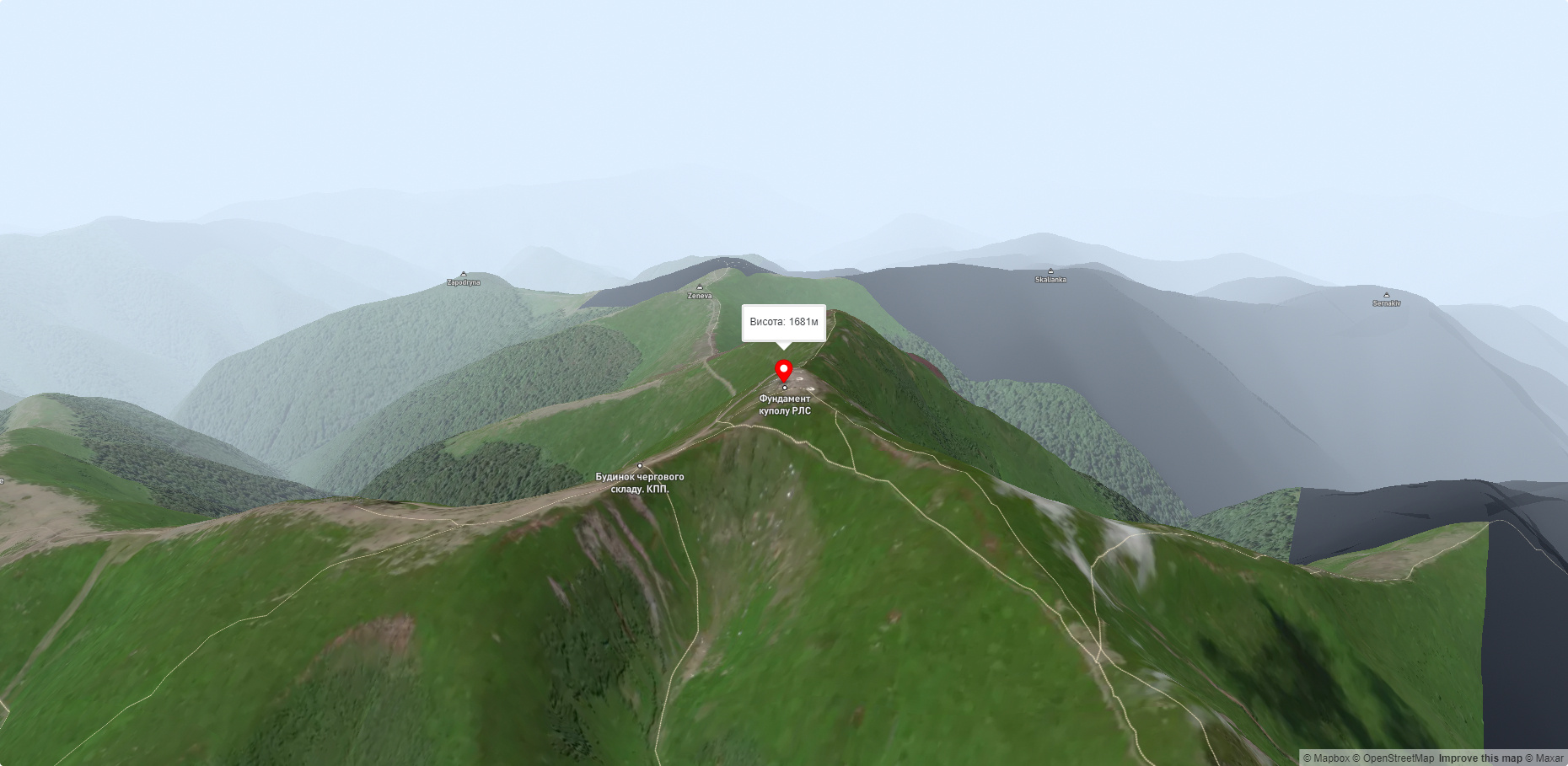
Stiy (also known as Stoy) is the highest peak of the Polonyna Borzhava mountain range on the Polonyna ridge (Polonyna Beskyd), located in the inner zone of the Ukrainian Carpathians. It is located within the Transcarpathian region. The height is 1681 meters.
The slopes of Mount Stiy are steep in the western direction, and gentler in the southern and eastern directions. Up to an altitude of 1100-1200 meters, the peak is covered with beech and beech-spruce virgin forests, and above the forest belt - with blueberry thickets.
On the western slopes of Mount Stiy there is a forest reserve of national importance called Rosishnyi.
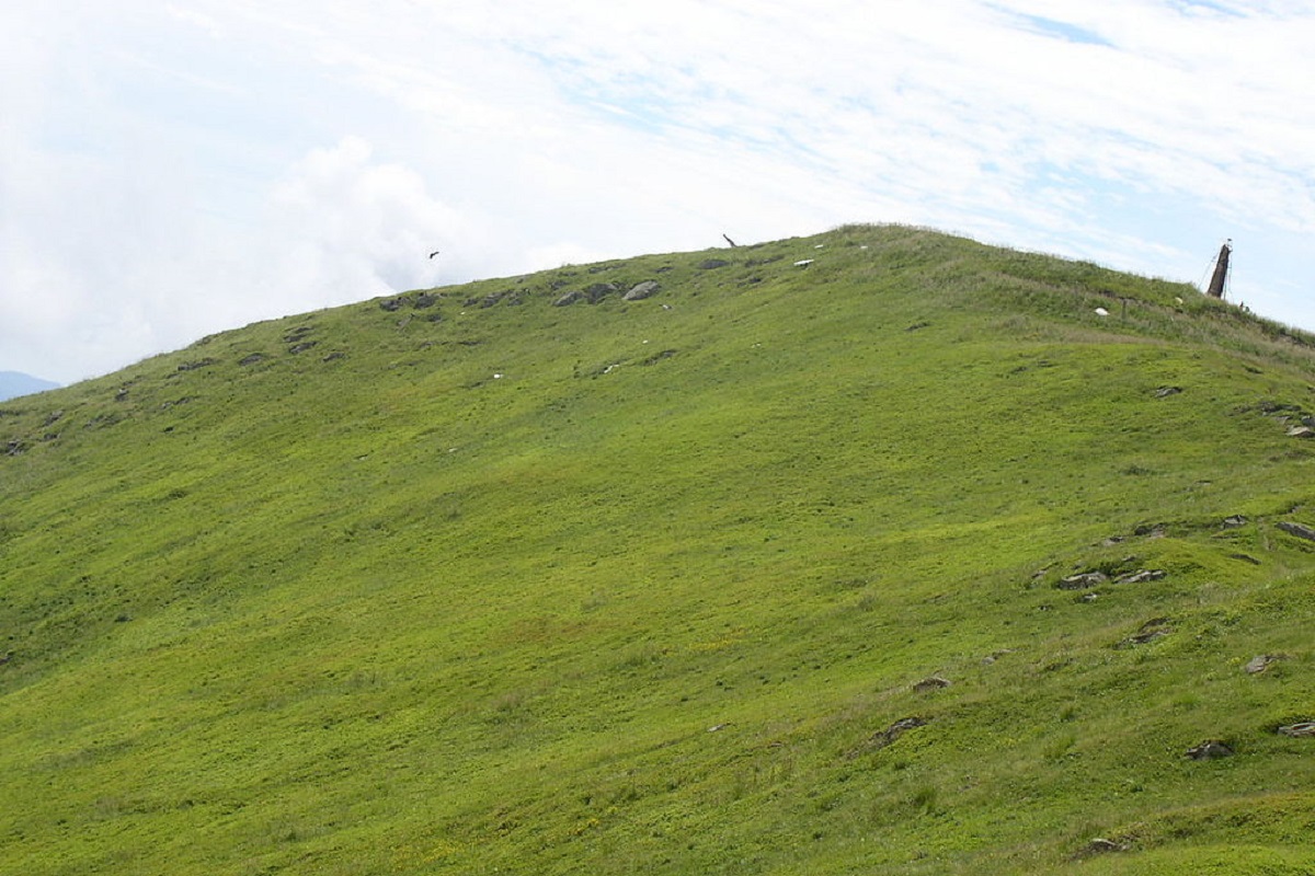
During the Soviet era, a radar station operated at the top. Later it was dismantled and today only numerous ruins remind us of the former radar.
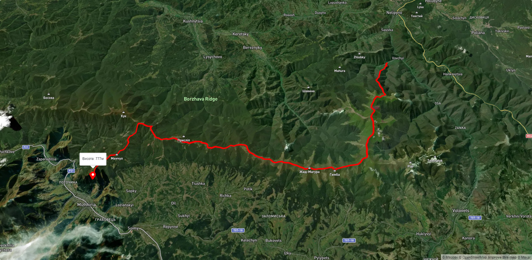
The nearest settlement is the village of Vovchyi in Svaliava district, Zakarpattia region.
Accommodation around Mt.:


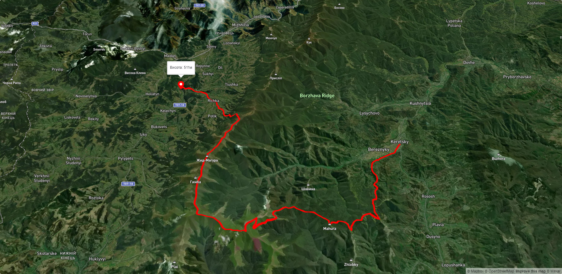
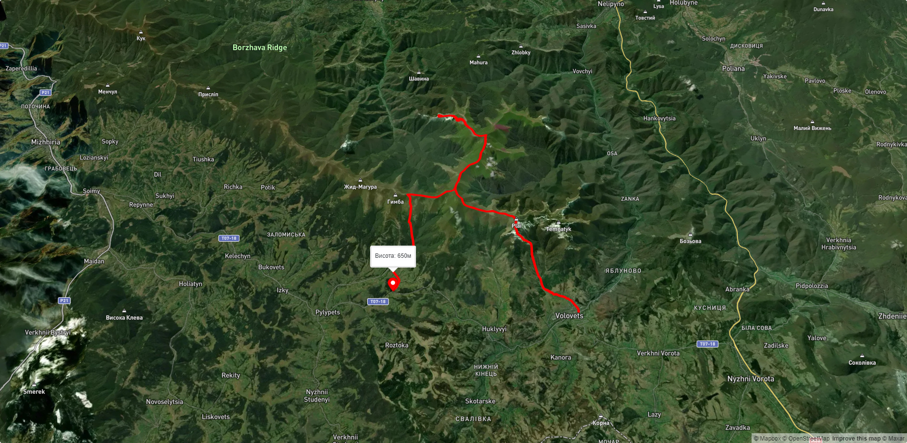
Nearby hiking trails near Mt.:
Які маршрути проходять повз Mt.?
Пропонуємо пройти такі туристичні (пішохідні) маршрути через/біля Mt.: с. Вовчий, через г. Стій, г. Гемба, г. Жид-Магура, пер. Присліп до смт. Міжгір'я, с. Керечки, через г. Стій, г. Великий Верх, г. Гемба, г. Жид-Магура до с. Ричка, смт. Воловець, через г. Плай, г. Великий Верх, г. Стій, вдсп. Шипіт до с. Подобовець, с. Сасівка, через. г. Іволове, г. Стій, г. Великий Верх, вдсп. Шипіт, г. Плай до смт. Воловець, с. Березники, через г. Іволове, г. Стій, г. Зенева до с. Вовчий, смт. Воловець, через г. Великий Верх, г. Стій до с. Вовчий