Mount Velyka Popadia
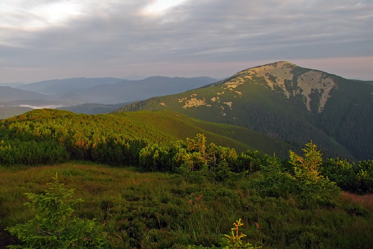
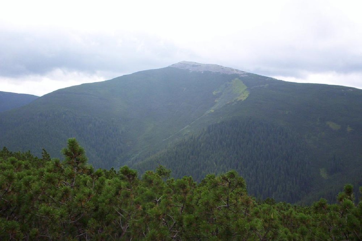
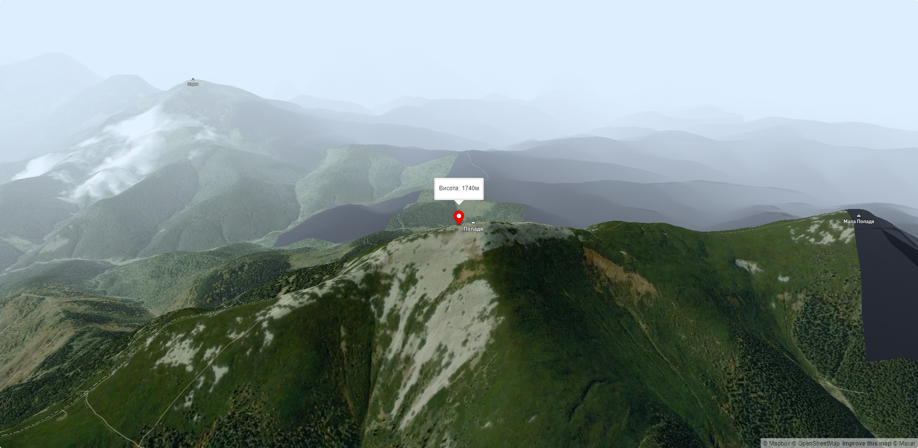
Mount Popadia (also known as Velyka Popadia) is located in the watershed of the upper reaches of two rivers, the Teresva and the Limnytsia, on the border of Rozhniativ district of Ivano-Frankivsk region and Tyachiv district of Zakarpattia region. The height of the peak, which is located on the territory of the Ukrainian Carpathian Mountains, is 1740 meters.
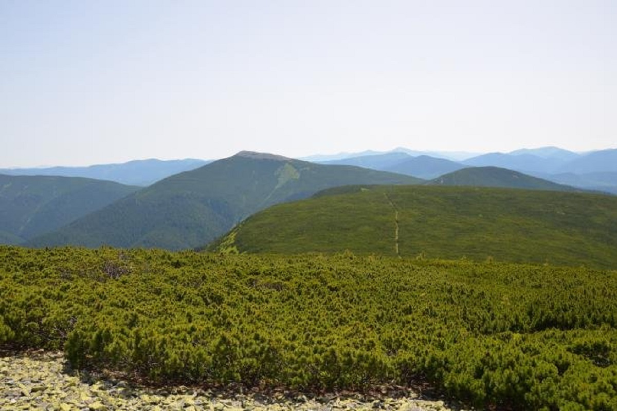
The northern part of Popadia lies within the Grofa landscape reserve, while the southern part is part of the Bradul reserve. As on other peaks of the Gorgan massif, stone scree is widespread on the mountain.
The slopes of the lower part of Mount Popadia are covered with spruce and beech-spruce old-growth forests, while the summit is covered with dense, difficult-to-pass shrubbery (fir or alpine pine).
It is worth noting that at the very top, there are still border posts that marked the border between Czechoslovakia and Poland until 1939, and trenches from the First World War remain in good condition.
Popadia, like the other Gorgan peaks, offers a magnificent view. From the mountain you can see Mala Popadia (in the northwest), Parenki and Grofa (in the north), Studeniec and Velyka Sywula (in the east).
The nearest settlement is the village of Osmoloda.
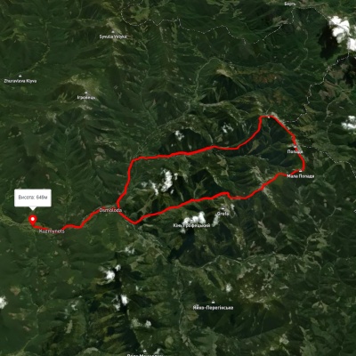
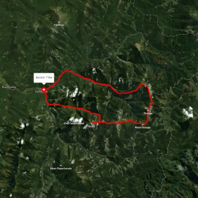
Accommodation around Mount Velyka Popadia:


Nearby hiking trails near Mount Velyka Popadia:

Які маршрути проходять повз Mount Velyka Popadia?
Пропонуємо пройти такі туристичні (пішохідні) маршрути через/біля Mount Velyka Popadia: с. Татарів, через г. Синяк, г. Довбушанка, г. Чорна Клева, г. Братківська, г. Сивуля, г. Кінець Горгану, г. Попадя, г. Грофа до с. Мислівка, с. Осмолода, через пол. Плісце, г. Коретвина, г. М. Попадя, г. В. Попадя до с. Осмолода, с. Осмолода, через г. Грофа, г. Паренки, г. Коретвина, г. Попадя до с. Осмолода, Східно-Карпатський туристичний шлях, с. Мислівка, через г. Яйко-Ілімеське, г. Молода, г. Грофа, г. Попадя до с. Осмолода, с. Осмолода, через г. Грофа, г. Коретвина, г. Попадя до с. Осмолода