Mount Tarnitsa
Tarnytsia is a peak in the Hryniavskyi mountain range of the Ukrainian Carpathians. The mountain is located in the Verkhovyna district of Ivano-Frankivsk region, southwest of the village of Probiynivka.
The height is 1553 meters (according to other information - 1558 m).
The top of Mount Tarnitsa is unforested and has a flat shape.
The slopes of the mountain in the western and eastern directions are very steep and inaccessible, the southern slopes are gentler, smoothly turning into a short ridge that extends to the neighboring peak, Mount Baba Liudova.
The nearest settlement is the village of Probiynivka in Verkhovyna district of Ivano-Frankivsk region.

Accommodation around Mount Tarnitsa:


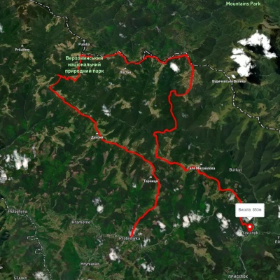
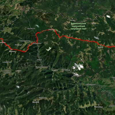
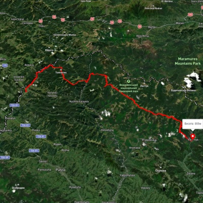
Nearby hiking trails near Mount Tarnitsa:
Які маршрути проходять повз Mount Tarnitsa?
Пропонуємо пройти такі туристичні (пішохідні) маршрути через/біля Mount Tarnitsa: с. Пробійнівка, через г. Тарниця, г. Пнів’є, г. Чивчин до с. Шибене, с. Шепіт, через г. Яровиця, г. Пнів'є, г. Тарниця до с. Пробійнівка, с. Шепіт, через г. Яровиця, г. Пнів'є, г. Масний Присліп до с. Шибене, г. Чивчин, через хр. Пнєв'є, хр. Ватунарка, г. Баба-Людова до с. Стовпні Горішні, г. Яровиця, через хр. Прилучний, г. Пнів'є до Свято-Троїцького Монастира, с. Красник, через г. Кринта, г. Зміїнська, с. Шибене, пол. Веснарка, оз. Марічейка до с. Дземброня


