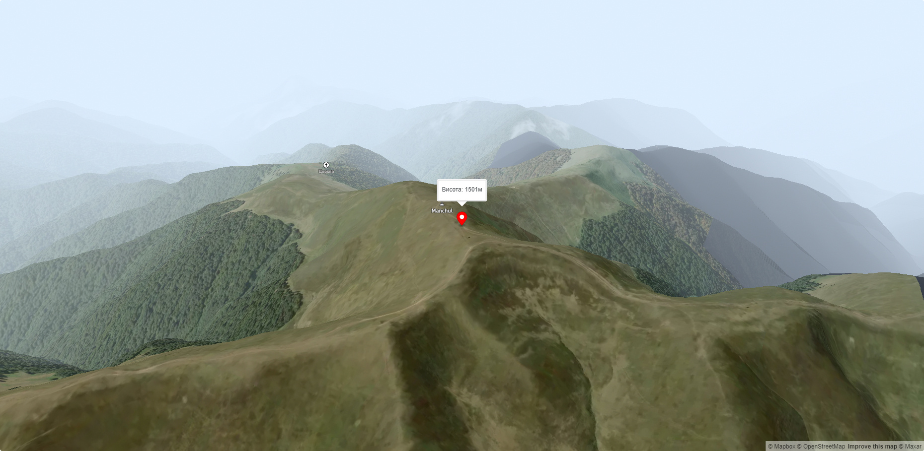
Mount Manchul
Mount Manchul (also known as Mount Menchul, Polonyna Manchul) is a 1501-meter peak in the Ukrainian Carpathians. It is located on the border of Khust and Tyachiv districts of Zakarpattia region and southwest of the Polonyna Krasna massif, which is part of the Polonyna Beskydy.
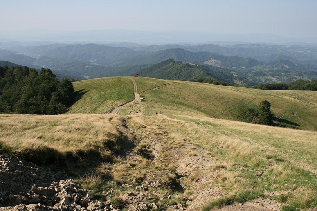
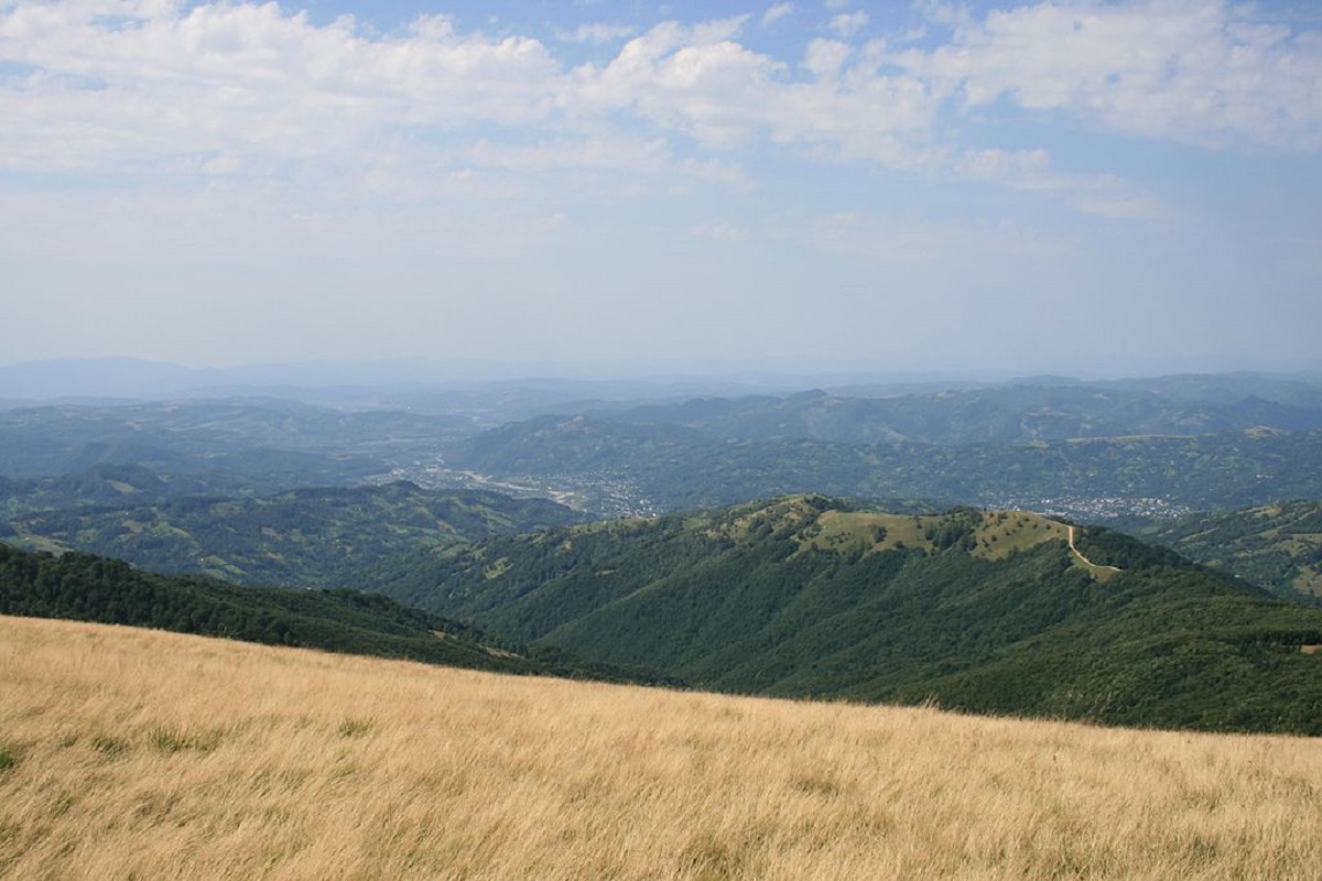
Manchul has the shape of a ridge (meadow) about 5 km long, with several spurs and minor peaks. The slopes up to an altitude of 1100-120 meters are covered mainly with beech forests, above this mark - with meadows with thickets of blueberries.
The northern, western, and southern slopes of the mountain are located within the Ugolsko-Shyrokoluzhanskyi protected area. The peak offers magnificent views of the surrounding mountains: to the east is the Svydovets massif, to the southeast is Mount Apetska, to the northwest is the Polonyna Borzhava massif, and to the south is the Verkhnotysynska Hollow.
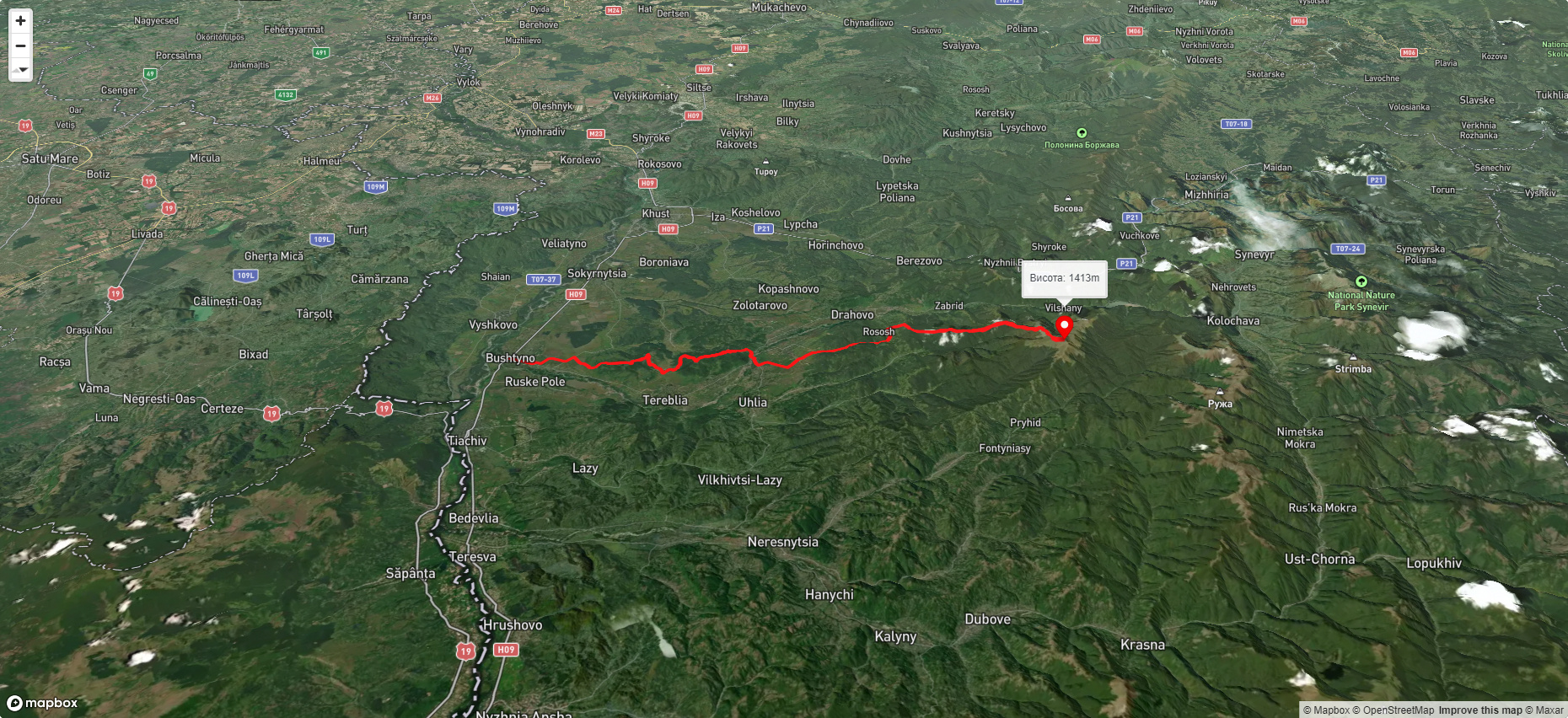
The nearest settlement is the village of Vilshany.
Accommodation around Mount Manchul:


Nearby hiking trails near Mount Manchul:
Які маршрути проходять повз Mount Manchul?
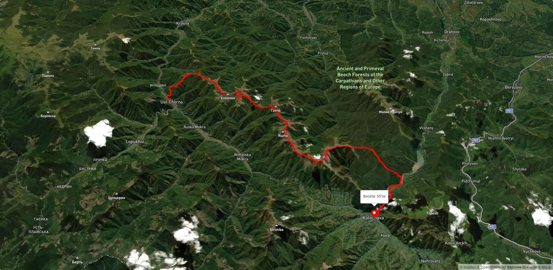
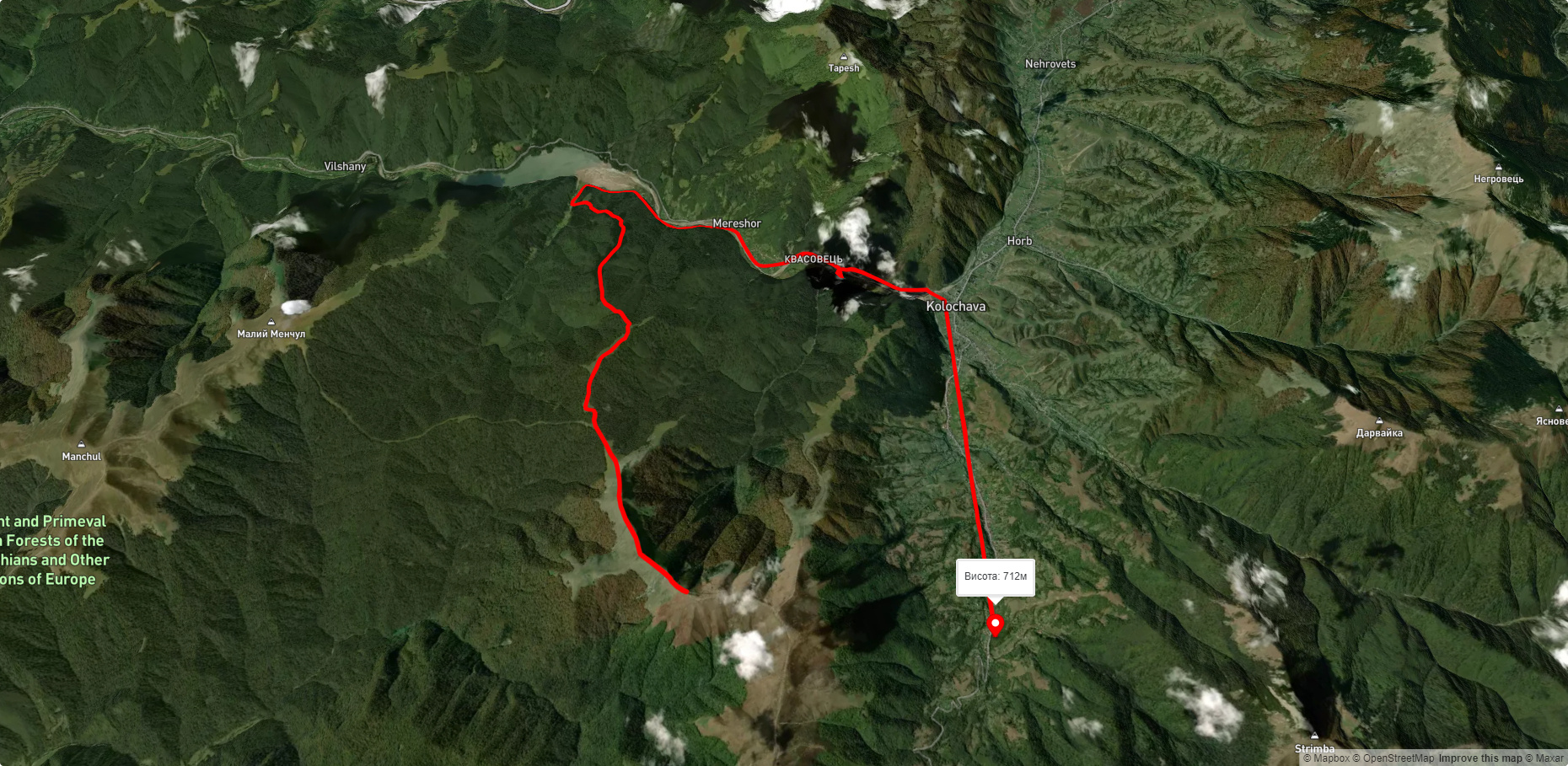
Пропонуємо пройти такі туристичні (пішохідні) маршрути через/біля Mount Manchul: смт. Буштино, через ур. Занівка до г. Манчул, с. Усть-Чорна, через г. Климова, г. Сигланський, г. Топас до с. Колочава, г. Топас, через с. Мерешор до с. Колочава, с. Скотарське, через пол. Боржава, пол. Палений Грунь до вдсх. Вільшанське, с. Колочава, через хр. Красна, с. Усть-Чорна, хр. Свидовець до смт. Ясіня, с. Колочава, через г. Сиглянський, г. Климова, г. Ружа до с. Усть Чорна