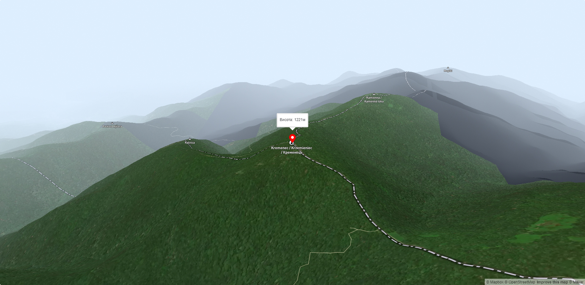
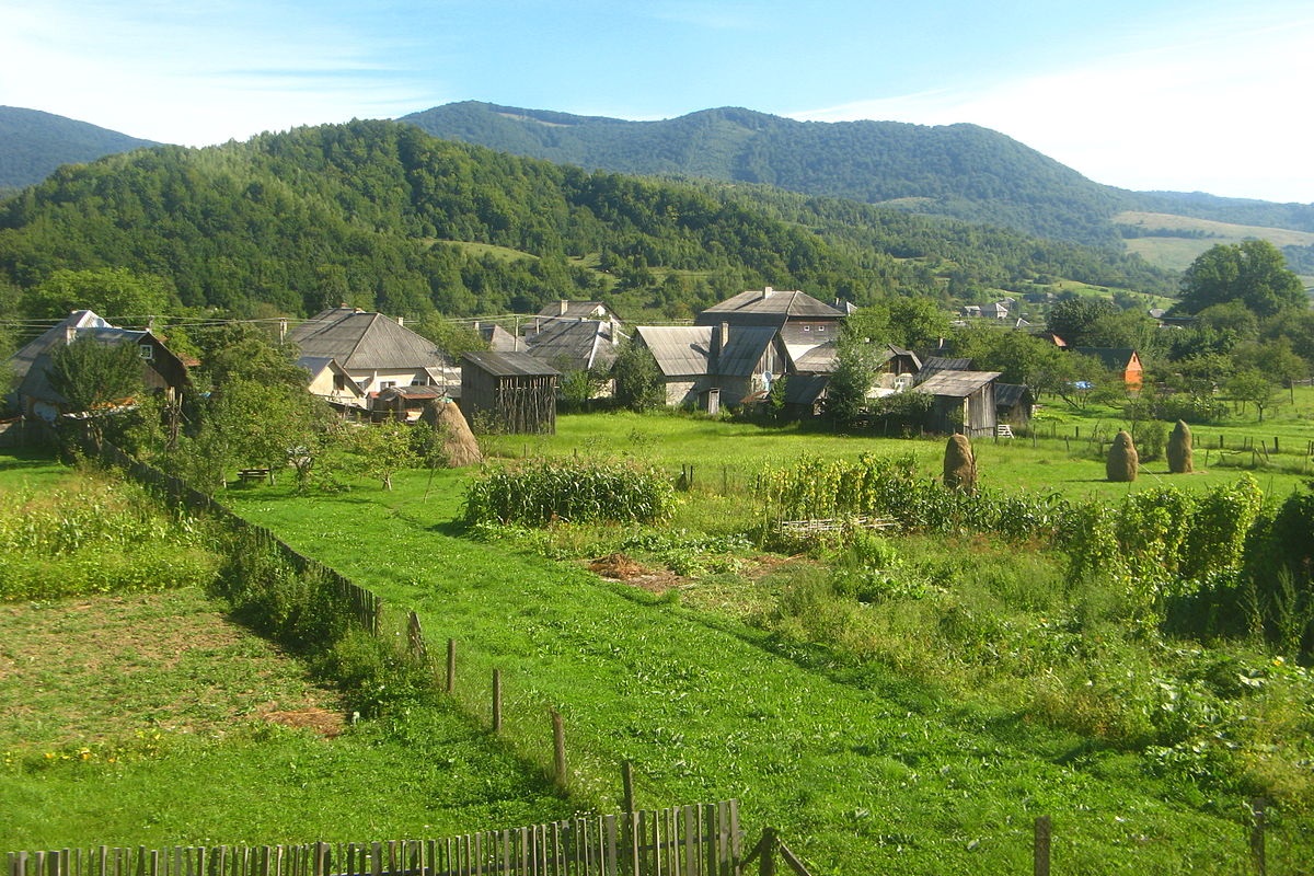
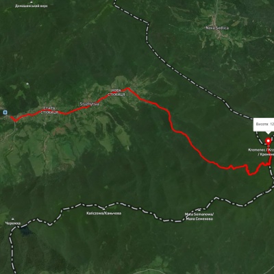
Kremenets (also known as Kreminets) is a mountain in the Ukrainian Carpathians, one of the highest peaks of the Bukivski Verkhy (Bukovinian Hills). It is located in the northwestern part of the Zakarpattia region, northwest of the village of Stuzhytsia(Velykyi Bereznyi district).
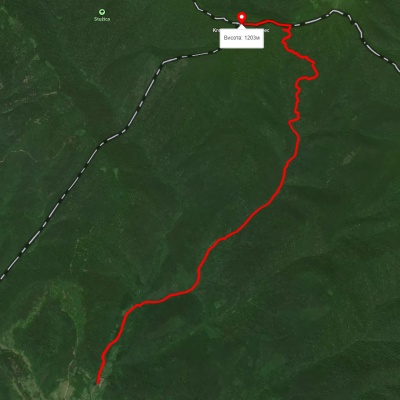
The height of Mount Kremenets is 1221 m (according to other information - 1216 m).
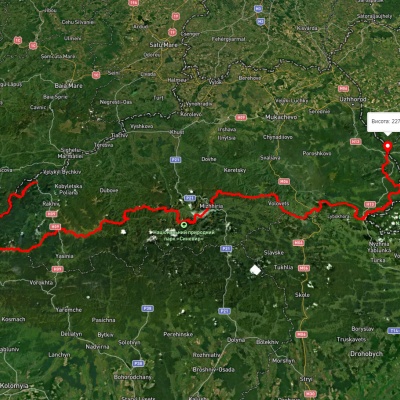
The state borders of Poland, Slovakia, and Ukraine intersect at the top of Kremenets. The southeastern slopes of the mountain lie on the territory of Ukraine (within the Uzhok National Nature Park), the northern slopes are in Poland, and the southwestern slopes are in Slovakia.
On the Ukrainian side, access to the mountain is from the village of Stuzhytsia. The route Stuzhytsia - Mount Kremenets - Stuzhytsia runs along the state borders of Poland and Slovakia. There is a border guard post in the village. To climb the mountain, you need permission from the border guards.
It is worth noting that from the Polish and Slovak sides, access to Mount Kremenets can be made without any permission. The route is almost 17 km long and lasts about 7 hours. This route was opened for tourists several years ago and runs through the Uzhansky National Nature Park, established by the Decree of the President of Ukraine in 1999. The park is unique in that it is part of the trilateral Ukrainian-Polish-Slovak Eastern Carpathians Biosphere Reserve.
On the trails to the top of Kreminets, you can often meet tourists from Poland and Slovakia. Almost on the ridge itself, at an altitude of 1121 m, there is a unique spring with healing water. Svyatyi Studnyk, which means "Holy Spring" in the local dialect, got its name for the crystal purity and inexhaustibility of its waters. For several centuries, the spring has been regularly blessed by representatives of the clergy of Ukraine and Poland.
Several organizational steps have to be taken to make this trip possible. These include obtaining a permit to be in the border zone and paying the forestry for the use of the national park. Therefore, preparatory work should be done during business hours and from Monday to Friday. Permission from the border services should be obtained at the Chop border guard detachment, and a pass at the Stuzhytsia border guard post. The outpost is located three kilometers from the village of Stuzhytsia.
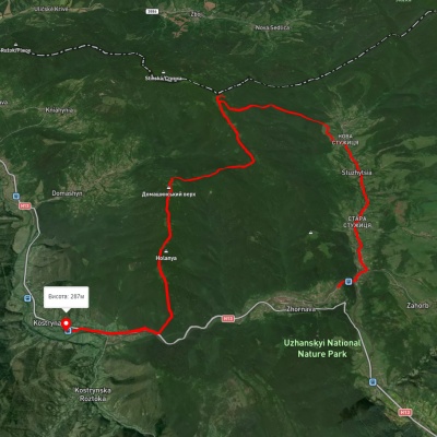
The road to it starts from the house number 221 in the center of the village. The fee for staying in the national park can be paid at the Stuzhytsia forestry. The most convenient way to get to the starting point of the route - Stuzhytsia forestry - is by car. The forestry has the necessary space for parking vehicles. Use the road T 14 03 Uzhhorod - Uzhok pass, then turn in the village of Zhornava towards the village of Stuzhytsia. From the road exit to the forestry is 8.7 km. Most of the road is asphalt, about 2 km is dirt. If you use a local train, you need to get off at the Zahorb station. This leaves 6.3 km to go on foot.
Start walking from the forestry building in a northerly direction. The distance to the top of Mount Kreminets is 8.37 kilometers. It usually takes 3.5 hours to complete the hike. We mostly have to walk along a dirt road, along streams. On the first kilometer, at the fork in the road, you need to go right along the Shvydkyi Potik stream. After 400 meters, we come to a small clearing where an old wooden shed is located on the border with the forest. An abandoned forest road goes uphill from the shed.
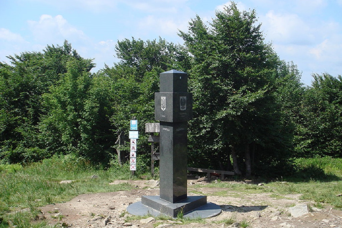
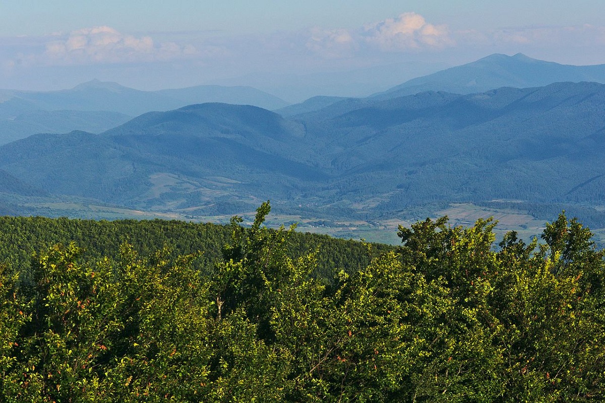
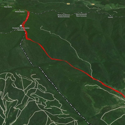
You will remember this place, as it is the descent on the way back. From here to the state border, the entire route is marked with two white and one red stripes applied to the trees. In some places, additional arrows are installed or painted in red. For 5 kilometers, the road slowly climbs upward, then enters the forest and sharply gains altitude. After a little more than 1 km of steep ascent, we come to a picturesque meadow, where a large wooden house of foresters (hunters) is cozy. The house has two rooms and is equipped with stoves and bunks. There is a spring 500 meters from the house near the trail, which runs at 238°. Let's continue our way along the trail going north at 25°. After 930 meters, the trail turns east (297°) and snakes between crooked woods and young trees, changing direction several times, either to the north or to the east. Soon we come to a trail junction where there is a signpost towards the spring. However, our path lies strictly to the north. After about a hundred meters, we come to an open space and encounter the state border of Ukraine with Poland. We turn left to the west (247°) and follow the path between the border posts. In 600 meters after the turn, we reach the top of Mount Kreminets (1,216 m), and in another 150 meters we reach the place (1,210 m) where the borders of the three countries converge. Here, a triangular granite stele with the coats of arms of Ukraine, Poland, and Slovakia engraved on its faces is installed. From here, you can see the Yavirnyk ridge (direction 185°) and Mount Velka Ravka (1,307 m), azimuth 45°.
Having finished exploring the territory and taking memorable photos, you can return home. We follow the route we took back to the hunter's house. From here, our path will go along the trails that tourists rarely walk. If you like semi-wild places and you like to test your ability to navigate mountainous terrain, then this will be exactly what makes tourism attractive and a tourist experienced. Let's go along the trail that goes from the house in a westerly direction (238°). For the first 600 meters, the narrow trail passes through a beech slope at an altitude of about 960 meters, then goes to the ridge of one of the spurs of Mount Kreminets. Then you have to move in a southerly direction. If you look closely at the forest environment, you will notice that once there was a road that ran along the top of the spur. The contours of the long-cut clearings have been preserved here, which help you to follow the set course. Try to keep to the top of the ridge, this will give you the opportunity to save energy and better navigate.
Pay attention to the small trails made of stones that used to mark the boundaries of the forest quarters. After 2.3 km of hiking along the southern course, you will come to a noticeable clearing overgrown with young trees and bushes. Some parts of the clearing are impassable. However, you can easily move through the forest, along the clearing itself. After 2 km, the clearing turns into a road, which leads to an old wooden house, familiar to us from the road to the top. From here it is 1.3 kilometers to the forestry.