Mount Klyuch
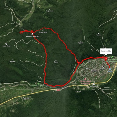
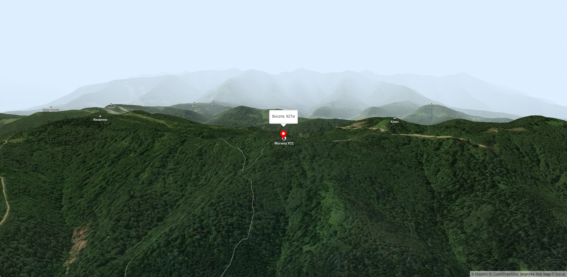
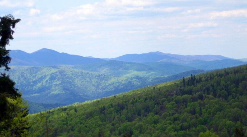
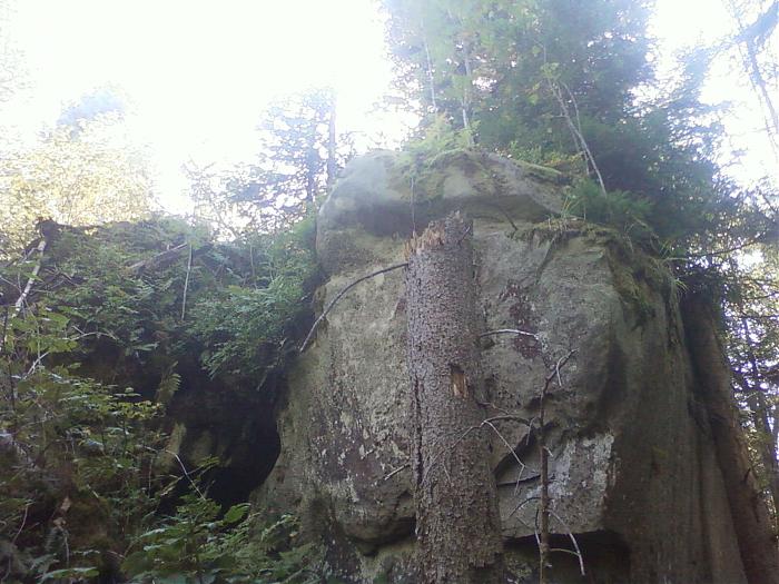
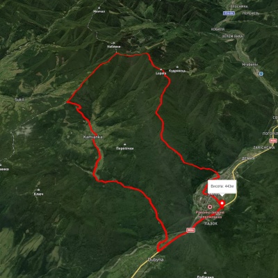
For lovers of outdoor activities, Mount Klyuch is just the perfect option. During the climb, you will see a magnificent panorama of the Ukrainian Carpathians. Of course, Mount Klyuch cannot be compared to Mount Hoverla, but there is something to see here as well. The beauty of high mountains covered with forests is sometimes impossible to describe, it is so wonderful here that you do not want to return to everyday worries. You can start your route from the village of Dubyna, which is located near the Kyiv - Chop highway (near Skole). Then turn off the highway towards the village of Kamianka. After 4 km you will see a magnificent 7-meter Kamianets waterfall, which attracts many tourists in the summer. Here you will have the opportunity to have lunch or buy souvenirs, mushrooms, berries. Just above the waterfall, on a cozy meadow, you can spend the night in a tent among the wildlife. After all, there is nothing more beautiful than meeting the sunrise or sunset in the Ukrainian Carpathians, walking barefoot on the morning silky grass or listening to birds singing and rustling leaves far away from the modern world. If you walk above the waterfall, above the road itself, you will see a spring of living water and a pointer to the beautiful Zhuravlyne Lake, also called Dead Lake. From the lake, I recommend that inexperienced tourists return to the road so as not to get lost and continue their route to Mount Klyuch. After walking along the road for about a kilometer or so, you will see the place where the Luzhky stream flows into the Kamianka River. Next, you need to leave the main road and continue your route along the field road along the stream. After walking a small section of the road, you will pass by 2 streams, they will flow into Luzhky on the left. As soon as you come to the confluence of the third stream, you will cross the Luzhky, the road leading from Kamianka to Trukhanove. It is from this section of the route that you will begin your ascent to the ridge of Mt. Klyuch. I tried to describe the route in detail, but I recommend hiring a local guide if possible, so you will feel more comfortable. During the ascent you will see bizarre rocks, the Pilgrim Cave. Climbing the ridge path, you will get to the memorial complex of the Sich Riflemen. From the top you will see a magnificent panorama that will take your breath away. Further west along the ridge, you will see another group of rocks. After admiring the unique beauty around you, you can start descending in a westerly direction to the Opir River.
Accommodation around Mount Klyuch:


Which trails pass by Mount Klyuch?
We suggest these hiking trails through or near Mount Klyuch: Trukhaniv village, via Mount Kliuch, Lake Zhuravlyne and Kamianka Waterfall to Skole, Skole, via Mount Lopata and Kamianka Waterfall to Dubyna village, Dubyna village, via Kamianka Waterfall, Mount Lopata and Mount Matahiv to Tukhlia village, Skole, via Mount Lopata, Mount Khom, Kamianka village, Kamianka Waterfall and Dubyna village to Skole, Skole, via Kamianka Waterfall and Lake Zhuravlyne to Skole, Kamianka village, via Mount Lopata, Skole and Mount Parashka to Krushelnytsia village


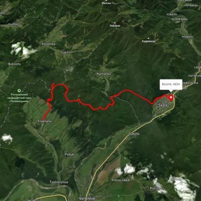
Trukhaniv village, via Mount Kliuch, Lake Zhuravlyne and Kamianka Waterfall to Skole
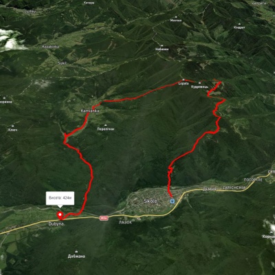
Skole, via Mount Lopata and Kamianka Waterfall to Dubyna village
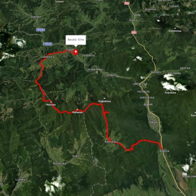
Dubyna village, via Kamianka Waterfall, Mount Lopata and Mount Matahiv to Tukhlia village
Skole, via Mount Lopata, Mount Khom, Kamianka village, Kamianka Waterfall and Dubyna village to Skole