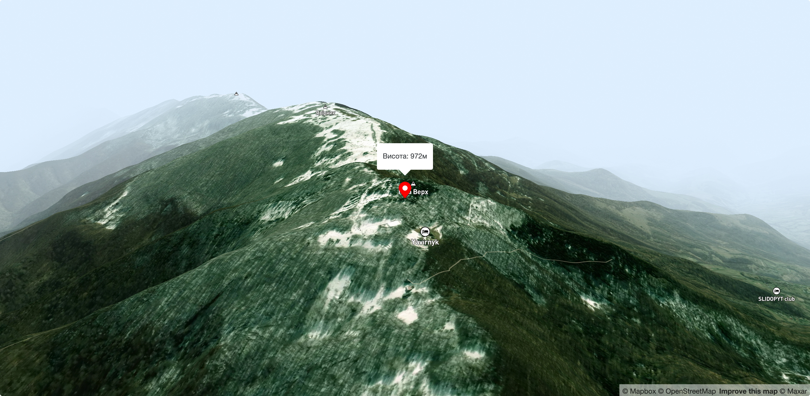
Mount Judah Top
One of the few places in the Ukrainian Carpathians where you can combine wildlife, beautiful scenery, easy accessibility and comfortable living conditions is the Yavirnyk tourist shelter near Velykyi Bereznyi. It is located on the western slopes of the mountain range of the same name, near the top of Judah Verkh, at an altitude of 930 meters above sea level.
The Yavirnyk ridge became a popular tourist destination back in the 1930s, when several hiking trails were laid here.
The Yavirnyk shelter is well known to many generations of tourists in Zakarpattia and beyond. The historic building, which is open to travelers all year round, had the status of a cult place in the Carpathians. A small rope tow lift for skiers was installed on the slopes of the mountain next to the shelter. After the collapse of the Soviet Union, the shelter building was privatized and changed hands several times. In 2015, the shelter was destroyed by a fire, but in a few years it was restored by the Carpathian Trails tourist association, under whose care it is now.
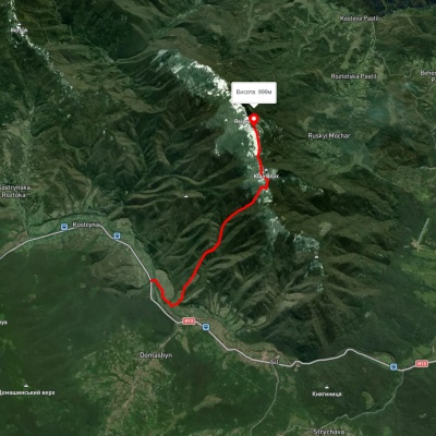
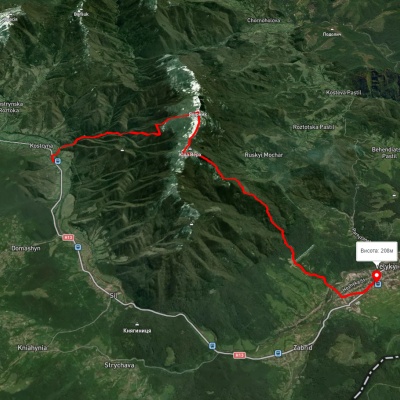
The shelter can be reached by several marked routes. From Velykyi Bereznyi, the shelter is reached by the Transcarpathian Tourist Route, the longest hiking route in the Ukrainian Carpathians, with a length of 398 km. There are also routes to Yavirnyk from the villages of Kostryno, Chornoholova, and Ruskyi Mochar.

Accommodation around Mount Judah Top:


Nearby hiking trails near Mount Judah Top:
Which trails pass by Mount Judah Top?
We suggest these hiking trails through or near Mount Judah Top: Kostryno village – Mount Yavirnyk, Transcarpathian Tourist Trail, Kostryno village, via Mount Yavirnyk to Velykyi Bereznyi village, Kostryno village, via Mount Yavirnyk to Ruskyi Mochar village, Velykyi Bereznyi village, via Mount Yavirnyk and Ruskyi Mochar village to Velykyi Bereznyi village, Velykyi Bereznyi village, via Ruskyi Mochar village, Mount Yavirnyk and Mount Yuda Verkh to Kostryno village