Hiking routes
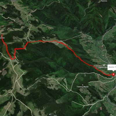
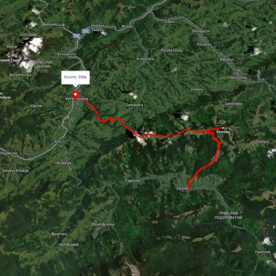
Zelene village, via Mount Skupova to Verkhovyna
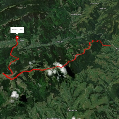

Voronenko village, via Mount Kukul, Mount Hoverla and Mount Pip Ivan Chornohirskyi to Zelene village
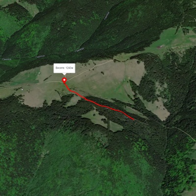
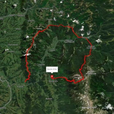
Krasnyk village, via Mount Krynta, Mount Zmiinska, Shybene village, Vesnarka polonyna and Lake Maricheika to Dzembronia village
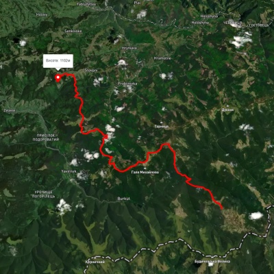
Mount Chyvchyn, via the Pnivie ridge, the Vatunarka ridge and Mount Baba-Liudova to Stovpni Horishni village
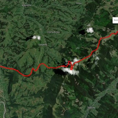
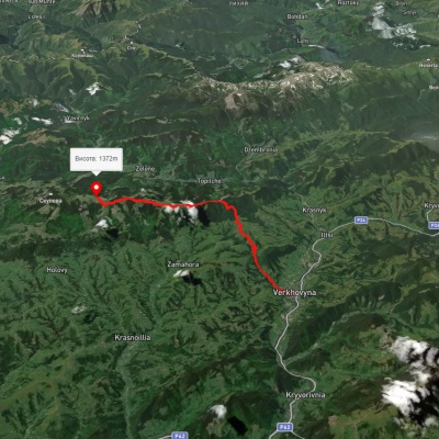
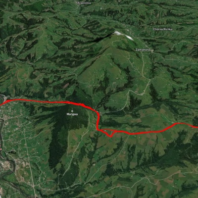
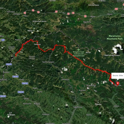
Shepit village, via Mount Yarovytsia, Mount Pnivie and Mount Masnyi Pryslip to Shybene village
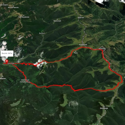
Shybene village, via Mount Stih, Mount Reheska and Mount Kopylash to Shybene village
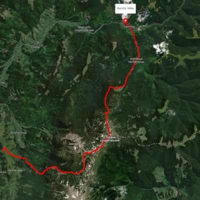
Dzembronia village, via Mount Pip Ivan Chornohirskyi and Vesnarka polonyna to Shybene village

Voronenko village, via Mount Kukul, Mount Hoverla and Mount Pip Ivan Chornohirskyi to Iltsi village
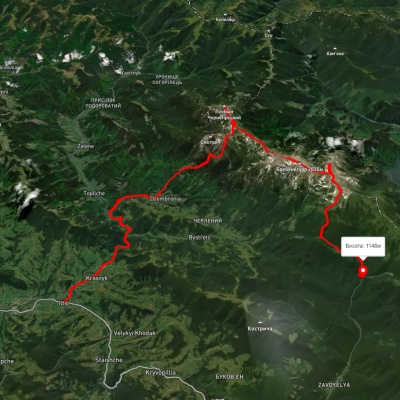
Iltsi village, via the Smotrych Waterfalls, Mount Pip Ivan Chornohirskyi and Mount Shpytsi to Zaroslyak base
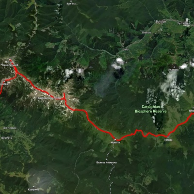
Kvasy village, via Mount Petros, Mount Hoverla and Mount Pip Ivan Chornohirskyi to Dzembronia village
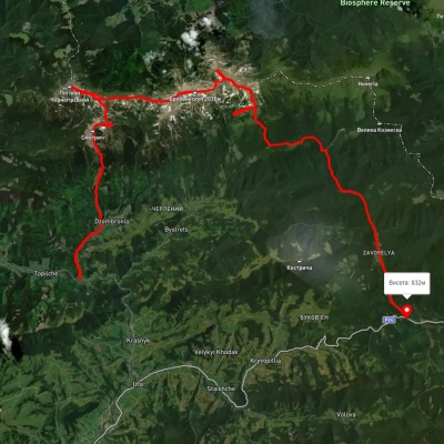
Dzembronia village, via Mount Smotrych, Mount Pip Ivan Chornohirskyi and Mount Shpytsi to the road to Vorokhta
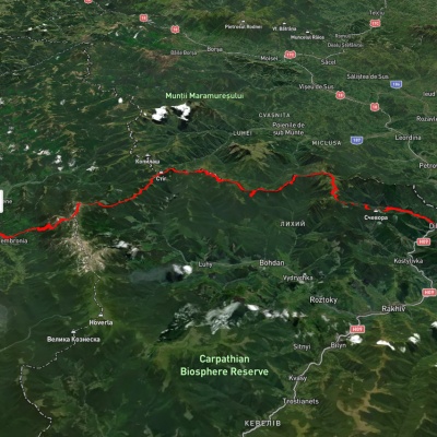
Dilove village, via Mount Pip Ivan Marmaroskyi and Mount Pip Ivan Chornohirskyi to Dzembronia village
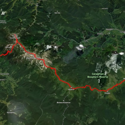
Iltsi village, via Dzembronia village, Mount Pip Ivan Chornohirskyi, Mount Hoverla and Mount Petros to Kvasy village
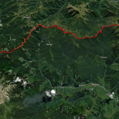
Dilove village, via Mount Pip Ivan Marmaroskyi, Mount Mika-Mare and Mount Pip Ivan Chornohirskyi to Bystrets village
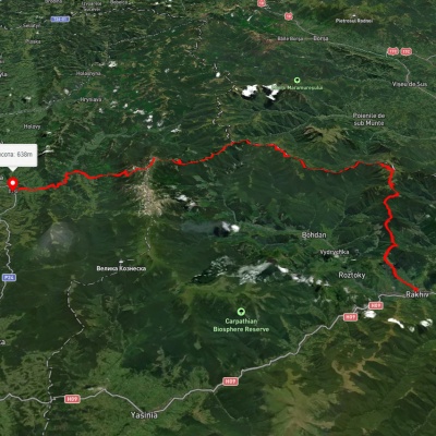
Rakhiv, via Mount Pip Ivan Marmaroskyi, Mount Mika-Mare and Mount Pip Ivan Chornohirskyi to Iltsi village
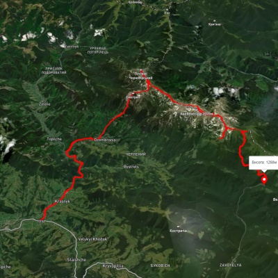
Iltsi village, via Mount Smotrych, Mount Pip Ivan Chornohirskyi, Mount Shpytsi and Lake Nesamovyte to Zaroslyak base
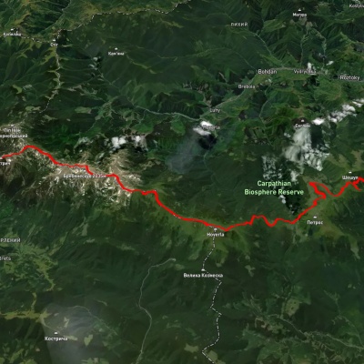
Kvasy village, via Mount Petros, Mount Hoverla, Lake Nesamovyte, Mount Brebeneskul and Mount Smotrych to Dzembronia village
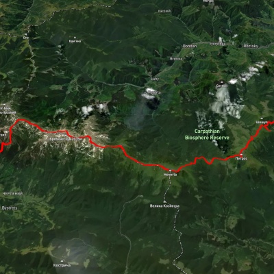
Kvasy village, via Mount Petros, Mount Hoverla, Mount Rebra and Mount Dzembronia to Topolche village
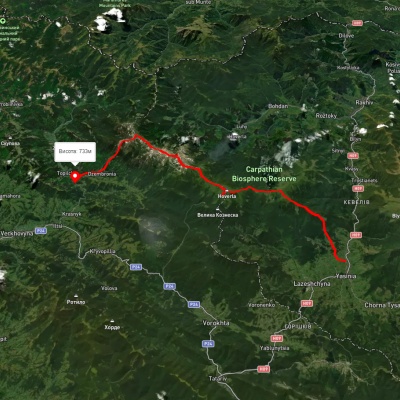
Yasinia, via Mount Petros, Mount Hoverla, Mount Dzembronia and Mount Smotrych to Dzembronia village
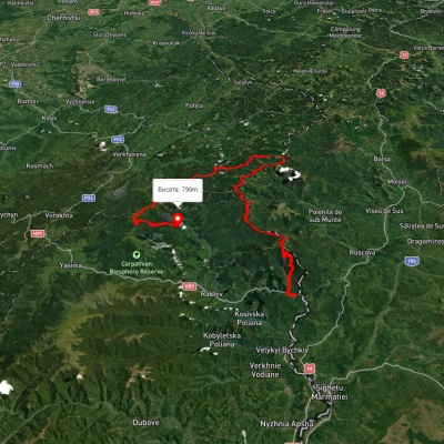
Dilove village, via Mount Pip Ivan Marmaroskyi, Mount Chyvchyn, Shybene village, Mount Pip Ivan Chornohirskyi and Mount Hoverla to Hoverla village
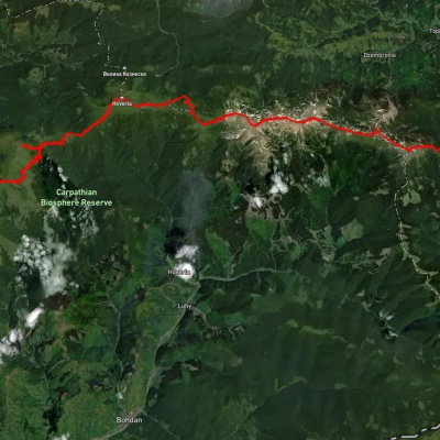
Kvasy village, via Mount Petros, Mount Hoverla and Mount Pip Ivan Chornohirskyi to Shybene village
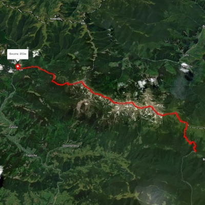
Zaroslyak base, via Mount Turkul, Mount Dzembronia and Mount Pip Ivan Chornohirskyi to Shybene village
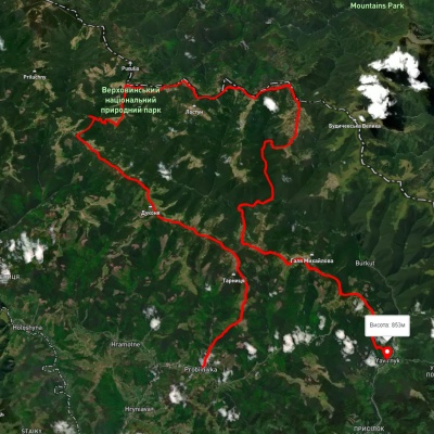
Probiinivka village, via Mount Tarnytsia, Mount Pnivie and Mount Chyvchyn to Shybene village
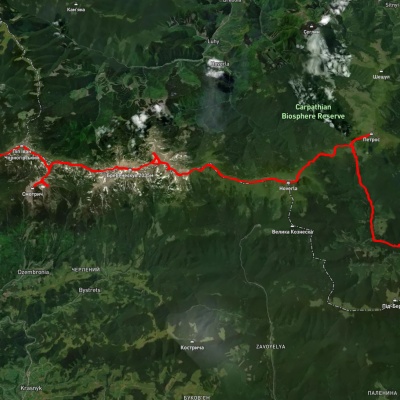
Lazeshchyna village, Mount Petros, Mount Hoverla, Mount Dzembronia, Mount Smotrych and Mount Pip Ivan Chornohirskyi to Shybene village
The Carpathian Mountains are one of the most beautiful places in Ukraine, attracting people from all over the world. These mountains stretch in the southwest of the country and consist of several mountain ranges, including Montenegro, Svydovets, Gorgany, Marmarosy, Beskydy, and others. Hiking routes in the Carpathians are a great way to experience the beauty of the mountain scenery and enjoy the fresh air. We'll take a look at the most popular routes for beginners and experienced hikers.
The most popular hiking routes in the Carpathians
The route to Mount Hoverla
The route to Mount Hoverla is the most popular route among tourists who come to the Carpathians. It is the highest mountain in Ukraine with a height of 2061 meters. Although the route is not too difficult, tourists should be prepared for long walks. Travel time depends on the route chosen, but on average it takes 5 to 8 hours. The best time to climb Hoverla is in summer or early autumn, when the weather is not as harsh as in winter, when the mountain is covered with snow.
Route to the Pip Ivan Chornohirsky mountain
Mount Pip Ivan Chornohirsky is the third highest mountain in the Carpathians after Hoverla and Brebeneskul. The height of its peak is 2028 meters. Another name for the peak is Chorna Hora, which gave the name to the Chornohora mountain range of the same name. The route to Pip Ivan Chornohirsky is more difficult than to Hoverla. It can take from 8 to 10 hours, depending on the route chosen. Tourists should be prepared to cross steep rocky areas. At the top of the mountain there is a stone tower, an old observatory, which offers a beautiful view of the Carpathians and the Chornohora range.
How to choose a hiking route
First of all, you should determine the level of physical fitness and experience of hiking in the mountains. For beginners, it is recommended to choose easy routes that do not require the use of special equipment. Experienced hikers can choose more difficult routes that include rocky areas and require the use of safety equipment.
It is also worth considering the time of year, as hiking routes in the Carpathians can be dangerous in winter or spring during snowmelt. The safest time for hiking is summer and fall.
You should also consider the length of the route and its complexity. It is not recommended to choose routes that take more than 10 hours if you do not have sufficient experience and physical fitness. For beginners, it is better to choose routes that take from 3 to 6 hours.
When choosing a route, you should also take into account the availability of springs, places for tents, where you can rest and have a snack.
Frequently asked questions about hiking routes in the Carpathians
Do I need special equipment for hiking in the Carpathians?
Some routes in the Carpathians may require special equipment, such as carabiners, a safety belt, ropes, etc. If you do not have enough experience or do not know how to use such equipment, it is better to contact an experienced guide or instructor.
Can I go hiking in the Carpathians on my own?
Yes, you can go hiking in the Carpathians on your own, but you should have sufficient experience and knowledge of the weather conditions and landscape of the region. You also need to be prepared for possible dangers and know how to act in case of emergency.
Is it safe to hike in the Carpathians?
Hiking in the Carpathians can be dangerous, especially in spring and winter. The safest time for hiking is summer and fall, but you should always consider the weather conditions and check the forecast before setting out on the route.
Hiking in the Carpathians is a great way to spend time outdoors, enjoy the panoramas and see the incredible beauty of this region. However, you should be well prepared before setting out on the route, taking into account the complexity of the route, weather conditions, and your own physical abilities. It is better to choose routes according to your abilities and experience, and if necessary, contact an experienced guide or instructor. Remember to be safe and enjoy your outdoor adventures!
