Ask the AI guide:

Hiking routes

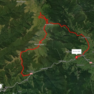
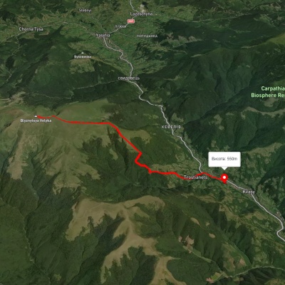
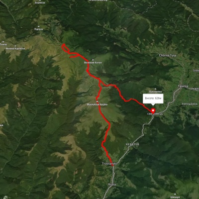
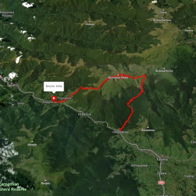
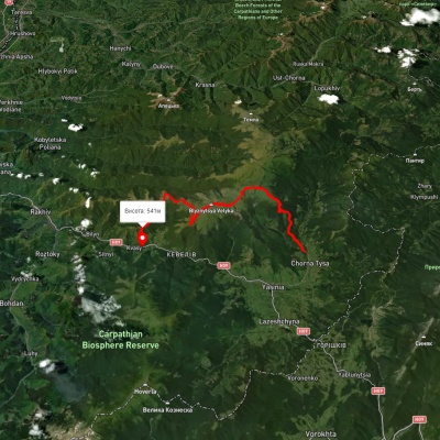
Chorna Tysa village, Mount Velykyi Kotel and Mount Blyznytsia to Kvasy village
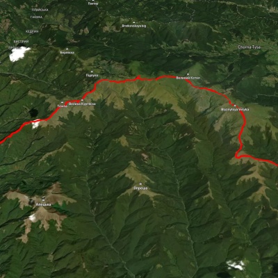
Chorna Tysa village, Mount Velykyi Kotel and Mount Blyznytsia to Kvasy village

Three days or more
Unmarked
Passes through peaks: Mount Bolshoi Kotel, Mount Stig (Dragobrat), Mount Bliznytsia
3D map
32 views
Length: 41.4km
Total ascent: 1993m
Total descent: 2191m
Minimum altitude: 541m
Maximum altitude: 1878m
More
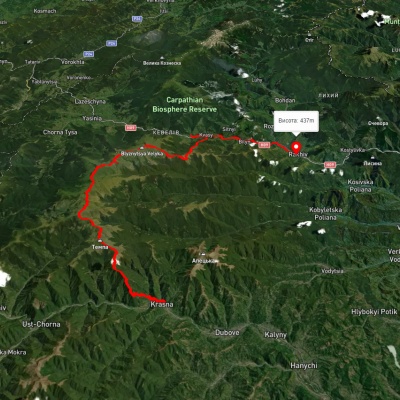
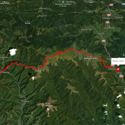
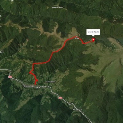
Krasna village, via Mount Tempa, Mount Unhariaska, Mount Velykyi Kotel and Mount Blyznytsia to Kvasy village
3D map
32 views
Length: 51.3km
Total ascent: 2329m
Total descent: 2199m
Minimum altitude: 421m
Maximum altitude: 1868m
More
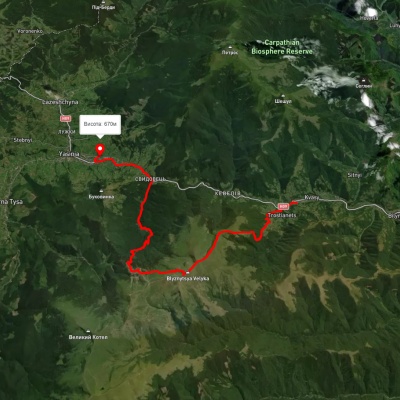
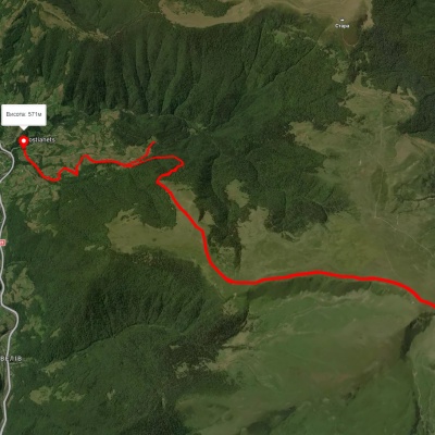
Kvasy village – Mount Pereslip

Kvasy village – Mount Pereslip

One-day routes
Unmarked
3D map
37 views
Length: 10.2km
Total ascent: 990m
Total descent: 210m
Minimum altitude: 572m
Maximum altitude: 1464m
More
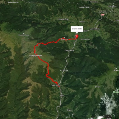
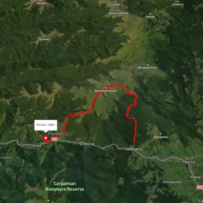
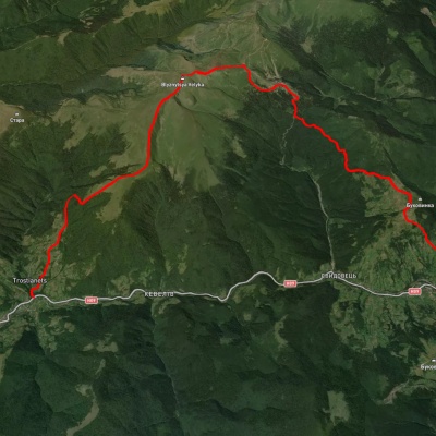
Kvasy village, via Mount Stara, Mount Blyznytsia and Lake Ivor to Kvasy village

Kvasy village, via Mount Stara, Mount Blyznytsia and Lake Ivor to Kvasy village

Ring routes
Unmarked
Passes through peaks: Mount Bliznytsia
3D map
33 views
Length: 25.8km
Total ascent: 1829m
Total descent: 1831m
Minimum altitude: 541m
Maximum altitude: 1855m
More
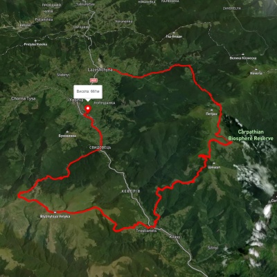
Yasinia, via Mount Tataruka, Mount Dohiaska, Mount Stih and Mount Blyznytsia to Kvasy village
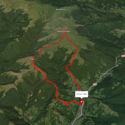
Yasinia, via Mount Tataruka, Mount Dohiaska, Mount Stih and Mount Blyznytsia to Kvasy village

Three days or more
Unmarked
Passes through peaks: Mount Tataruka, Mount Trojaska, Mount Dogyaska, Mount Bolshoi Kotel, Mount Stig (Dragobrat), Mount Bliznytsia
3D map
51 view
Length: 62.2km
Total ascent: 2811m
Total descent: 2899m
Minimum altitude: 536m
Maximum altitude: 1866m
More
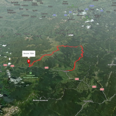
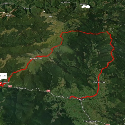
Kvasy village, via Mount Blyznytsia, Mount Stih, Mount Velykyi Kotel and Chorna Tysa village to Yasinia
3D map
39 views
Length: 51.7km
Total ascent: 2900m
Total descent: 2807m
Minimum altitude: 566m
Maximum altitude: 1846m
More
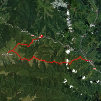
Krasna village, via the Svydovets ridge to Rakhiv

Krasna village, via the Svydovets ridge to Rakhiv

Three days or more
Unmarked
Passes through peaks: Mount Tempe, Mount Shpanska, Mount Velyka Kurtyaska (Svydovets), Mount Mala Kurtiaska, Mount Ungaryaska, Mount Trojaska, Mount Dogyaska, Mount Bolshoi Kotel, Mount Stig (Dragobrat), Mount Bliznytsia
3D map
42 views
Length: 67.3km
Total ascent: 2316m
Total descent: 2301m
Minimum altitude: 425m
Maximum altitude: 1862m
More
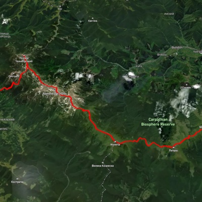
Iltsi village, via Dzembronia village, Mount Pip Ivan Chornohirskyi, Mount Hoverla and Mount Petros to Kvasy village
3D map
30 views
Length: 68.2km
Total ascent: 3105m
Total descent: 3200m
Minimum altitude: 535m
Maximum altitude: 2037m
More
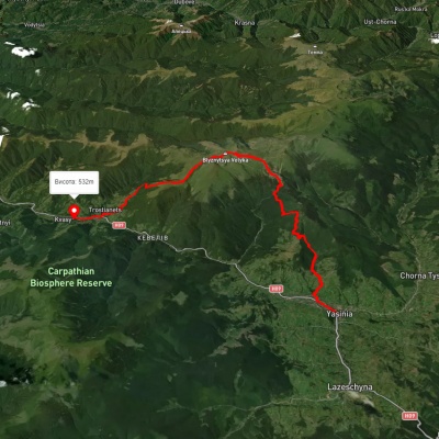
Yasinia, via Mount Bratkivska, Mount Troiaska and Mount Blyznytsia to Kvasy village

Yasinia, via Mount Bratkivska, Mount Troiaska and Mount Blyznytsia to Kvasy village

Three days or more
Unmarked
Passes through peaks: Black Kleva Mountain, Mount Ruska, Mount Bratkivska, Mount Tataruka, Mount Trojaska, Mount Dogyaska, Mount Bolshoi Kotel, Mount Stig (Dragobrat), Mount Bliznytsia
3D map
46 views
Length: 60.3km
Total ascent: 3353m
Total descent: 3183m
Minimum altitude: 532m
Maximum altitude: 1867m
More
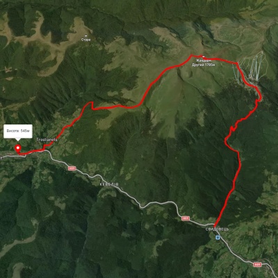
Kvasy village – Mount Blyznytsia – Kvasy village

Kvasy village – Mount Blyznytsia – Kvasy village

Ring routes
Unmarked
Passes through peaks: Mount Bliznytsia
3D map
35 views
Length: 20.2km
Total ascent: 1498m
Total descent: 1500m
Minimum altitude: 545m
Maximum altitude: 1858m
More
Yasinia, via Mount Chorna Kleva, Mount Bratkivska, Mount Dohiaska and Mount Blyznytsia to Kvasy village
3D map
42 views
Length: 68.9km
Total ascent: 3840m
Total descent: 3962m
Minimum altitude: 537m
Maximum altitude: 1848m
More
Yasinia, via Dragobrat and Mount Blyznytsia to Kvasy village

Yasinia, via Dragobrat and Mount Blyznytsia to Kvasy village

Two-day routes
Unmarked
Passes through peaks: Mount Bliznytsia
3D map
33 views
Length: 21.6km
Total ascent: 1357m
Total descent: 1430m
Minimum altitude: 544m
Maximum altitude: 1853m
More
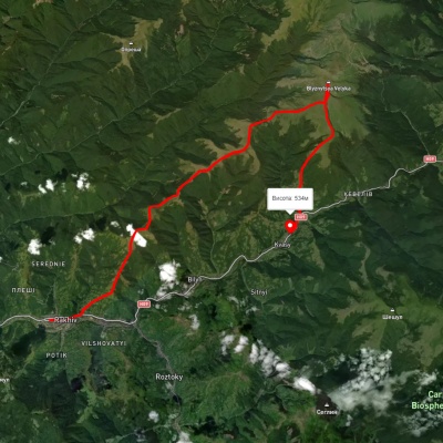
Rakhiv, via Mount Blyznytsia to Kvasy village

Rakhiv, via Mount Blyznytsia to Kvasy village

Three days or more
Unmarked
Passes through peaks: Mount Bliznytsia
3D map
41 view
Length: 31.7km
Total ascent: 1840m
Total descent: 1742m
Minimum altitude: 434m
Maximum altitude: 1855m
More
Yasinia, via Dragobrat and Mount Blyznytsia to Kvasy village

Yasinia, via Dragobrat and Mount Blyznytsia to Kvasy village

Three days or more
Unmarked
Passes through peaks: Mount Bliznytsia
3D map
41 view
Length: 26.6km
Total ascent: 1670m
Total descent: 1789m
Minimum altitude: 532m
Maximum altitude: 1849m
More
Dilove village, via Mount Pip Ivan Marmaroskyi, Mount Hoverla, Mount Petros, Kvasy village, Mount Blyznytsia and Mount Ruska to Yablunytsia village
3D map
48 views
Length: 156.7km
Total ascent: 9253m
Total descent: 8677m
Minimum altitude: 362m
Maximum altitude: 2013m
More
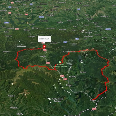
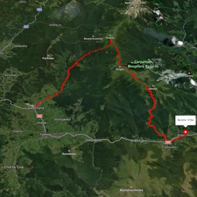
Lazeshchyna village, via Kozmeshchyk, Mount Hoverla and Mount Petros to Kvasy village

Lazeshchyna village, via Kozmeshchyk, Mount Hoverla and Mount Petros to Kvasy village

Three days or more
Unmarked
Passes through peaks: Mount Hoverla, Mount Petros, Mount Petrosul, Mount Sheshul
3D map
42 views
Length: 43.4km
Total ascent: 1613m
Total descent: 1808m
Minimum altitude: 550m
Maximum altitude: 1885m
More
Kvasy village, via Mount Blyznytsia, Mount Velykyi Kotel and Mount Dohiaska to the Yablunytsia Pass

Kvasy village, via Mount Blyznytsia, Mount Velykyi Kotel and Mount Dohiaska to the Yablunytsia Pass

Three days or more
Unmarked
Passes through peaks: Mount Bliznytsia, Mount Stig (Dragobrat), Mount Bolshoi Kotel, Mount Dogyaska, Mount Trojaska, Mount Ruska
3D map
38 views
Length: 36km
Total ascent: 3313m
Total descent: 2171m
Minimum altitude: 535m
Maximum altitude: 1852m
More
Lazeshchyna village, via Mount Petros, Mount Sheshul, Kvasy village, Mount Blyznytsia and Mount Stih to Yasinia
3D map
35 views
Length: 69.1km
Total ascent: 2758m
Total descent: 2821m
Minimum altitude: 537m
Maximum altitude: 1861m
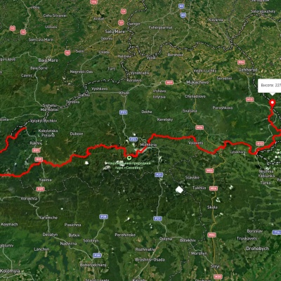
More
Transcarpathian Tourist Trail

Transcarpathian Tourist Trail

Three days or more
Has red marking.
Passes through peaks: Berlebashka Mountain, Mount Pip Ivan of Marmarosh, Mount Mala Nenieska, Mount Mica Mare, Mount Birsenscu, Mount Steavul, Mount Stig, Mount Shchavnyk, Mount Pip Ivan of Chornohora (Pip Ivan, Black Mountain), Mount Dzembronya, Mount Menchul, Mount Brebeneskul, Mount Gutin Tomnatik, Mount Rebra, Mount Turkul, Mount Danzig, Mount Pozhyzhevska, Mount Breskul, Mount Hoverla, Гора Говерла - найвища точка Карпат і всієї України, Mount Petros, Mount Petrosul, Mount Sheshul, Mount Bliznytsia, Mount Stig (Dragobrat), Mount Bolshoi Kotel, Mount Dogyaska, Mount Trojaska, Mount Ungaryaska, Mount Mala Kurtiaska, Mount Velyka Kurtyaska (Svydovets), Mount Tempe, Mount Shpanska, Mount Negrovets, Mount Velyka Gropa, Mount Yasenovets, Mount Zhid-Magura, Mount Gemba, Mount Veliky Verkh
3D map
48 views
Length: 393.2km
Total ascent: 30283m
Total descent: 30433m
Minimum altitude: 198m
Maximum altitude: 2031m
More
Kvasy village, via Mount Blyznytsia, Lake Ivor and Dragobrat to Yasinia

Kvasy village, via Mount Blyznytsia, Lake Ivor and Dragobrat to Yasinia

Three days or more
Unmarked
Passes through peaks: Mount Bliznytsia
3D map
36 views
Length: 32.4km
Total ascent: 1570m
Total descent: 1446m
Minimum altitude: 573m
Maximum altitude: 1909m
More
Ust-Chorna village, via Mount Tempa, Mount Mala Kurtiaska, Mount Unhariaska and Mount Blyznytsia to Kvasy village
3D map
43 views
Length: 51.2km
Total ascent: 2670m
Total descent: 2652m
Minimum altitude: 511m
Maximum altitude: 1876m
More
Kvasy village, via Mount Blyznytsia and Dragobrat to Yasinia

Kvasy village, via Mount Blyznytsia and Dragobrat to Yasinia

Three days or more
Unmarked
Passes through peaks: Mount Bliznytsia
3D map
34 views
Length: 26.1km
Total ascent: 1642m
Total descent: 1531m
Minimum altitude: 546m
Maximum altitude: 1875m
More
Kvasy village, via Mount Blyznytsia, Mount Stih, Mount Velykyi Kotel, Mount Troiaska, Mount Dohiaska and Dragobrat to Yasinia
3D map
57 views
Length: 41km
Total ascent: 2512m
Total descent: 2435m
Minimum altitude: 552m
Maximum altitude: 1864m
More
Yasinia, via Dragobrat and Mount Blyznytsia to Kvasy village

Yasinia, via Dragobrat and Mount Blyznytsia to Kvasy village

Two-day routes
Unmarked
Passes through peaks: Mount Bliznytsia
3D map
37 views
Length: 22.5km
Total ascent: 1632m
Total descent: 1711m
Minimum altitude: 517m
Maximum altitude: 1863m
More
Kvasy village, via Mount Blyznytsia, Mount Bratkivska, Mount Chorna Kleva and Chorna Tysa village to Yasinia
3D map
34 views
Length: 60.1km
Total ascent: 2858m
Total descent: 2945m
Minimum altitude: 532m
Maximum altitude: 1871m
More
Rakhiv, via Mount Blyznytsia to Kvasy village

Rakhiv, via Mount Blyznytsia to Kvasy village

Three days or more
Unmarked
Passes through peaks: Mount Bliznytsia
3D map
38 views
Length: 34.9km
Total ascent: 2176m
Total descent: 2169m
Minimum altitude: 427m
Maximum altitude: 1881m
More
Yasinia, via Dragobrat, Mount Blyznytsia and Lake Ivor to Kvasy village
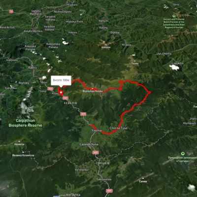
Yasinia, via Dragobrat, Mount Blyznytsia and Lake Ivor to Kvasy village

Three days or more
Unmarked
Passes through peaks: Mount Stig (Dragobrat), Mount Bliznytsia
3D map
40 views
Length: 24.3km
Total ascent: 1743m
Total descent: 1826m
Minimum altitude: 541m
Maximum altitude: 1848m
More
Kvasy village, via Mount Blyznytsia and Dragobrat to Yasinia

Kvasy village, via Mount Blyznytsia and Dragobrat to Yasinia

Two-day routes
Unmarked
Passes through peaks: Mount Bliznytsia
3D map
38 views
Length: 22.6km
Total ascent: 1609m
Total descent: 1525m
Minimum altitude: 558m
Maximum altitude: 1859m
More
Kvasy village – Mount Blyznytsia – Kvasy village
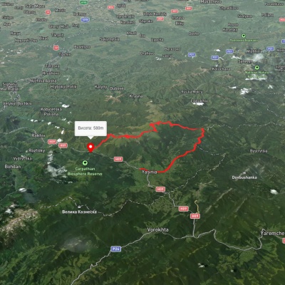
Kvasy village – Mount Blyznytsia – Kvasy village
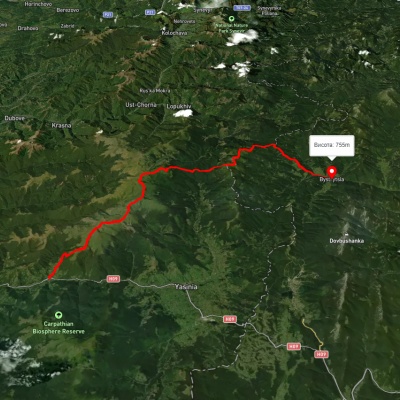
Ring routes
Unmarked
Passes through peaks: Mount Bliznytsia
3D map
36 views
Length: 20.2km
Total ascent: 1447m
Total descent: 1473m
Minimum altitude: 583m
Maximum altitude: 1875m
More
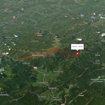
Kvasy village, via Mount Blyznytsia, Mount Tataruka and Mount Bratkivska to Bystrytsia village

Kvasy village, via Mount Blyznytsia, Mount Tataruka and Mount Bratkivska to Bystrytsia village

Three days or more
Unmarked
Passes through peaks: Mount Bliznytsia, Mount Stig (Dragobrat), Mount Bolshoi Kotel, Mount Dogyaska, Mount Trojaska, Mount Tataruka, Mount Bratkivska, Mount Grope, Mount Durnia
3D map
42 views
Length: 49.8km
Total ascent: 2955m
Total descent: 2772m
Minimum altitude: 547m
Maximum altitude: 1846m
More

The Carpathian Mountains are one of the most beautiful places in Ukraine, attracting people from all over the world. These mountains stretch in the southwest of the country and consist of several mountain ranges, including Montenegro, Svydovets, Gorgany, Marmarosy, Beskydy, and others. Hiking routes in the Carpathians are a great way to experience the beauty of the mountain scenery and enjoy the fresh air. We'll take a look at the most popular routes for beginners and experienced hikers.


The most popular hiking routes in the Carpathians

The route to Mount Hoverla

The route to Mount Hoverla is the most popular route among tourists who come to the Carpathians. It is the highest mountain in Ukraine with a height of 2061 meters. Although the route is not too difficult, tourists should be prepared for long walks. Travel time depends on the route chosen, but on average it takes 5 to 8 hours. The best time to climb Hoverla is in summer or early autumn, when the weather is not as harsh as in winter, when the mountain is covered with snow.

Route to the Pip Ivan Chornohirsky mountain

Mount Pip Ivan Chornohirsky is the third highest mountain in the Carpathians after Hoverla and Brebeneskul. The height of its peak is 2028 meters. Another name for the peak is Chorna Hora, which gave the name to the Chornohora mountain range of the same name. The route to Pip Ivan Chornohirsky is more difficult than to Hoverla. It can take from 8 to 10 hours, depending on the route chosen. Tourists should be prepared to cross steep rocky areas. At the top of the mountain there is a stone tower, an old observatory, which offers a beautiful view of the Carpathians and the Chornohora range.

How to choose a hiking route

First of all, you should determine the level of physical fitness and experience of hiking in the mountains. For beginners, it is recommended to choose easy routes that do not require the use of special equipment. Experienced hikers can choose more difficult routes that include rocky areas and require the use of safety equipment.

It is also worth considering the time of year, as hiking routes in the Carpathians can be dangerous in winter or spring during snowmelt. The safest time for hiking is summer and fall.

You should also consider the length of the route and its complexity. It is not recommended to choose routes that take more than 10 hours if you do not have sufficient experience and physical fitness. For beginners, it is better to choose routes that take from 3 to 6 hours.

When choosing a route, you should also take into account the availability of springs, places for tents, where you can rest and have a snack.

Frequently asked questions about hiking routes in the Carpathians

Do I need special equipment for hiking in the Carpathians?

Some routes in the Carpathians may require special equipment, such as carabiners, a safety belt, ropes, etc. If you do not have enough experience or do not know how to use such equipment, it is better to contact an experienced guide or instructor.

Can I go hiking in the Carpathians on my own?

Yes, you can go hiking in the Carpathians on your own, but you should have sufficient experience and knowledge of the weather conditions and landscape of the region. You also need to be prepared for possible dangers and know how to act in case of emergency.

Is it safe to hike in the Carpathians?

Hiking in the Carpathians can be dangerous, especially in spring and winter. The safest time for hiking is summer and fall, but you should always consider the weather conditions and check the forecast before setting out on the route.

Hiking in the Carpathians is a great way to spend time outdoors, enjoy the panoramas and see the incredible beauty of this region. However, you should be well prepared before setting out on the route, taking into account the complexity of the route, weather conditions, and your own physical abilities. It is better to choose routes according to your abilities and experience, and if necessary, contact an experienced guide or instructor. Remember to be safe and enjoy your outdoor adventures!

Carpathian GuideOnline

Ask a question about travelling in the Carpathians to start a conversation.