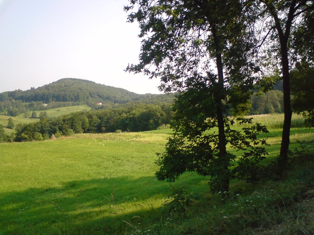
Kostyntsi is a village in Ukraine, in the Storozhynets district of the Chernivtsi region. Kostyntsi is located 20 km northwest of Storozhynets and 34 km from the regional center. The nearest railway station is Komarivtsi, 13 km away. Kostyntsi is located in the western part of the Prut-Siret interfluve, in the foothill zone of the Carpathians. The village borders on the northwest with the villages of Dibrova and Vynohrad, on the west with the village of Verkhni Stanovtsi, on the northeast with the village of Drachyntsi, on the east with the village of Yaseni, and on the south with the village of Sloboda-Komarivtsi. The territory stretches from north to south 7 km, from west to east 6 km. The village is connected to the regional and district centers by a highway.
There are several assumptions about the origin of the village name:
- From the name of the Moldovan voivode Konstantin Mohyla; from the plum seeds that can be found in the village almost at every step.
- There is another legend. It says that a man named Constantine once liked this place and settled here with his family. Later, more and more people wanted to live here. They formed a village, which was later named in honor of Kostiantyn.
- Another legend says that once upon a time there was a guy named Kostyn who fell in love with a girl and decided to marry her. But during their wedding, the village was attacked by Turks. They destroyed everything in their path, killing people or taking them prisoner. The guy somehow escaped from captivity and killed the Turkish leader, and rescued his bride and the prisoners. The enemies retreated. Celebrating the victory, people decided to name the village in Kostyn's honor.
The village was first mentioned in the Moldovan chronicle of 1608 as Costesti, which is very similar to the modern name of the village. The name of the village is associated with the personal name Kostiantyn.
Excavations on the territory of the village
The history of Kostyntsi village dates back to the Trypillians, who settled here in the fourth and third millennia BC. According to the Bukovinian archaeologist Elazar Lazar, who conducted excavations here in 1936 on the hill where the secondary school is currently located, he claims that the Trypillians were evicted or partially assimilated by tribes that came from the north around the beginning of the second millennium BC. The archaeologist investigated settlements of the Late Trypillian and Early Bronze Age. At the excavation site, he found the remains of several dwellings, fragments of pottery, stone axes, flint and bone products. Remains of other archaeological cultures were also found, including pottery decorated with cord imprints.
In 2002-2003, archaeological excavations were carried out by the student archaeological group "Antikva" under the direction of Serhii Volodymyrovych Pyvovarov in the Centino tract. They discovered a multilayered settlement of Trypillian (IV-II millennia BC), Goligrad (XII-VIII centuries BC), and Lipytska (II century BC) cultures, as well as remains that, by all indications, belong to the Carpathian kurgans. At the same time, another archaeological site was discovered in the southeastern part of the village in the Okopy tract - the ruins of ancient fortifications of the Slavic-Russian period (VII-XII centuries). On the territory of the settlement, hollows were found from semi-dugouts. Thus, archaeological research shows that the village has long been inhabited by people who had well-developed crafts and economy at that time.
Another important thing is that the past claims that Slavs lived here. In the late 50s of the last century, the famous Ukrainian archaeologist Borys Tymoshchuk conducted archaeological excavations in the Selyshche tract. He discovered a settlement of the fourteenth and fifteenth centuries. Perhaps this was the settlement mentioned in Moldovan chronicles in 1608.
The village was part of Kievan Rus from the late ninth century until the early twelfth century. From the beginning of the twelfth to the middle of the fifteenth century Kostyntsi was part of the Galician-Volyn principality. In the middle of the fifteenth century the village became part of the Moldavian principality. 100 years later, in the middle of the sixteenth century, Kostyntsi, along with Bukovyna and Moldova, fell into the hands of the Ottoman Empire.
The Turks visited the village. When they robbed the local population, they buried the loot under three beeches, putting a spell on them. They said that if these beeches were cut down, half of the village would be gone. People forgot about it and cut down the trees. Eventually, their prophecy came true in 1999. Many villagers knew about the treasure and where it was hidden, but no one had managed to find it. They enchanted not only the beeches, but also the bells, which are located in the village near St. Michael's Church in the bell tower. If you ring the bells when black clouds are approaching Kostyntsi, which have not yet crossed the border between the villages, there will be no hail. When Turkish troops were conquering Bukovyna, passing through Kostyntsi, they built a wooden tower on Mount Horyany (455 meters above sea level). They used it to observe the surrounding areas. Unfortunately, it has not survived to this day.
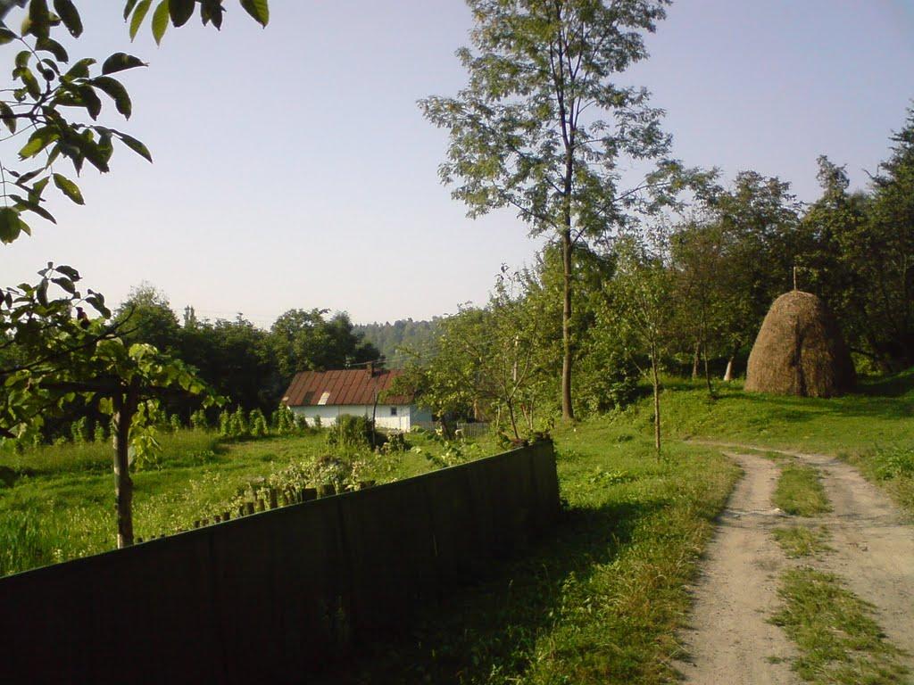
On May 7, 1775, the Ottoman Empire ceded Northern Bukovyna to Austria. Many Germans and Jews appeared in the village. They were mainly engaged in crafts and trade. There were 17 shops and taverns in the village, all owned by Jews. Ukrainians also lived in Kostyntsi, and they were mainly engaged in farming and animal husbandry. Fruit orchards appeared on the territory of the village, which are now the hallmark of Kostyntsi.
In 1785, St. Michael's Church was built. It was a wooden church with five domes. In 1860, a school was built with 4 classes. Being a part of the Moldavian principality, and later of the Ottoman Empire, Austria, and Romania, the village gradually grew and developed. At the beginning of the twentieth century, the population of the village was 2064 people.
In 1914, the First World War broke out, and Kostynchany residents fought on the side of Austria-Hungary. Not everyone returned home from the fronts, 54 people died. As Austria-Hungary was defeated by its allies and collapsed, Kostyntsi, along with Bukovyna, became part of the Kingdom of Romania.
In 1940, the USSR issued an ultimatum to Romania to return the territories occupied in 1918. After the Bessarabian-Bukovyna campaign, Romanian troops panicked and left Northern Bukovyna, which was reunited with other Ukrainian lands as part of the Ukrainian SSR on June 28, 1940.
In 1941, World War II broke out. The events of 1941 were reconstructed from the stories of old-timers and archival sources. Many Jews lived on the territory of Kostyntsi. In July 1941, Romanian soldiers (possibly a patrol) appeared in the village. At that time, some Kostyntsi residents began to actively help the occupiers drive Jews to the synagogue. They kept them there without food and water until German troops arrived in the village. One morning, the Jews were lined up in a column of four in a line that stretched for tens of meters, and taken under escort to the Buchma tract. Here, civilians were massacred: they were shot to death. The next day, when local residents were brought to the site of the tragedy to bury the bodies, many of the victims were still showing signs of life. People who lived nearby said that the water in the wells was red with blood. In the postwar period, a monument was erected at the place where the ashes of 359 innocently tortured villagers are buried. In 2005, a symbolic Star of David was erected in its place. This was initiated by the regional Jewish community and the Hesed-Shushana charitable foundation.
Kostyntsi was liberated in March-April 1944, when three tanks under the command of Karyukin, Kryvenko, and Chuhunin entered the village of Yaseni on the road from Hlynica. Many residents of Kostyntsi were participants in the war. They took part in the fighting on the territory of what was then Czechoslovakia, Hungary, Poland, and Germany and were awarded orders and medals.
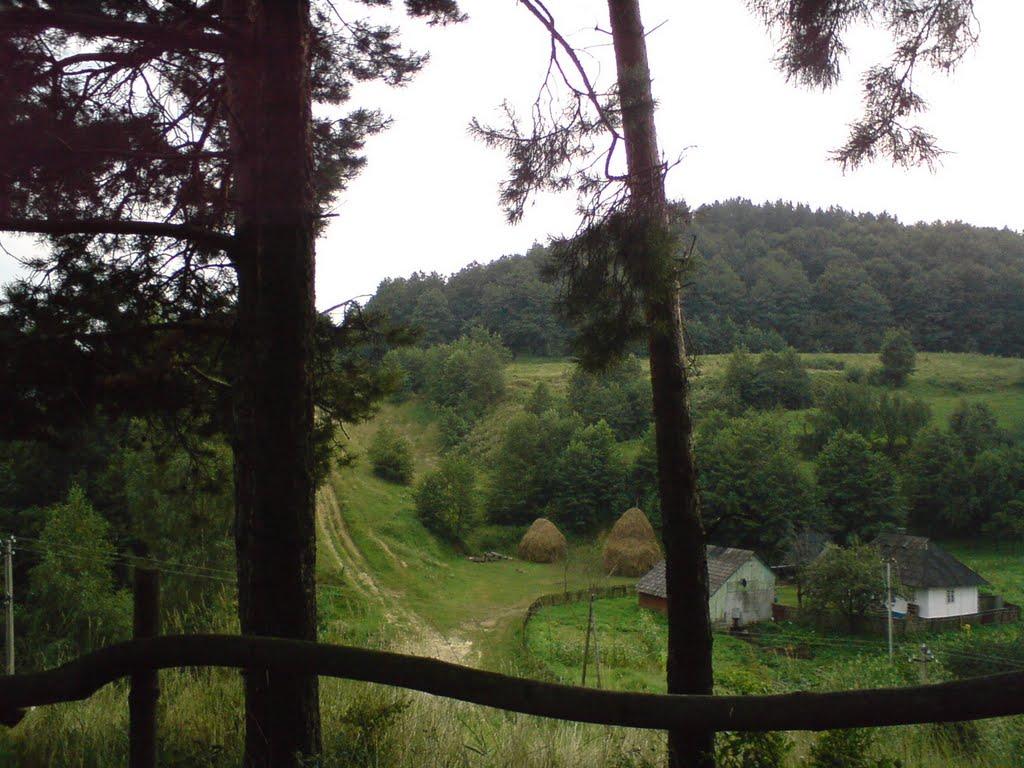
In March 1947, the Bolshevik collective farm was built. Then in February 1963, the collective farm was renamed the Michurin collective farm. The collective farm was assigned 2628 hectares of land, including 800 hectares of arable land, 196 hectares of orchards, and 545 hectares of forest. The main direction of the farm was livestock. The collective farm sowed such crops as flax, wheat, corn, potatoes, and sugar beets. Gardening was well developed. Under Soviet rule, about 500 houses were built and rebuilt in Kostyntsi. There were 3 shops in the village, the Cheremshyna village department store and the Marichka canteen, a village culture center opened in 1966, a household workshop, a savings bank, a maternity hospital, a kindergarten, a library, a secondary school (1975), and a children's music school (1985).
In 1979, a seventeenth-century architectural monument, St. Michael's Church, burned down, along with the entire church archive. People wanted to build a new one, but the Soviet authorities did not give permission for construction.
In 1991, under independent Ukraine, construction began on a new church of St. Michael the Archangel, which was completed 18 months later, in 1992.
Another important event in the history of the village is the catastrophic landslide from Mount Sopyhora. Then, in the middle of the night on April 18, 1999, it led to the destruction and damage of 140 residential buildings in the Pidsopyhora tract. As a result, 493 people were injured, including 88 children. According to the classification of emergencies, this problem was classified as a national emergency. Within a few days, the evacuation of people from the emergency site and the removal of property was organized. The then President of Ukraine Leonid Kuchma visited the site of the landslide. The victims were assisted in buying or building new housing in Kostyntsi.


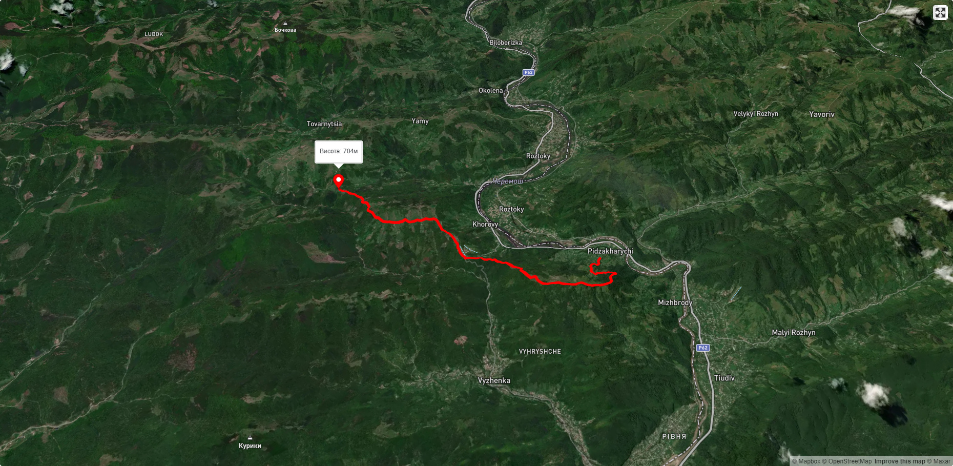
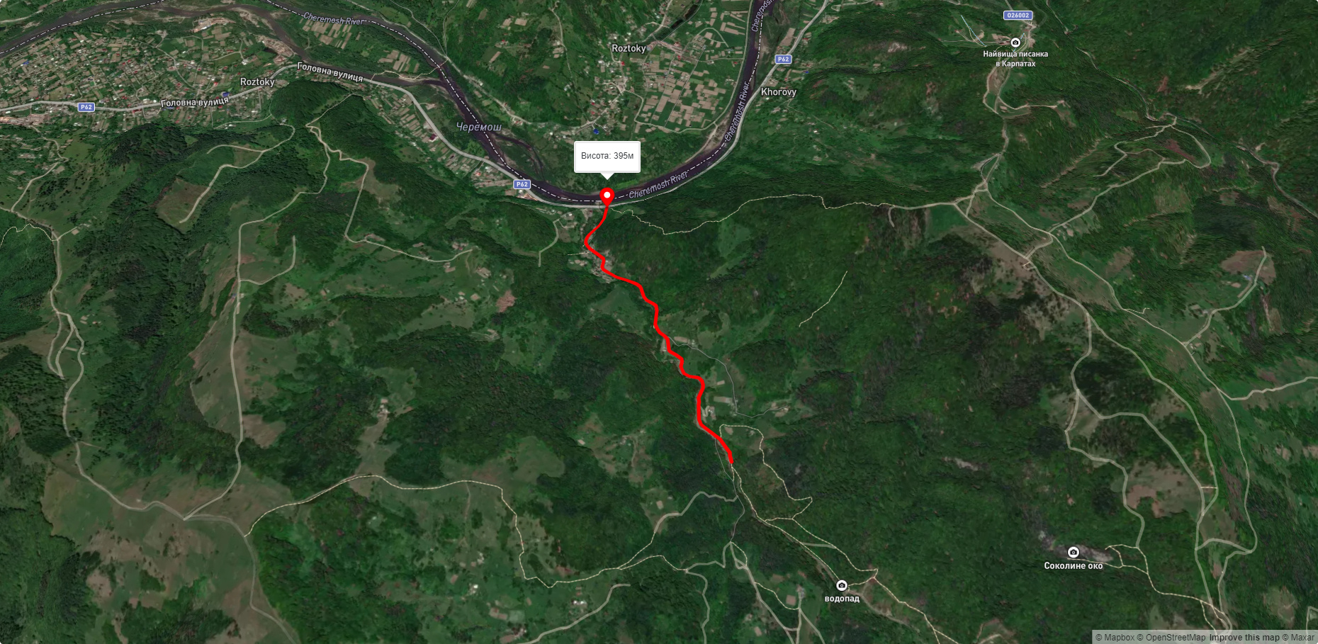
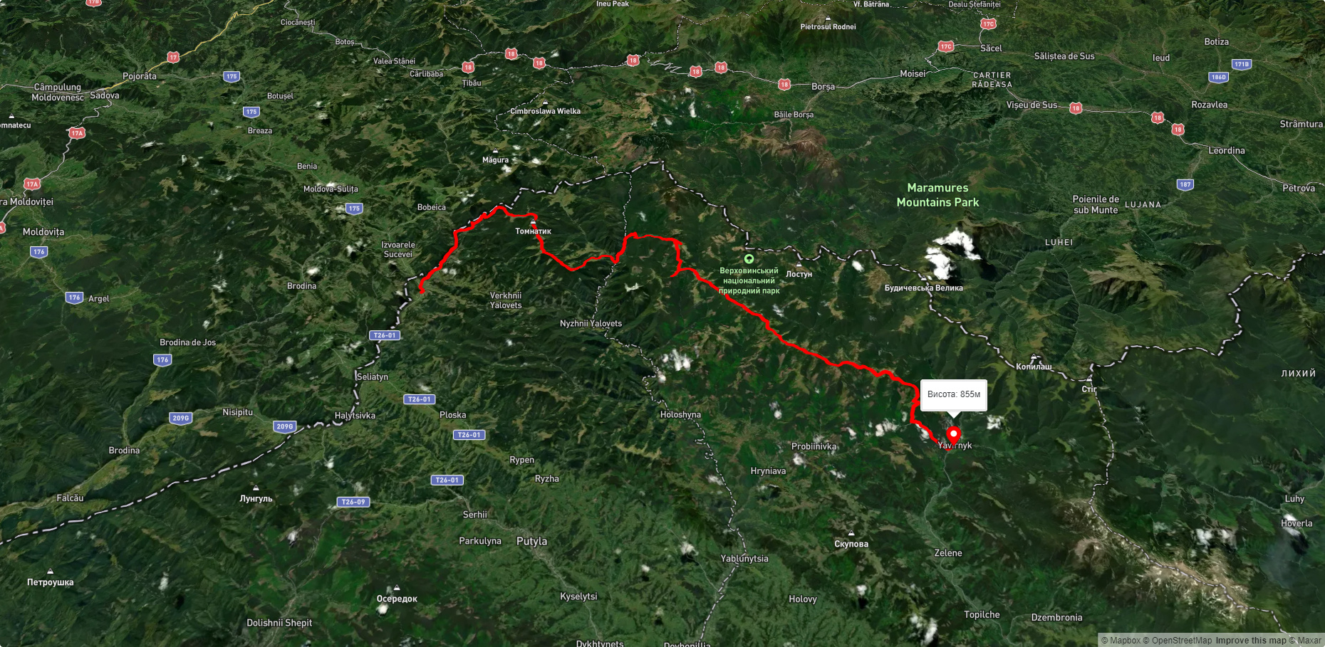
Які туристичні (пішохідні) маршрути проходять через/біля Bones?
Пропонуємо пройти такі туристичні (пішохідні) маршрути через/біля Bones: пер. Німчич - Протяте Каміння, Смугарські водоспади, с. Шепіт, через г. Яровиця, г. Пнів'є, г. Масний Присліп до с. Шибене, с. Шепіт – г. Яровиця, с. Нижній Яловець, через г. Яровиця до с. Шипіт, с. Буковець – Писаний Камінь – с. Буковець