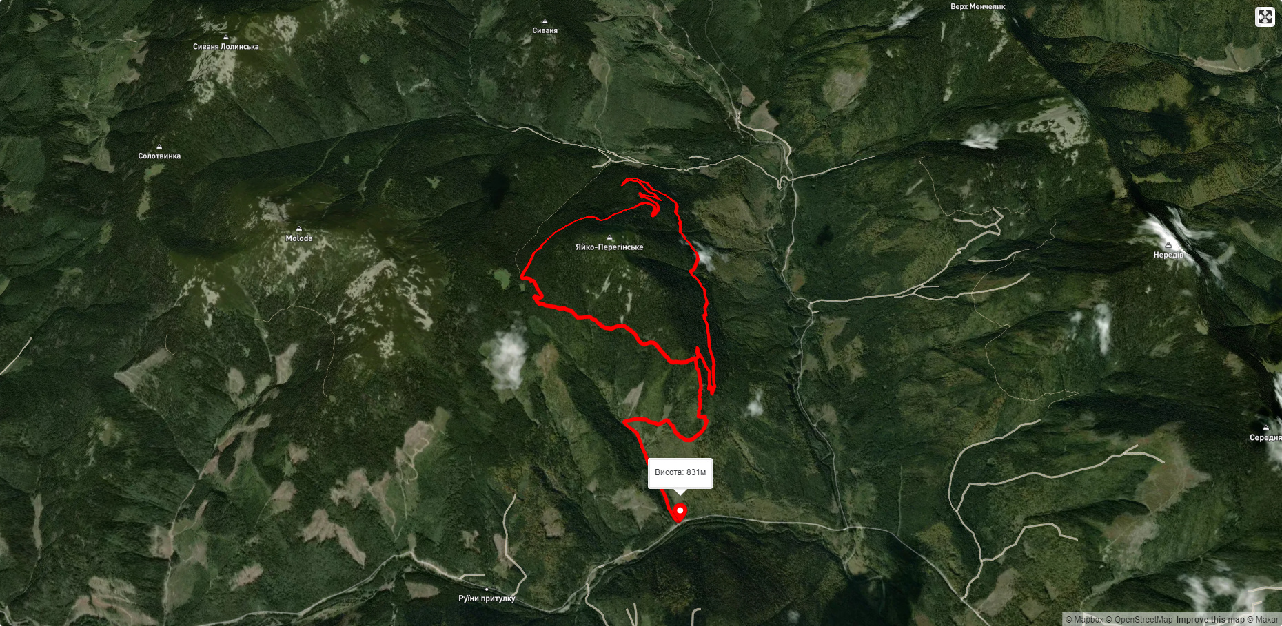
Yaykivsky Reserve is a botanical reserve of national importance in Ukraine. It is located west of the village of Osmolody, Rozhniativ district, Ivano-Frankivsk region, on the slopes of Yayko-Perehinske mountain in the Gorgany mountain range.
The area is 263 hectares. It was established in 1974. It is managed by the State Enterprise "Osmolodske Forestry".
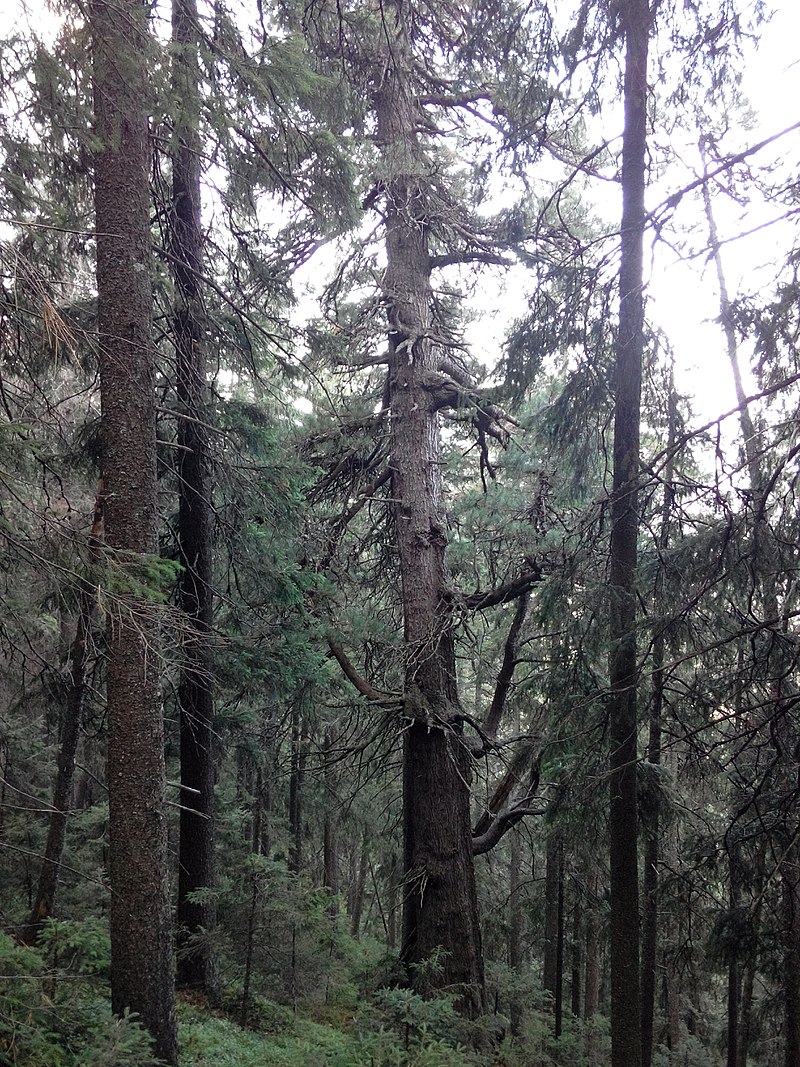
The reserve was created to protect the forest landscape of virgin forests. On the mountain slopes (within the altitudes of 900-1600 m above sea level), the largest relict massif of European cedar pine in Ukraine (preserved from the Early Holocene), listed in the Red Book of Ukraine, is protected. The forest is dominated by wet and damp cedar and spruce forests with blueberry and moss cover. On the stone scree (in places where there is no soil cover), there is a crooked forest of mountain pine.
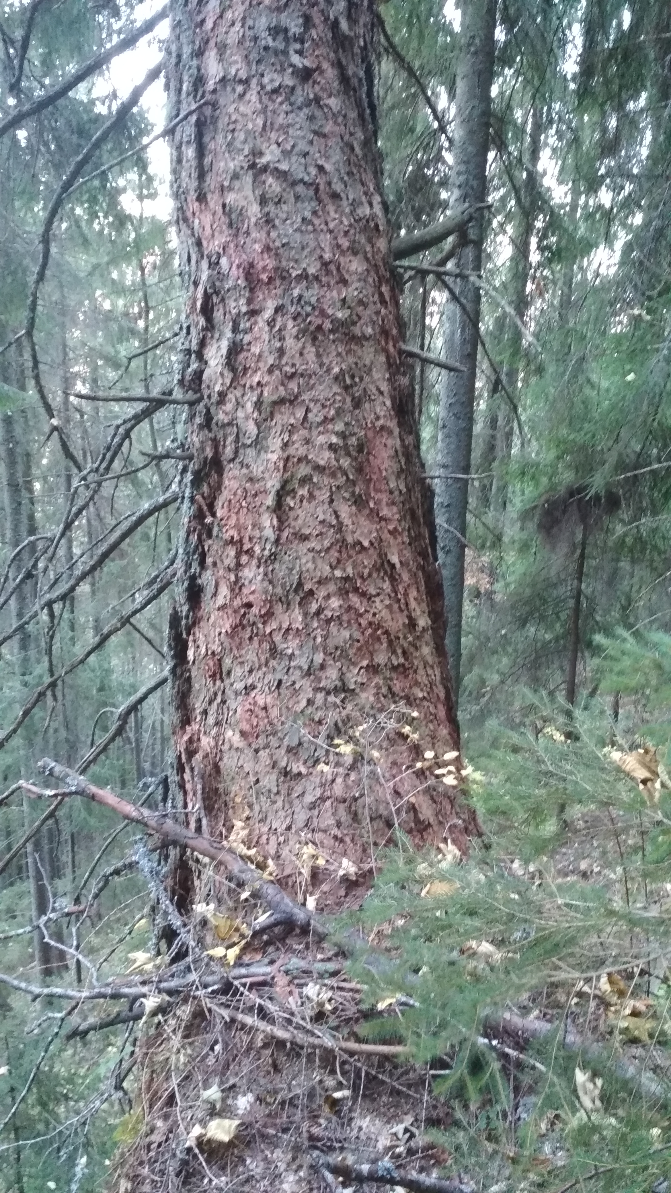
The reserve has a rich fauna: European chamois, brown bear, wolf, lynx, forest cat, forest marten; birds include grouse, spruce nuthatch, nuthatch, and bobwhite. There is a forest seed plot. A giant cedar grows in the reserve. An information table within the framework of the Rufford/Peace Corps Ukraine/Carpathian Trails project is tied to the tree and waymarks are installed from the side of the traverse eco-trail. The circumference of the tree is 310 cm at the level of 1 m from the ground. The tree is over 500 years old.
The age is confirmed by Platon Tretiak in his work "Chronicles of the Osmolodska Pushcha" (p. 24): "Here some cedars aged 100-600 years were 28 m high and 1 m in diameter at breast height."
Bohdan Luchakovsky (founder of the Association of Ukrainian Foresters in the Diaspora) notes that the Yaytse reserve is home to the oldest cedars in Europe, some of which are 130 cm in diameter, and thus older than 500 years.
On the northeastern slope, 2 larch trees were found. The circumference of the larger one is more than 200 cm.
The famous Polish botanist and conservationist, Professor Władysław Śafer, as well as Metropolitan Andrey Sheptytsky, played an important role in the preservation of the Carpathian mountain forests and the creation of protected areas in the most valuable areas. In a letter dated 26.03.1934, the Metropolitan Forestry Administration informed V. Shafer that the Yaytse Reserve was being created to preserve valuable virgin pine forests on an area of 255.12 hectares. The reserve was to be managed according to the instructions of engineer V. Levytskyi of the State Forests Directorate in Lviv.
The Yaytse reserve had legal grounds for its existence, namely: an order of the Minister of Religious Denominations and Public Education, decisions of the Stanyslaviv voivode of 30 May 1934 and 20 September 1934, and a decision of the President of the Polish-Lithuanian Commonwealth of 24 June 1927 on the protection of forests that were not state property.
In 1934, the original entrance gate to the Yaytse reserve and the hunting hut on the pass between Mount Yayk and Mount Moloda were built of cedar pine wood. On August 12 of the same year, the opening of the reserve took place. A solemn liturgy was celebrated and an excursion to the reserve was conducted, and it was dedicated. Now it has received the official name of the Metropolitan Andrey Sheptytsky Cedar Reserve. In the evening, a scientific conference was held, which was opened by the Metropolitan. Speeches were made by the head of the Shevchenko Scientific Society, Dr. V. Levytsky, and the head of the Polish Society for the Protection of Nature, Professor W. Schafer. Engineer A. Piasecki gave a scientific report on topical issues of creating nature reserves.
Metropolitan Andrei Sheptytsky issued a formal act, a charter on the creation of the Yaytse reserve, on April 15, 1935. By this act, he transferred it to the care of the Shevchenko Scientific Society in Lviv with a proposal that it inform the metropolitanate about the state of scientific work in the reserve and give its recommendations in all important matters concerning the reserve. At the same time, the "Regulations for Visitors to the Cedar Reserve" were approved, which established an appropriate security regime. In addition, a "General Description of the Metropolitan Andrey Sheptytsky Cedar Reserve in Gorgany" was created. It provides general information about the natural complexes of the reserve, in particular, it states that its lowest point was at an altitude of 921 m above sea level in the Rosokhan ("Cat") tract, and its highest point was at the top of Yaytse Mountain (1600 m above sea level).
The plant complexes were represented by:
1. Forest stands of cedar pine with a stallion (mountain pine) and a small admixture of spruce. It was noted that there was a lot of different ages of cedar pine undergrowth.
2. Mixed forests with spruce and cedar pine.
3. Purely spruce forests.
4. Dwarf spruce forests.
5. A stallion around the top of the mountain. An egg and a stork (Duskyia green) in the circles.
6. Mixed cedar-fir-spruce forests with sycamore, elm, beech (in the Rosokhan tract).
7. Wind breakers. Two sites. They appeared in a dense cedar-fir forest in October 1926.
The fauna of the reserve was represented by 2-3 bears, 20 deer (8 males). There were also lynxes, wild cats and pigs, wolves, chamois (roe deer), minks, otters, martens, viviparous, goths, hazel grouse, buzzards, falcons, black egrets, herons, and numerous small birds. At the end of the "Description", it was suggested that an inventory of biodiversity should be made as the main focus of scientific research in the reserve and a monograph on its nature, flora and fauna should be prepared. The map of the reserve has also been preserved.
In 2007, the Carpathian Trails Foundation installed information and protection signs (anslagas) as part of a project of the Embassy of the Kingdom of the Netherlands in Ukraine. In 2011, in cooperation with the Peace Corps in Ukraine and the Rufford Foundation, the hunting lodge, whose predecessor was built in the 1930s as the administration of the Ukrainian Nature Park on the initiative of Andrey Sheptytsky and destroyed, presumably, during the liberation war, was overhauled. In addition, the perimeter of the reserve was cleared, marked, and an ecological trail was created.
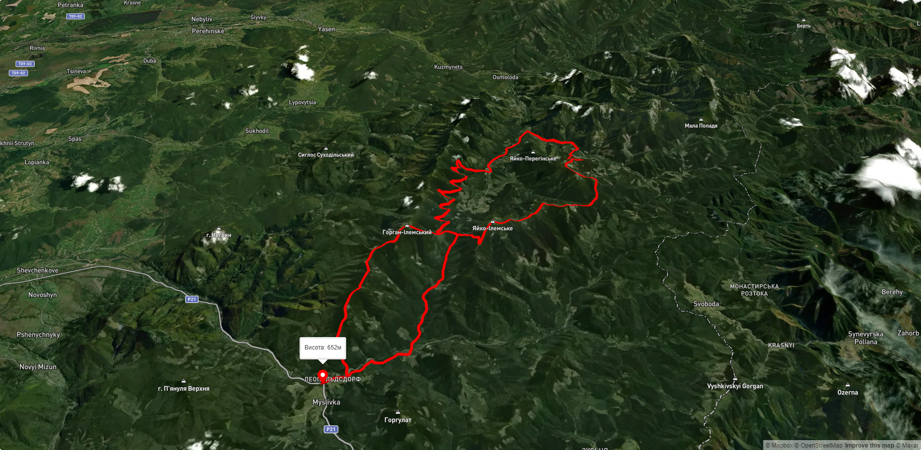
Yaykivsky Reserve - the nearest towns, villages are Svoboda, Myslivka, Sukhodil, Osmoloda, Luhy; or the nearest water bodies are Synya Magura, Pleshcha, Hycha, Chorna, Rosolan, Mshana, Dariv, Moloda, Ilemka, Petros, Bystryk, Kuzminets; to the mountains of Kanch, Kanch, Pleshka, Velyka Megla, Mala Megla, Pyanula-Verkhnia, Kichera, Velykyi Dybak, Perekhrestia, Velykyi Pustyshak, Zhuravel, Yayko-Ilemske, Horhan-Ilemskyi, Moloda, Sokolova, Mala Popadia, Nyagra, Yayko, Serh Slubushnytsia, Popadia, Negryn, Parenky, Magura, Round Top, Sdygunova, Grofa, Menchil, Height 1670, Stovb, Kin Grofetskyi, Neredov, Studena, Kanyusiak-Velykyi, Kanyusiak-Malyi, Height 1486, Sivakova, Prychalen, Arshytsia, Sykhlis.