Mount Spitz
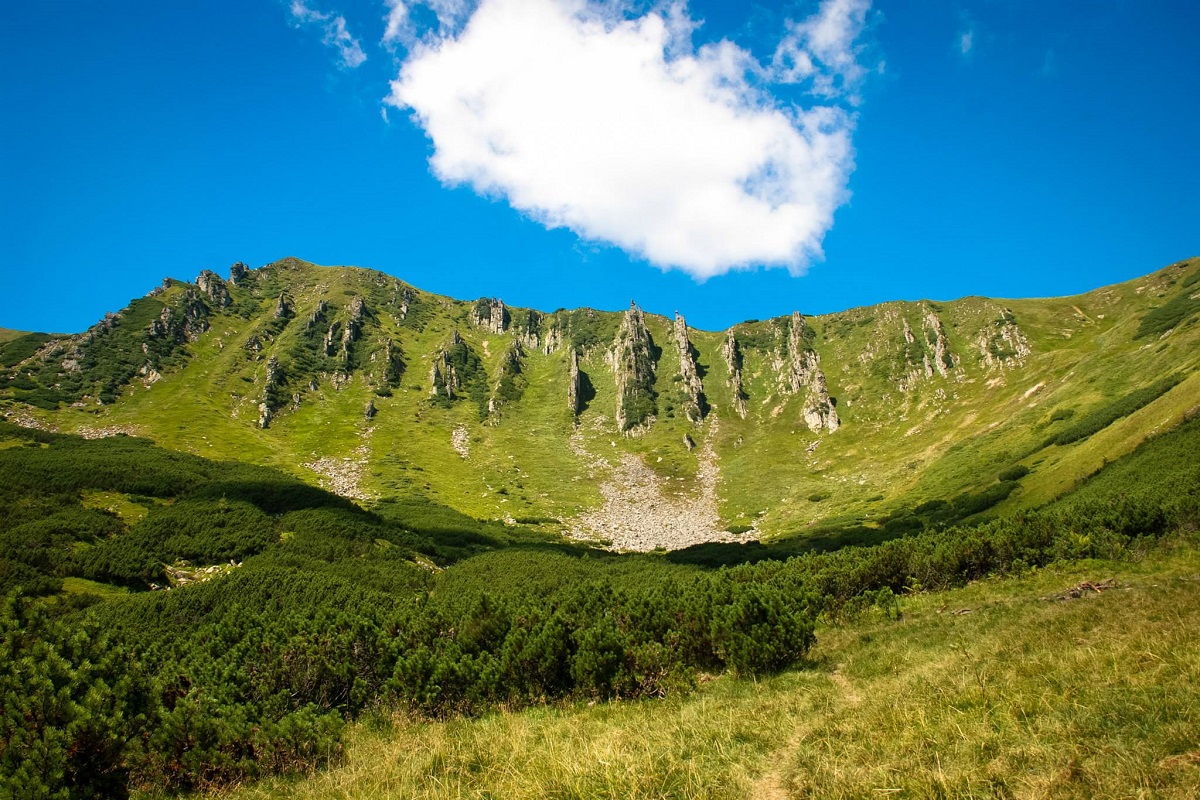
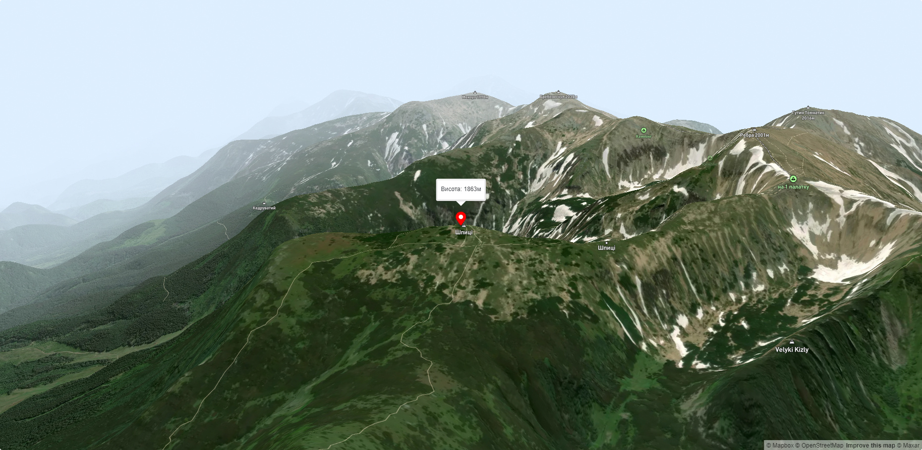
Shpytsi is a mountain of the Ukrainian Carpathians, 1863 m high, which lies on the territory of Verkhovyna district of Ivano-Frankivsk region. The peak is located in the Carpathian National Reserve in the central part of the Chornohora mountain range, several kilometers northeast of the main ridge, with which it is connected by a gentle bridge.
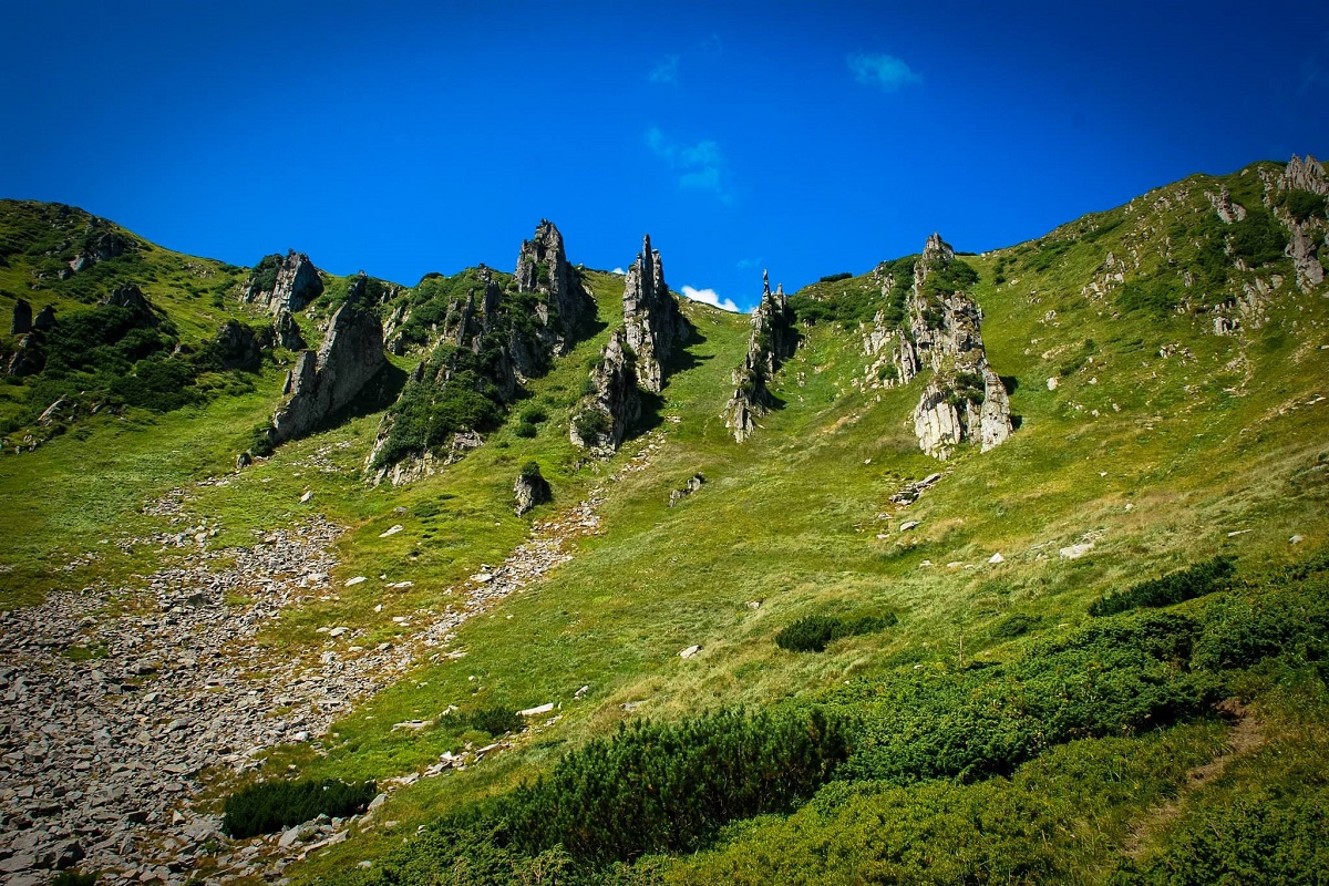
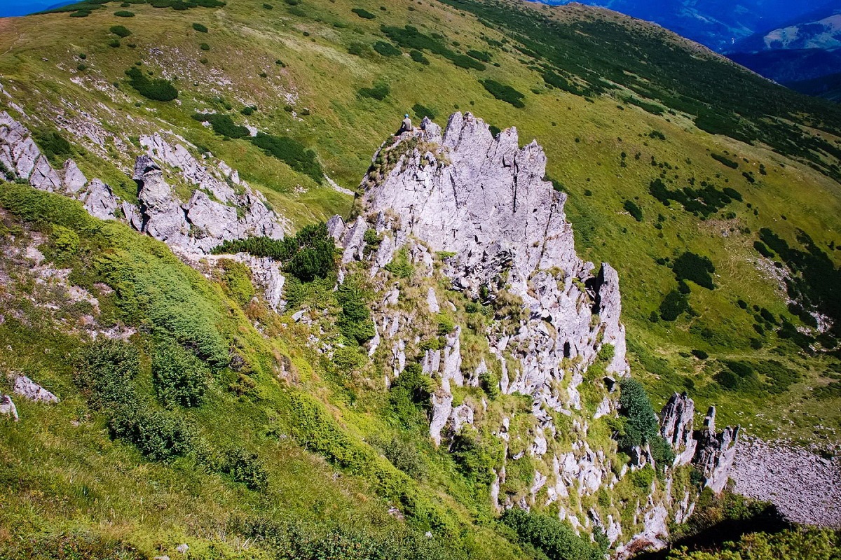
The Shpytsi is one of the most interesting and unusual mountains in the Ukrainian Carpathians. The fact is that its slopes are encircled by 20-50-meter rocky ledges (in some places there are up to 15 rows), which resemble huge stone spikes in their shape (hence the name of the peak).
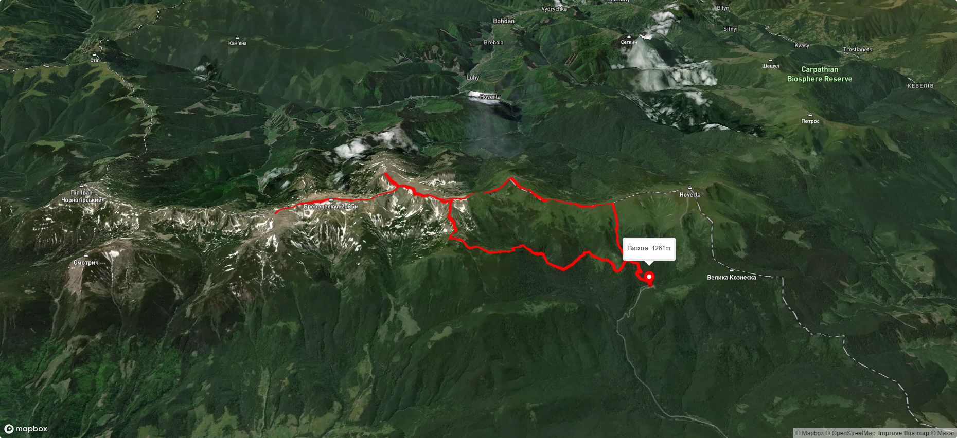
To the north-west of Mount Spires is the basin of Mount Danciz (1850 m), to the north - Mount Gomul (1788 m), and to the northeast - Mount Wielkie Mariszewska (1567 m), to the south - Mount Brebeneskul (2035 m).
The slopes of the mountain are covered with semi-shrub and grass alpine and subalpine meadows.
The nearest settlement is the village of Bystrets (Verkhovyna district, Ivano-Frankivsk region).
Accommodation around Mount Spitz:


Nearby hiking trails near Mount Spitz:
Які маршрути проходять повз Mount Spitz?
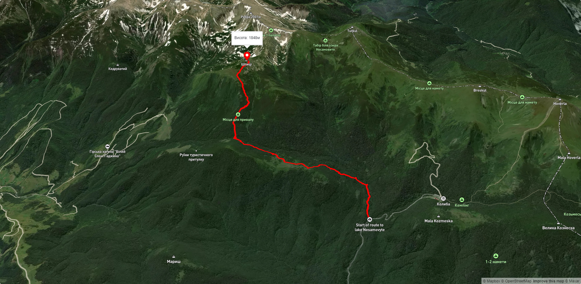
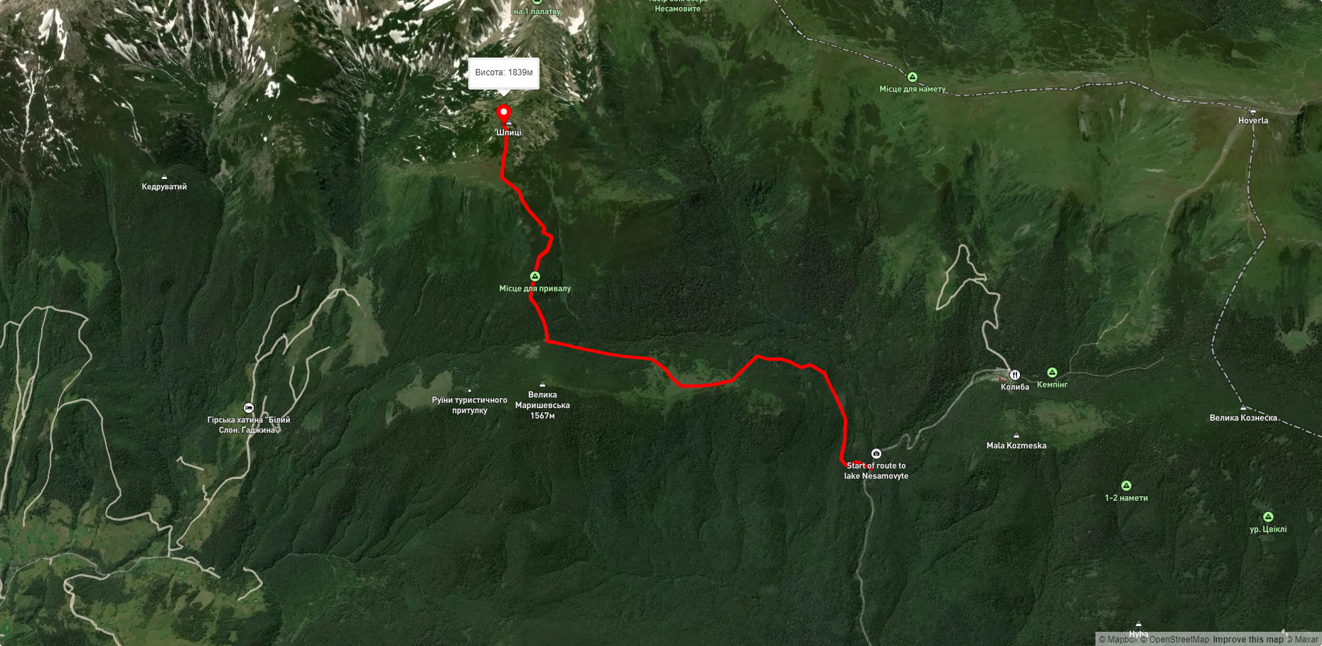
Пропонуємо пройти такі туристичні (пішохідні) маршрути через/біля Mount Spitz: Турбаза "Заросляк", через г. Шпиці, г. Ребра, г. Менчул, г. Туркул, г. Пожижевська до турбази "Заросляк", турбаза "Заросляк" – г. Шпиці, турбаза "Заросляк" – г. Шпиці, с. Дземброня, через г. Піп Іван Чорногірський, г. Шпиці до с. Кривопілля, с. Кваси, через г. Петрос, г. Говерла, г. Бребенескул, г. Шпиці до турбази "Заросляк", с. Дземброня, через г. Смотрич, г. Піп Іван Чорногірський, г. Шпиці до дороги на Ворохту