Mount Koretvina
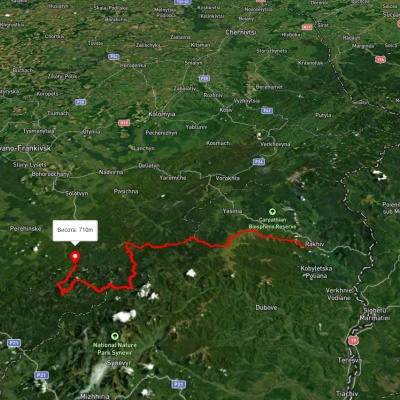
Mount Koretvina (also known as Korytvina) is a peak of the Ukrainian Carpathians, part of the western part of the Gorgan mountain range. It is located in the Rozhnyativ district of Ivano-Frankivsk region.
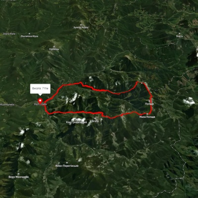
The height of the peak is 1671 meters.
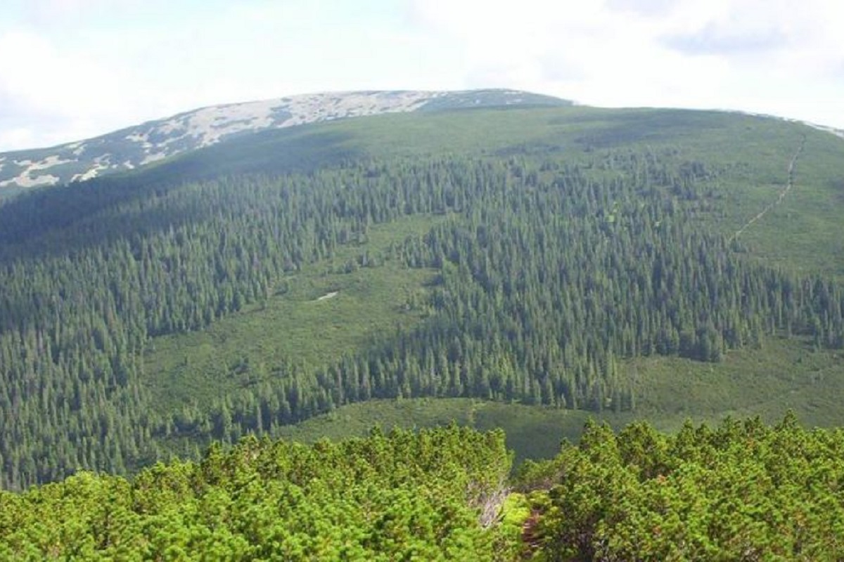
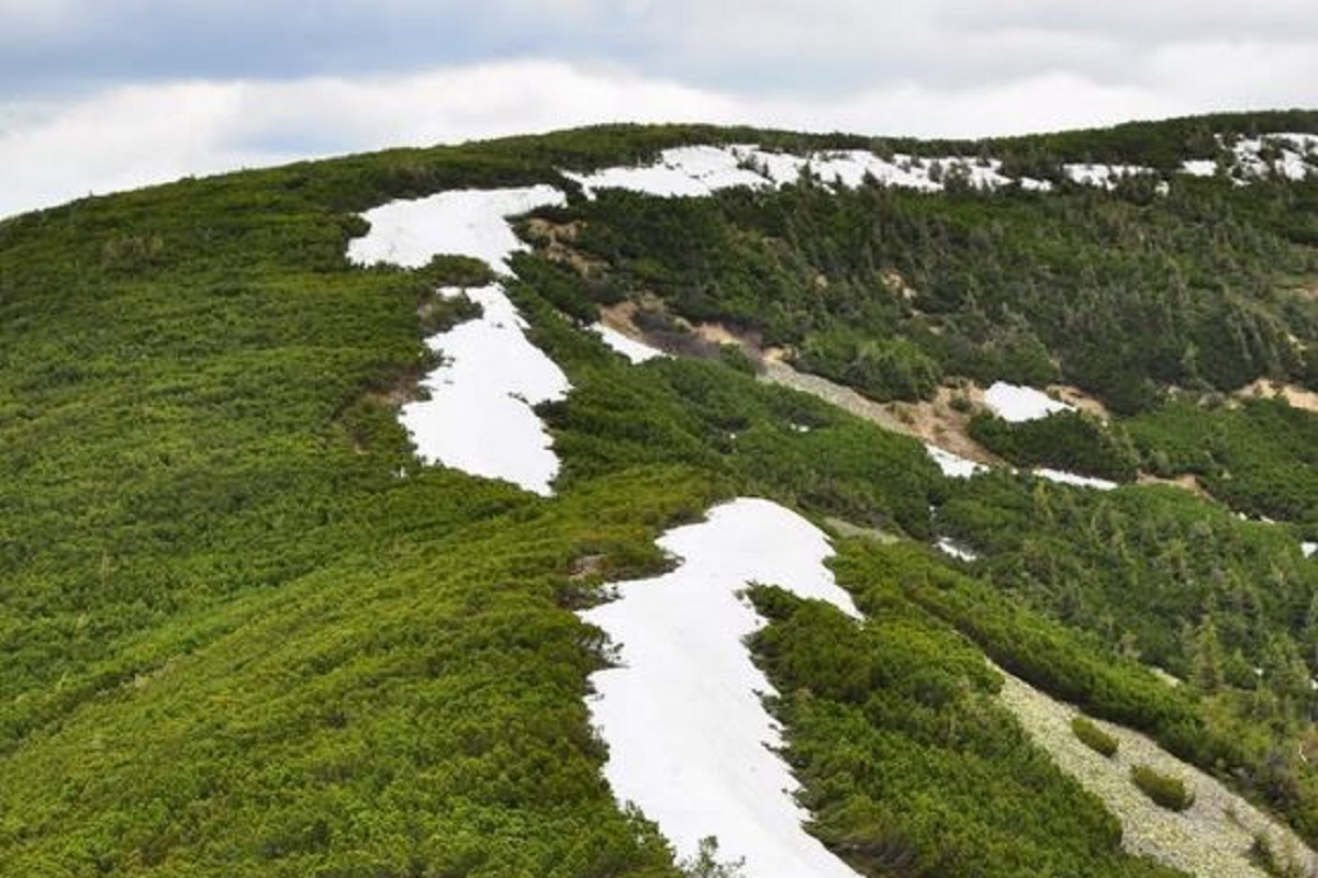
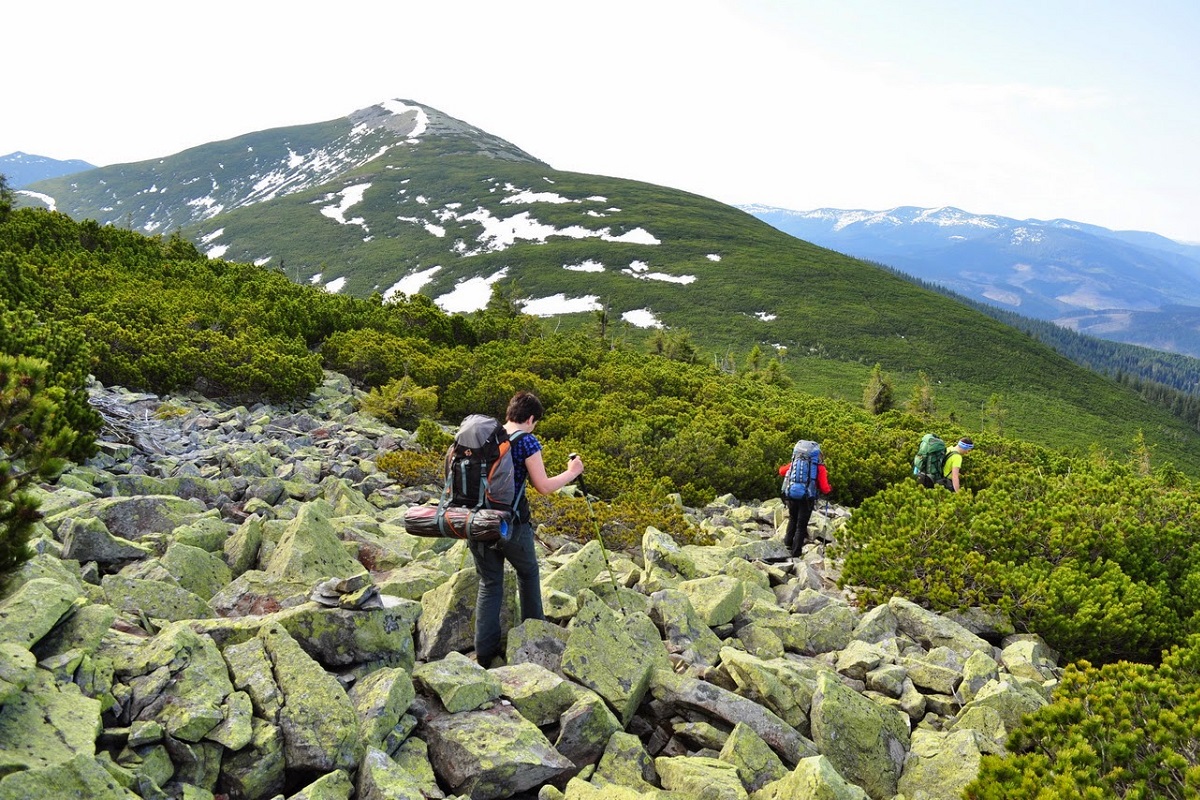
The landscape of Koretvina is typical for the Gorgany Mountains: huge piles of stone placers, densely covered with yellowish-green lichens, and dense, difficult to pass thickets of fir (alpine pine) shrubs. The northern and southern slopes are very steep and inaccessible.
Koretvina is a part of the very popular among tourists route "Grofets-Popadia Ring": from the village of Osmoloda through Grofa, Parenki, Mala Popadia, Velyka Popadia, Petros Horganskyi traverse and to the village of Osmoloda.
Koretvina is connected to Popadia (in the west) and Petros Horhanskyi (in the east).
It is worth noting that a marked route passes through the very top (a white and red marker on the route "Hrofetska-Popadia Ring"), leading from Popadia, crossing Petros Horhanskyi and descending into the valley of the small river Petros, and then to Osmoloda.
The nearest settlement is the village of Osmoloda.

Accommodation around Mount Koretvina:


Nearby hiking trails near Mount Koretvina:
Які маршрути проходять повз Mount Koretvina?
Пропонуємо пройти такі туристичні (пішохідні) маршрути через/біля Mount Koretvina: м. Рахів, через г. Близниця, г. Трояска, г. Братківська до с. Осмолода, с. Осмолода, через г. Коретвина, г. Мала Попадя, г. Велика Попадя до с. Осмолода, с. Осмолода, через г. Грофа, г. Паренки, г. Коретвина, г. Попадя до с. Осмолода, с. Осмолода, через г. Грофа, г. Коретвина, г. Попадя до с. Осмолода, Східно-Карпатський туристичний шлях, с. Мислівка, через г. Яйко-Ілімеське, г. Молода, г. Грофа, г. Попадя до с. Осмолода