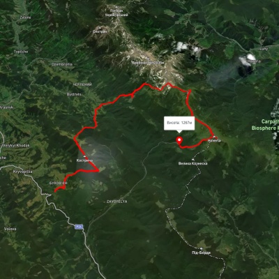
Kostrich Ridge
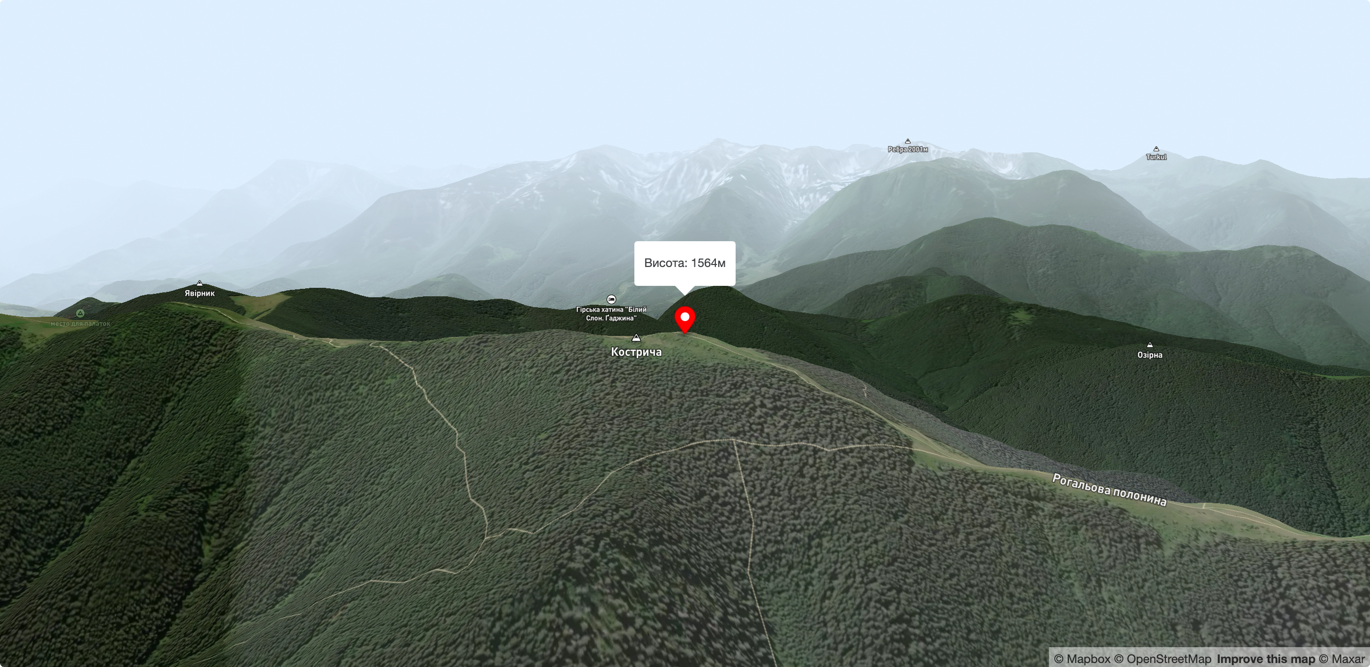
Kostrych (Kostrycha) is a mountain range(parallel to the Chornohora range, which can be seen in good weather) with the highest point at 1586 meters above sea level. The ridge is located in the Verkhovyna district and is a well-known tourist attraction in the Carpathians. From the top, you can enjoy magnificent views of the entire Chornohora ridge, which runs parallel to Kostrych. The Svydovets, Gorgany and Pokutsko-Bukovyna Carpathians are also clearly visible. The Kostrych Ridge is known for its meadows where cattle graze, as well as for mushrooms, berries and crocuses listed in the Red Book of Ukraine. The easiest and best way to get to Kostrych is to climb from the Kryvopil Pass.
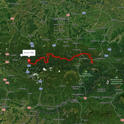
The KryvopilPass is one of the passes in the Ukrainian Carpathians. It is located on the outskirts of the village of Kryvopillia, from which the pass got its name. The height of the pass is 970 m above sea level. The pass is crossed by the Vorokhta-Verkhovyna paved road. The slopes of the pass are relatively gentle and easily accessible. Kryvopillia is a village in Verkhovyna district of Ivano-Frankivsk region. Until 1958 it was called Kryvopole.
Kostrycha is also a mushroom picker's paradise. The harvest time is late September and early October, when there are so many mushrooms that a persistent thick smell of mushrooms hangs in the air and you inhale it along with the coolness of the forest. In summer, there are even more berries than mushrooms on Kostrych! Delicious blueberries, which leave your hands smeared with ink, grow right on the trail - you walk up, bend down, pick a few ripe berries and move on.
Polonyna cheese in Kostrych has an amazing flavor, no matter what kind of cheese we are talking about: budz, brynza, or vurda. Each kolyba (and there are several on the ridge) has something to taste and buy as a souvenir.
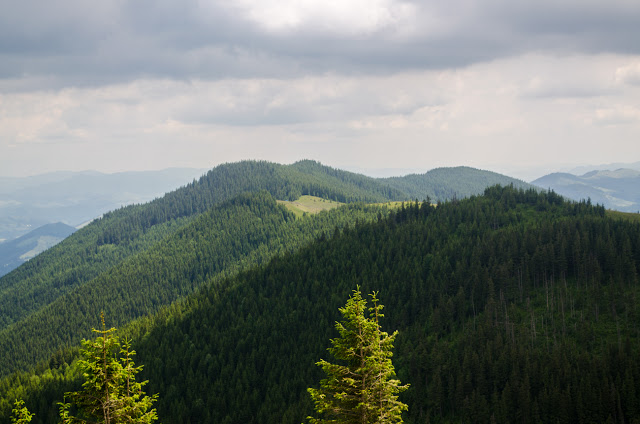
Kostrycha is a fabulous forest. It is so quiet that you can hear every step. Mossy stones, trunks of centuries-old trees, tall pine needles, and knots of roots cross the paths. As a souvenir from such a forest, you can bring back not only photos saturated with all shades of green, but also a picture of someone's predatory paw print. Bears walk here, but they do not harm people - it is very rare to meet a clubfoot in person on Kostrych. More often, people see claw marks in the damp soil or scratch marks on trees.
Summer on Kostrych, in addition to mushrooms and berries, smells like mountain cheese. There is a lot of space for grazing, which is actively used by local Hutsuls. There are several kolybas along the ridge, and you can visit each one to buy some goodies - brynza, budz. vurda, fresh milk or whey. Do you like cheese and dairy products? Stock up on containers and money - you may be given a taste of cheese or milk for free, and the "sample" piece will usually be generous, but you won't be fed for free. Keep in mind that making cheese is a lot of work, and usually only a kilogram of cheese is made from 10 liters of fresh milk. So any declared price is justified.
It is not known for sure why the ridge got this name, but one of the variants of its origin is from the name of a Red Book plant that was found on the slopes of Kostrycha, rock fescue. You may find it difficult to recognize a protected plant in a spikelet on a thin stem at first, but know that it grows only in the highlands, prefers altitudes from 1400 to 1800 meters above sea level, and is found, in addition to Kostrycha, on Chornohora (most of all on Mount Petros), as well as in the Marmarosh massif (on Petros Marmarosh and Mount Nenesk), locally fescue can also be found in the Eastern Beskydy (Mount Stiy and Mount Stinka).
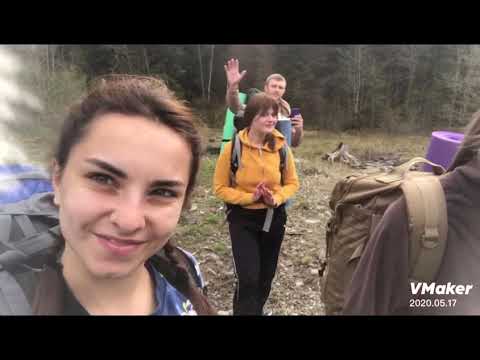
We start the route from the bus stop, where there is also a grocery store. Then we go up to the church and turn left. The road runs past Hutsul houses and soon we come to a large meadow - a large old beech tree and a telecommunication tower serve as a landmark. Then the trail enters the forest and begins to climb more steeply. There is a lot of mud here, which is not surprising, since we are walking from the north side. You can climb the Kostrych ridge not only from the pass, but also from Krasnyk and Bystrets, but then the climb will be much harder physically.
You can also go to Kostrych from the village of Iltsi, but you lose the advantage of starting from a decent height - you have to take +150 meters in vertical height from Iltsi, and you have to make a hook to get to the highest point of the ridge.
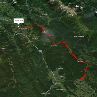
But it's best to leave Iltsi after the hike. Or, at least, move towards this village after descending the ridge. By the way, we recommend going down to the village of Krasnyk - despite the Hutsul huts, there is a well-paved dirt road there. By the way, we advise you to choose the right path to climb the ridge from Krasnyk. There are two options: to go along the serpentine path, but such a climb will drink all the juices out of even a hardy tourist before the middle of the road. It's quite steep here. The second trail, which starts behind the sawmill, leads through the forest to Mount Hedya - this option looks more attractive.
After descending to Krasnyk, walk to Iltsi - it's really not far, and you can catch a bus to Verkhovyna and a ride to the highway, where the choice of transport will be a little wider.
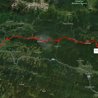
Kostrychi is at best a two-day hike with one overnight stay, although the views can certainly make tourists stay longer. Do you want a more varied hike? You can turn the same three hiking days into 32 km of adventure: for example, go from Voronenko to Mount Pid-Beskydy, then through the Labieska meadow to Kukul and through the Vesnarka meadow to Kostrycha. Then you have a choice: walk the entire ridge and go down to Krasnyk or Bystrets, or admire Chornohora a little more and head to the neighboring village of Staische.
Your key task is to get to the Kryvopil Pass. You can do this by taking a minibus in the direction of Vorokhta-Verkhovyna. Then, depending on the time you arrive at the disembarkation point, either spend the night in the forest from the pass or on the ridge, say, in the kolyba. There is enough water on the ridge, as well as places for tents, so you have a choice.
If you choose a place to descend, it's easier to go towards Krasnyk - there, in the likely event of no public transportation, you can either walk to Iltsi or the road to Verkhovyna, or try to rent a car in the same direction or even a carrier to your home.
Accommodation around Kostrich Ridge:


Which trails pass by Kostrich Ridge?
We suggest these hiking trails through or near Kostrich Ridge: Iltsi village, via Mount Kukul to Voronenko village, East Carpathian Tourist Trail, Krasnyk village, via Kostrych ridge and Mount Kukul to Voronenko village, Voronenko village, via Mount Kukul to Staishche village, Kryvopillia village, via Mount Shpytsi and Mount Hoverla to Zaroslyak base, Mykulychyn village, via Mount Khorde, Mount Pozhyzhevska, Mount Hoverla and Mount Kukul to Voronenko village


Iltsi village, via Mount Kukul to Voronenko village
East Carpathian Tourist Trail

Krasnyk village, via Kostrych ridge and Mount Kukul to Voronenko village
Voronenko village, via Mount Kukul to Staishche village