Ask the AI guide:

Hiking routes

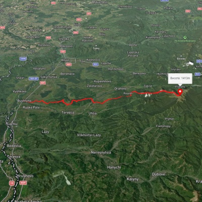
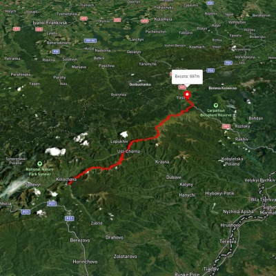
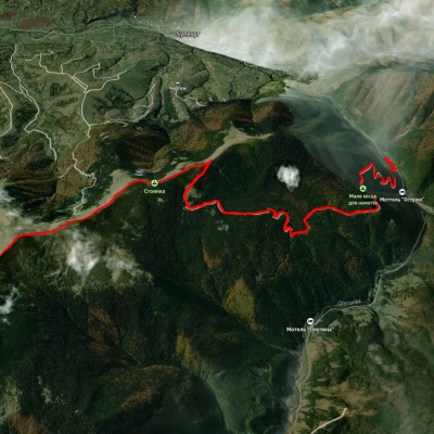
Bushtyno, via Zanivka tract to Mount Manchul

Bushtyno, via Zanivka tract to Mount Manchul

Three days or more
Unmarked
Passes through peaks: Mount Manchul
3D map
51 view
Length: 45.5km
Total ascent: 2066m
Total descent: 789m
Minimum altitude: 200m
Maximum altitude: 1488m
More
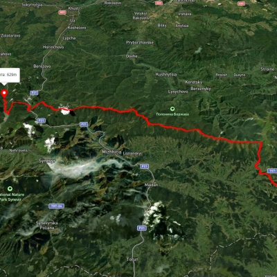
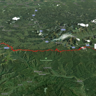
Skotarske village, via Borzhava polonyna and Palenyi Hrun polonyna to Vilshanske reservoir

Skotarske village, via Borzhava polonyna and Palenyi Hrun polonyna to Vilshanske reservoir

Three days or more
Unmarked
Passes through peaks: Mount Gemba, Mount Zhid-Magura
3D map
44 views
Length: 72.3km
Total ascent: 3487m
Total descent: 3658m
Minimum altitude: 315m
Maximum altitude: 1504m
More
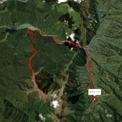
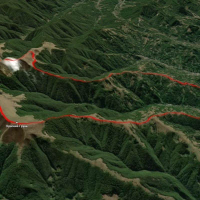
Mount Topas, via Mereshor village to Kolochava village
3D map
68 views
Length: 21.8km
Total ascent: 434m
Total descent: 1436m
Minimum altitude: 459m
Maximum altitude: 1531m
More
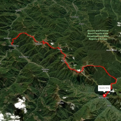
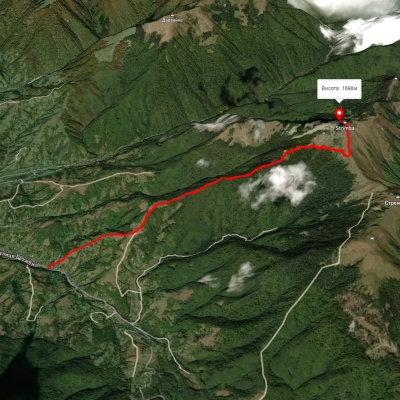
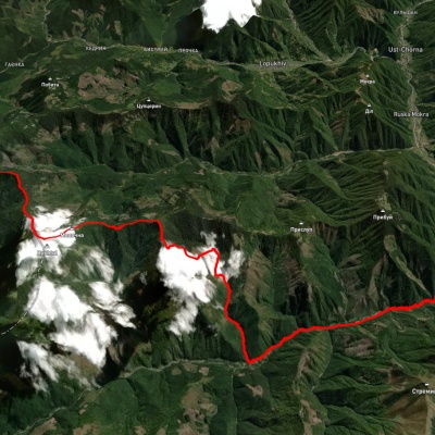
Ust-Chorna village, via Mount Klymova, Mount Syhlianskyi and Mount Topas to Kolochava village
3D map
34 views
Length: 42.1km
Total ascent: 1698m
Total descent: 1680m
Minimum altitude: 522m
Maximum altitude: 1558m
More
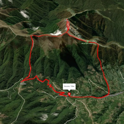
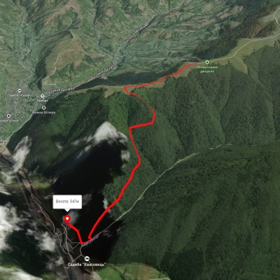
Kolochava village – Mount Topas – Kolochava village
3D map
43 views
Length: 16.2km
Total ascent: 1020m
Total descent: 1025m
Minimum altitude: 630m
Maximum altitude: 1540m
More
Transcarpathian Tourist Trail

Transcarpathian Tourist Trail

Three days or more
Has red marking.
Passes through peaks: Berlebashka Mountain, Mount Pip Ivan of Marmarosh, Mount Mala Nenieska, Mount Mica Mare, Mount Birsenscu, Mount Steavul, Mount Stig, Mount Shchavnyk, Mount Pip Ivan of Chornohora (Pip Ivan, Black Mountain), Mount Dzembronya, Mount Menchul, Mount Brebeneskul, Mount Gutin Tomnatik, Mount Rebra, Mount Turkul, Mount Danzig, Mount Pozhyzhevska, Mount Breskul, Mount Hoverla, Гора Говерла - найвища точка Карпат і всієї України, Mount Petros, Mount Petrosul, Mount Sheshul, Mount Bliznytsia, Mount Stig (Dragobrat), Mount Bolshoi Kotel, Mount Dogyaska, Mount Trojaska, Mount Ungaryaska, Mount Mala Kurtiaska, Mount Velyka Kurtyaska (Svydovets), Mount Tempe, Mount Shpanska, Mount Negrovets, Mount Velyka Gropa, Mount Yasenovets, Mount Zhid-Magura, Mount Gemba, Mount Veliky Verkh
3D map
48 views
Length: 393.2km
Total ascent: 30283m
Total descent: 30433m
Minimum altitude: 198m
Maximum altitude: 2031m
More
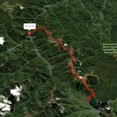
Kolochava village, via Mount Syhlianskyi, Mount Klymova and Mount Ruzha to Ust-Chorna village
3D map
34 views
Length: 29.4km
Total ascent: 1742m
Total descent: 1831m
Minimum altitude: 515m
Maximum altitude: 1557m
More
Synevyr village, via Mount Nehrovets, Mereshor village, Krasna ridge, Ust-Chorna village and Svydovets ridge to Kvasy village
3D map
41 view
Length: 100.3km
Total ascent: 5367m
Total descent: 5484m
Minimum altitude: 516m
Maximum altitude: 1843m
More
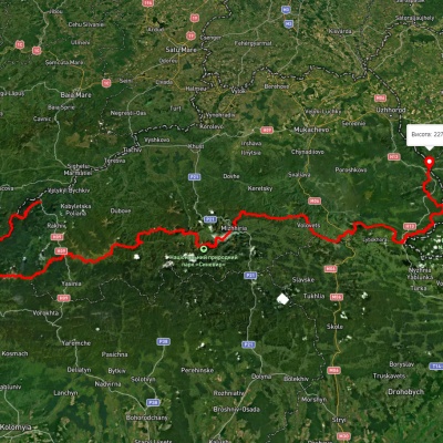
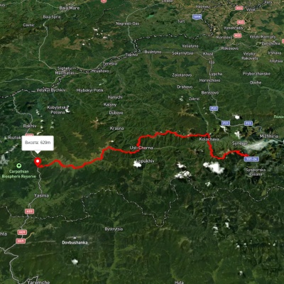
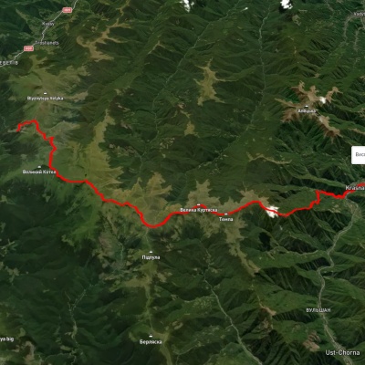
Kolochava village, via Krasna ridge, Ust-Chorna village and Svydovets ridge to Yasinia

Kolochava village, via Krasna ridge, Ust-Chorna village and Svydovets ridge to Yasinia

Three days or more
Unmarked
Passes through peaks: Mount Shpanska, Mount Tempe, Mount Velyka Kurtyaska (Svydovets), Mount Mala Kurtiaska, Mount Ungaryaska, Mount Trojaska, Mount Dogyaska, Mount Bolshoi Kotel, Mount Stig (Dragobrat)
3D map
42 views
Length: 81.4km
Total ascent: 3395m
Total descent: 3265m
Minimum altitude: 527m
Maximum altitude: 1756m
More
Kolochava eco-trail

Kolochava eco-trail

One-day routes
Has blue marking.
3D map
50 views
Length: 3.5km
Total ascent: 142m
Total descent: 601m
Minimum altitude: 533m
Maximum altitude: 992m
More
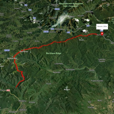
Skotarske village, via Borzhava polonyna and Palenyi Hrun polonyna to Nyzhnii Bystryi village

Skotarske village, via Borzhava polonyna and Palenyi Hrun polonyna to Nyzhnii Bystryi village

Three days or more
Unmarked
Passes through peaks: Mount Gemba, Mount Zhid-Magura
3D map
47 views
Length: 63.7km
Total ascent: 3008m
Total descent: 3353m
Minimum altitude: 287m
Maximum altitude: 1505m
More
Vovchyi village, via Mount Stiy, Mount Zhyd-Mahura, Pryslip Pass, Kuk polonyna, Mount Korytyshche and Shyroke village to Nyzhnii Bystryi village
3D map
37 views
Length: 60.7km
Total ascent: 2680m
Total descent: 2655m
Minimum altitude: 285m
Maximum altitude: 1649m
More
Kolochava – Tapesh

Kolochava – Tapesh

One-day routes
Has green marking.
3D map
37 views
Length: 6.7km
Total ascent: 894m
Total descent: 153m
Minimum altitude: 543m
Maximum altitude: 1304m
More
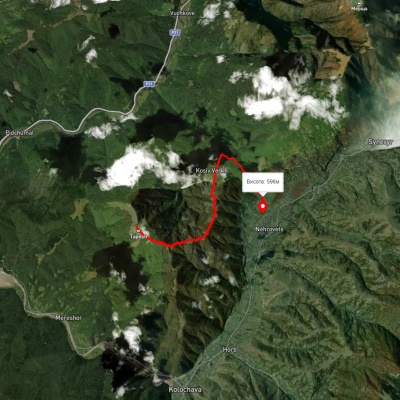
Nehrovets – Kosiv Verkh – Tapesh

Nehrovets – Kosiv Verkh – Tapesh

One-day routes
Has green marking.
3D map
34 views
Length: 7.6km
Total ascent: 421m
Total descent: 1121m
Minimum altitude: 597m
Maximum altitude: 1304m
More
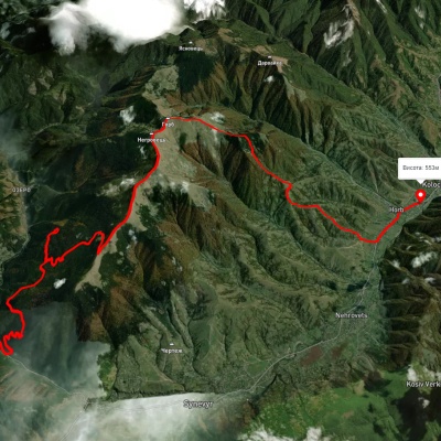
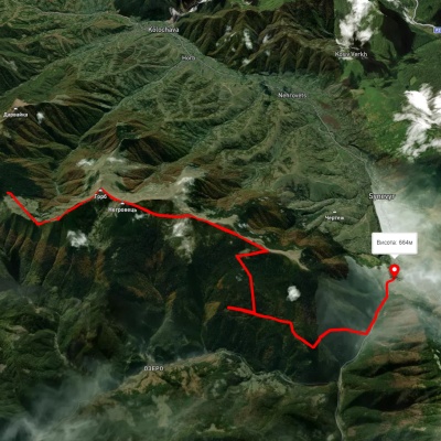
Synevyr village, via Mount Nehrovets to Kolochava village

Synevyr village, via Mount Nehrovets to Kolochava village

Three days or more
Unmarked
Passes through peaks: Mount Yasenovets, Mount Velyka Gropa, Mount Negrovets
3D map
44 views
Length: 25.4km
Total ascent: 1531m
Total descent: 1675m
Minimum altitude: 539m
Maximum altitude: 1697m
More
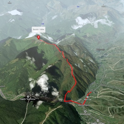
To Mount Strymba

To Mount Strymba

One-day routes
Has blue marking.
Passes through peaks: Mount Strymba
3D map
44 views
Length: 5.5km
Total ascent: 1092m
Total descent: 42m
Minimum altitude: 634m
Maximum altitude: 1700m
More
Kolochava village – Mount Strymba – Kolochava village

Kolochava village – Mount Strymba – Kolochava village

Ring routes
Unmarked
Passes through peaks: Mount Strymba
3D map
36 views
Length: 16.2km
Total ascent: 1145m
Total descent: 1147m
Minimum altitude: 637m
Maximum altitude: 1703m
More
Kolochava village – Mount Strymba – Kolochava village

Kolochava village – Mount Strymba – Kolochava village

Ring routes
Unmarked
Passes through peaks: Mount Strymba
3D map
31 view
Length: 16.2km
Total ascent: 1126m
Total descent: 1115m
Minimum altitude: 716m
Maximum altitude: 1716m
More
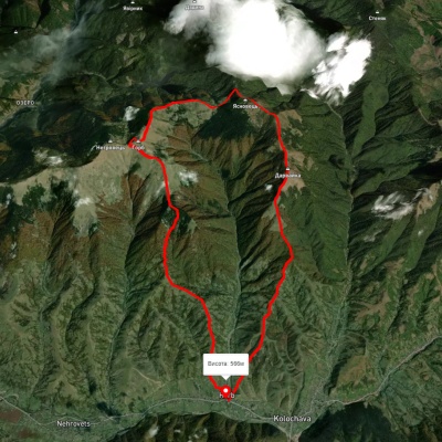
Kolochava village, via Mount Darvaika and Mount Nehrovets to Kolochava village

Kolochava village, via Mount Darvaika and Mount Nehrovets to Kolochava village

Ring routes
Unmarked
Passes through peaks: Mount Yasnovets, Mount Negrovets
3D map
33 views
Length: 21.9km
Total ascent: 1545m
Total descent: 1544m
Minimum altitude: 566m
Maximum altitude: 1657m
More
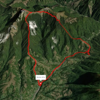
Kolochava village, via Mount Strymba and Pryslip Pass to Kolochava village

Kolochava village, via Mount Strymba and Pryslip Pass to Kolochava village

One-day routes
Unmarked
Passes through peaks: Mount Strymba
3D map
39 views
Length: 13.6km
Total ascent: 1130m
Total descent: 1044m
Minimum altitude: 673m
Maximum altitude: 1751m
More
Carpathian Tourist Trail

Carpathian Tourist Trail

One-day routes
Has green marking.
3D map
38 views
Length: 5.4km
Total ascent: 896m
Total descent: 292m
Minimum altitude: 343m
Maximum altitude: 1030m
More
Carpathian Tourist Trail

Carpathian Tourist Trail

One-day routes
Has yellow marking.
3D map
40 views
Length: 4.2km
Total ascent: 622m
Total descent: 241m
Minimum altitude: 349m
Maximum altitude: 840m
More
Dubove village – Mount Apetska – Dubove village

Dubove village – Mount Apetska – Dubove village

Ring routes
Unmarked
Passes through peaks: Mount Apetska
3D map
41 view
Length: 21.2km
Total ascent: 1212m
Total descent: 1213m
Minimum altitude: 385m
Maximum altitude: 1490m
More
Dubove village, via Mount Apetska, Mount Dohiaska, Mount Stih and Mount Blyznytsia to Kvasy village

Dubove village, via Mount Apetska, Mount Dohiaska, Mount Stih and Mount Blyznytsia to Kvasy village

Three days or more
Unmarked
Passes through peaks: Mount Apetska, Mount Tempe, Mount Shpanska, Mount Velyka Kurtyaska (Svydovets), Mount Pidpula, Mount Trojaska, Mount Dogyaska, Mount Bolshoi Kotel, Mount Stig (Dragobrat), Mount Bliznytsia
3D map
28 views
Length: 69.1km
Total ascent: 4845m
Total descent: 4669m
Minimum altitude: 386m
Maximum altitude: 1851m
More
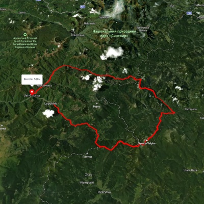
Lopukhiv village, via Legioniv Pass, Peklo tract, Mount Syvulia, Mount Popadia and Nimetska Mokra village to Ust-Chorna village
3D map
34 views
Length: 94.1km
Total ascent: 3095m
Total descent: 3165m
Minimum altitude: 522m
Maximum altitude: 1809m
More
Bert ridge, via Mount Bushtul to Nimetska Mokra village

Bert ridge, via Mount Bushtul to Nimetska Mokra village

Two-day routes
Unmarked
Passes through peaks: Mount Bushtul
3D map
29 views
Length: 21.3km
Total ascent: 684m
Total descent: 1573m
Minimum altitude: 618m
Maximum altitude: 1710m
More
Synevyr village – Mount Nehrovets

Synevyr village – Mount Nehrovets

One-day routes
Unmarked
Passes through peaks: Mount Yasenovets, Mount Velyka Gropa, Mount Negrovets
3D map
44 views
Length: 12.3km
Total ascent: 1310m
Total descent: 293m
Minimum altitude: 647m
Maximum altitude: 1700m
More
Mount Nehrovets – Synevyr village

Mount Nehrovets – Synevyr village

Two-day routes
Unmarked
Passes through peaks: Mount Yasnovets, Mount Negrovets, Mount Velyka Gropa, Mount Yasenovets
3D map
43 views
Length: 17.1km
Total ascent: 562m
Total descent: 1539m
Minimum altitude: 586m
Maximum altitude: 1690m
More
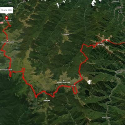
Dragobrat, via Mount Stih, Mount Velykyi Kotel, Mount Unhariaska and Mount Tempa to Krasna village

Dragobrat, via Mount Stih, Mount Velykyi Kotel, Mount Unhariaska and Mount Tempa to Krasna village

Three days or more
Unmarked
Passes through peaks: Mount Stig (Dragobrat), Mount Bolshoi Kotel, Mount Dogyaska, Mount Trojaska, Mount Ungaryaska, Mount Mala Kurtiaska, Mount Velyka Kurtyaska (Svydovets), Mount Tempe, Mount Shpanska
3D map
37 views
Length: 35.3km
Total ascent: 1166m
Total descent: 2064m
Minimum altitude: 422m
Maximum altitude: 1751m
More
Lake Synevyr, via Mount Ozerna and Mount Kamianka to Synevyr village

Lake Synevyr, via Mount Ozerna and Mount Kamianka to Synevyr village

Two-day routes
Unmarked
Passes through peaks: Ozerna Mountain, Kamyanka Mountain
3D map
43 views
Length: 19.4km
Total ascent: 1213m
Total descent: 1401m
Minimum altitude: 661m
Maximum altitude: 1553m
More

The Carpathian Mountains are one of the most beautiful places in Ukraine, attracting people from all over the world. These mountains stretch in the southwest of the country and consist of several mountain ranges, including Montenegro, Svydovets, Gorgany, Marmarosy, Beskydy, and others. Hiking routes in the Carpathians are a great way to experience the beauty of the mountain scenery and enjoy the fresh air. We'll take a look at the most popular routes for beginners and experienced hikers.


The most popular hiking routes in the Carpathians

The route to Mount Hoverla

The route to Mount Hoverla is the most popular route among tourists who come to the Carpathians. It is the highest mountain in Ukraine with a height of 2061 meters. Although the route is not too difficult, tourists should be prepared for long walks. Travel time depends on the route chosen, but on average it takes 5 to 8 hours. The best time to climb Hoverla is in summer or early autumn, when the weather is not as harsh as in winter, when the mountain is covered with snow.

Route to the Pip Ivan Chornohirsky mountain

Mount Pip Ivan Chornohirsky is the third highest mountain in the Carpathians after Hoverla and Brebeneskul. The height of its peak is 2028 meters. Another name for the peak is Chorna Hora, which gave the name to the Chornohora mountain range of the same name. The route to Pip Ivan Chornohirsky is more difficult than to Hoverla. It can take from 8 to 10 hours, depending on the route chosen. Tourists should be prepared to cross steep rocky areas. At the top of the mountain there is a stone tower, an old observatory, which offers a beautiful view of the Carpathians and the Chornohora range.

How to choose a hiking route

First of all, you should determine the level of physical fitness and experience of hiking in the mountains. For beginners, it is recommended to choose easy routes that do not require the use of special equipment. Experienced hikers can choose more difficult routes that include rocky areas and require the use of safety equipment.

It is also worth considering the time of year, as hiking routes in the Carpathians can be dangerous in winter or spring during snowmelt. The safest time for hiking is summer and fall.

You should also consider the length of the route and its complexity. It is not recommended to choose routes that take more than 10 hours if you do not have sufficient experience and physical fitness. For beginners, it is better to choose routes that take from 3 to 6 hours.

When choosing a route, you should also take into account the availability of springs, places for tents, where you can rest and have a snack.

Frequently asked questions about hiking routes in the Carpathians

Do I need special equipment for hiking in the Carpathians?

Some routes in the Carpathians may require special equipment, such as carabiners, a safety belt, ropes, etc. If you do not have enough experience or do not know how to use such equipment, it is better to contact an experienced guide or instructor.

Can I go hiking in the Carpathians on my own?

Yes, you can go hiking in the Carpathians on your own, but you should have sufficient experience and knowledge of the weather conditions and landscape of the region. You also need to be prepared for possible dangers and know how to act in case of emergency.

Is it safe to hike in the Carpathians?

Hiking in the Carpathians can be dangerous, especially in spring and winter. The safest time for hiking is summer and fall, but you should always consider the weather conditions and check the forecast before setting out on the route.

Hiking in the Carpathians is a great way to spend time outdoors, enjoy the panoramas and see the incredible beauty of this region. However, you should be well prepared before setting out on the route, taking into account the complexity of the route, weather conditions, and your own physical abilities. It is better to choose routes according to your abilities and experience, and if necessary, contact an experienced guide or instructor. Remember to be safe and enjoy your outdoor adventures!

Carpathian GuideOnline

Ask a question about travelling in the Carpathians to start a conversation.