Kolomyia district
Kolomyia district is a district of Ukraine in the center of Ivano-Frankivsk region. The district center is the city of Kolomyia. The population is 100,511 people (as of August 1, 2013). The area of the district is 1000 km². The district was formed on January 17, 1940. It has three towns and 80 villages. It is located in the southeast of Ivano-Frankivsk region, and the main tourist locations of the district besides Kolomyia are: Verkhniy Verbizh, Knyazhdvir.
The favorable geographical location, concentration of special natural resources in the area with a unique flora and fauna of the foothill regions of the Carpathians, favorable ecology, a large number of architectural monuments of different styles and eras, a suburban protected area, preserved cultural traditions of the ancestors, well-known art centers and artistic and festival image, as well as historical heritage undoubtedly define Kolomyia district as an attractive tourist destination.
In Kolomyia district, the Yahidnyi Yew Grove, or Knyazhdvir Yew Grove, has been preserved on an area of about 70 hectares near the village of Knyazhdvir. The Knyazhdvir forests are an attractive corner of the Carpathian foothills and the largest yew reserve in Ukraine.
- Botanical reserves: Knyazhdvirsky (of national importance).
- Hydrological reserves: Pistynka River with a coastal strip.
- Botanical natural monuments: Gray walnut, Ivan Franko oak, Karpinsky oak, magnolia.
- Geological natural monuments: Kovalivske lignite deposit.
- Protected tracts: Kropyvets, Oblogy, Nad stany, Pid gory-1, Pid gory-2, Plosky-1, Plosky-2, Staiky, Stanislavivka, Toloka, Chymshory, Sheparivskyi forest.
- Dendrological parks: Dendropark, Park (Kolomyia).
The oldest settlements in Pokuttia are located on the territory of Kolomyia district: Otynia village (XIII century) - the main stronghold during the peasant uprising led by S. Vysoczan (1648); Pechenizhyn village (XIV century) - the birthplace of O. Dovbush (1700-1745), the leader of the Oprishky movement in Pokuttia, Korshiv village (first mentioned in written sources in 1434).
The district was formed on January 17, 1940. By the decree of the Presidium of the Supreme Soviet of the Ukrainian SSR on October 23, 1940, village councils were transferred to the Kolomyia district: Nazyrnyanska from Hvizdetskyi district, Troitska from Zabolotivskyi district, and Ispaska from Pechenizhynskyi district. On June 6, 1957, a part of Pechenizhyn district was annexed to Kolomyia district, on March 11, 1959 - a part of Korshiv district, on December 30, 1962 - Otynyansky and Zabolotiv districts and parts of Horodenkivsky, Lanchynsky and Yabluniv districts, while a part of Kolomyia district was transferred to Kosiv district.
Administratively and territorially, the district is divided into 3 settlement councils and 47 village councils, which unite 83 settlements and are subordinated to the Kolomyia District Council. The administrative center is the city of Kolomyia, which is a city of regional significance and is not part of the district.
Architectural monuments of Kolomyia district
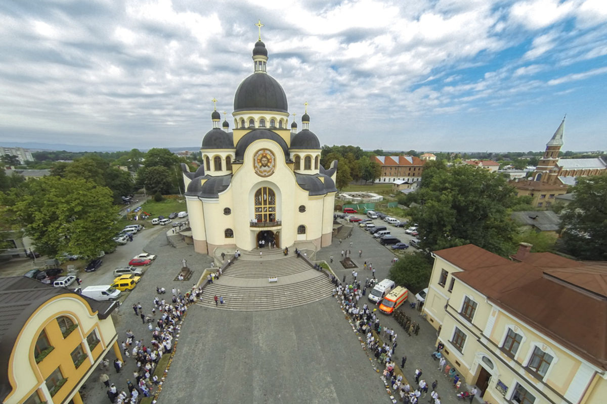
Architectural monuments that have survived to this day testify to the rich historical past of Kolomyia district. There are 54 buildings in the district's villages and towns that are valuable for their style, construction method, and use of local building materials.
- Church of the Annunciation (1587), wooden; Kolomyia. Kolomyia, 2 Karpatska St.
- St. Michael's Church (1864); Kolomyia, M. Hruhruyska str. Kolomyia, 11 M. Hrushevskoho str.
- City Hall (1877); Kolomyia. Kolomyia, Hrushevskoho str. 1
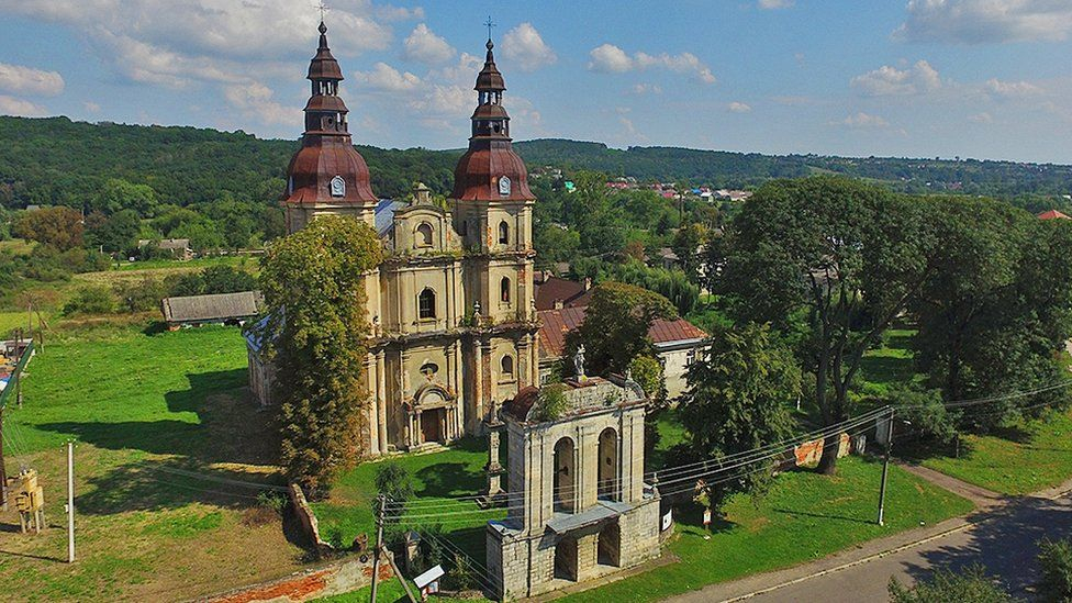
- Bernardine church (1725), cell, gate bell tower; Hvizdets village
- Church of St. Elijah (1855) in Hvizdets
- Church of the Assumption of the Blessed Virgin Mary (1905), Otynia village
- Bell tower and school (XVIII century), Pechenizhyn village
- Church of St. Michael (1794), Velyka Kamianka village
- Church of the Ascension and bell tower (1780), Strupkiv village
- St. George's Church and bell tower (1752), Babianka village
- Church of the Cathedral of the Blessed Virgin Mary (moved in 1864), Zaluchia village, N 48.48417 E 25.15671
- Church of the Assumption of the Blessed Virgin Mary in the village of Dzhurkiv (1810)
- Church of the Nativity of the Blessed Virgin Mary in the village of Nyzhniy Verbizh (1808)
- Church of St. Nicholas and bell tower in the village of Sidlyshche (1763)
- Church of the Ascension and bell tower in the village of Strupkiv (1780)
- Church of the Exaltation of Christ and bell tower in the village of Tsenyava (1808).
There are 140 archaeological sites in Kolomyia district, including a mound-burial ground of the Pchevorian culture in Velyka Kamianka village, an early Iron Age settlement in Vynohrad village, an Eneolithic and Trypillian settlement in Vorona village, a Trypillian settlement in Voskresyntsi village, and a Bronze Age settlement in Lisnyi Khlibychyn village. Geographical location, favorable ecology, a significant number of architectural monuments of different styles and epochs, preserved cultural traditions, famous art centers, interesting historical heritage define Kolomyia region as an attractive tourist destination.
Natural monuments
- Bila Krynytsia mineral water spring, Markivka village
- A 7-meter-high waterfall and the valley of snowdrops "Kropyvets", Molodyatyn village
- Knyazhdvir Yew Reserve, Knyazhdvir village
The greatest value of the reserve is the Berry Yew, a relic of the Tertiary period listed in the Red Book of Ukraine. Some trees reach a height of 10-12 meters, the oldest of which is over 500 years old.
Museums, theater
- Museum of Folk Art of Hutsul and Pokuttya, Kolomyia.
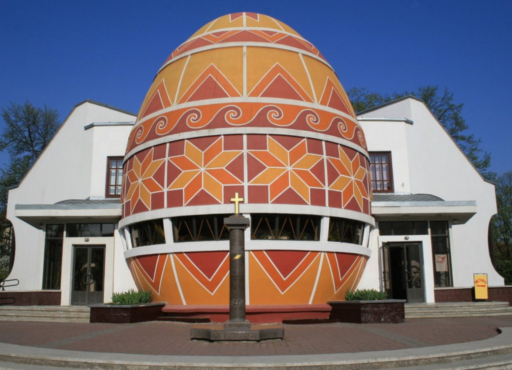
- Museum of Easter egg painting, Kolomyia.
- Kolomyia History Museum, Kolomyia.
- Private Ethnographic Museum of R. Yavorsky's Enlightenment, Kolomyia, 2 Blavatsky St., +38 (03433) 2-54-68.
- Oleksa Dovbush Museum of History and Local Lore. 9 Nezalezhnosti St., Pechenizhyn, 9, 9:00-16:00, SUN-SUN - weekends.
- Myroslav Irchan Museum. Pyadyky village, +38 (03433) 9-73-49, 9-72-48 (booking an excursion, school phone).
- Local History Museum of Carpathian Flora and Fauna on the territory of the Knyazhdvir Nature Reserve. To book a tour: +38 (03433) 2-48-10, 2-38-72.
- Kolomyia Regional Ukrainian Drama Theater named after I. Ozarkevych. Kolomyia, Vicheva Square, 7.


Які туристичні (пішохідні) маршрути проходять через/біля Kolomyia district?
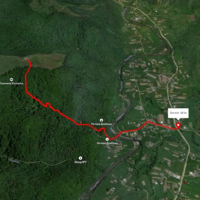
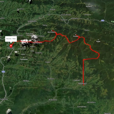
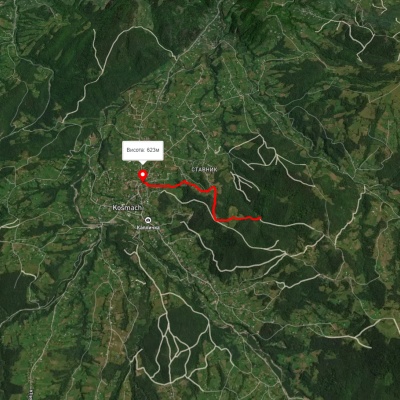
Пропонуємо пройти такі туристичні (пішохідні) маршрути через/біля Kolomyia district: Шешори - Росохата, с. Космач, через г. Ротило, г. Грегіт, г. Біла Кобила до с.Буковець, Дорога опришків, ур. Медвежий - г. Куратул, с. Микуличин, через г. Хорде, г. Ротило до с. Космач, с. Микуличин - г. Рокита