Tukholka


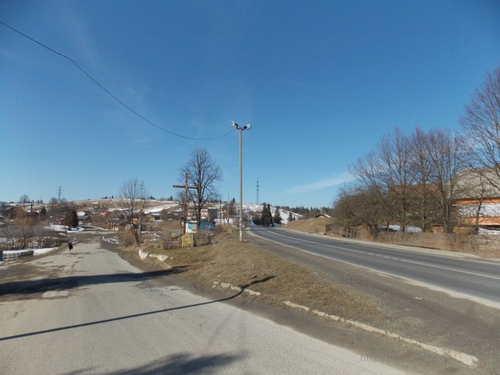
Before traveling to the wonderful small village of Tukholka (about a thousand inhabitants), take care of renting an apartment. The village is located in the valley of the Brynivka River, within the Eastern Beskydy, 20 km from the district center of Skole, Lviv region, a few kilometers south of the ski resort of Plai. The international highway Kyiv-Lviv-Chop passes by the northern part of the village, which has a turn to the village of Nahirne. A secondary road that stretches through the village starts from here. This road used to be the main international road that went through the village of Klymets, Veretsky Pass, the villages of Verbyazh, Zavadka, and Nyzhni Vorota. This road had steep slopes and has survived to this day. The new international highway has already been built through the north of Tukholka village and the villages of Nahirne, Dolynivka, Smozhe, Latirka, Bilasovytsia, Kotelnytsia, Tyshiv, Nyzhni Vorota. Although this route is longer, it has no steep descents or ascents. At the crossroads of these roads in the village of Tukholka there is a cross that was erected in honor of the declaration of independence of Ukraine as an independent state on August 24, 1991.
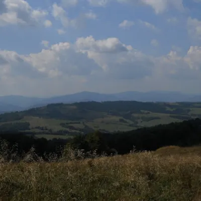
The village of Tukholka, like other Carpathian villages, is surrounded by mountains and meadows. To the north of the village is Mount Dolzhka (1056 m). It is on the slopes of this mountain that the slopes of the ski resort of Plai are located. To the east of Tukholka is a small mountain Koloska (867 m). From this peak stretches a meadow that separates Tukholka from the villages of Plavia and Khitar. There are several local peaks on this meadow, including Mount Solotvynia (815 meters). There are three rivers in Tukholka. Two rivers, Kopanina and Rostoka, originate in the south of the village and form the Brynivka River in the north of the village. The Brynivka River then flows through the village of Plavia and flows into the Holovchanka River, which flows into the Opir River near the village of Tukhlia.
The first mention of the settlement of Mala Tukhlia is found in the charter of Kostiantyn Ostroh in 1552. Oleksa Dovbush is said to have visited the village often. According to legend, the founders of the settlement were three men who fled from the Tatars from neighboring Tukhlia and settled here - hence the name Mala Tukhlia, Tukholka. The village of Tukholka is known for the fact that in Lviv, in the Shevchenkivskyi Hai park-museum, there is a house from 1910 from this village. This house belonged to the village elder F. Barna. It consists of two living quarters separated by a hallway. The right room is adjacent to the pantry. The walls of the Boyko's house are made of cut timbers, which are tied into a fishtail lock at the corners. The roof is gable and covered with shingles. The house is decorated with carvings based on traditional motifs: rosettes, floral and geometric ornaments. The author is I. Voloshyn. The house was recreated in the museum in 1974.
It is worth seeing in the village:
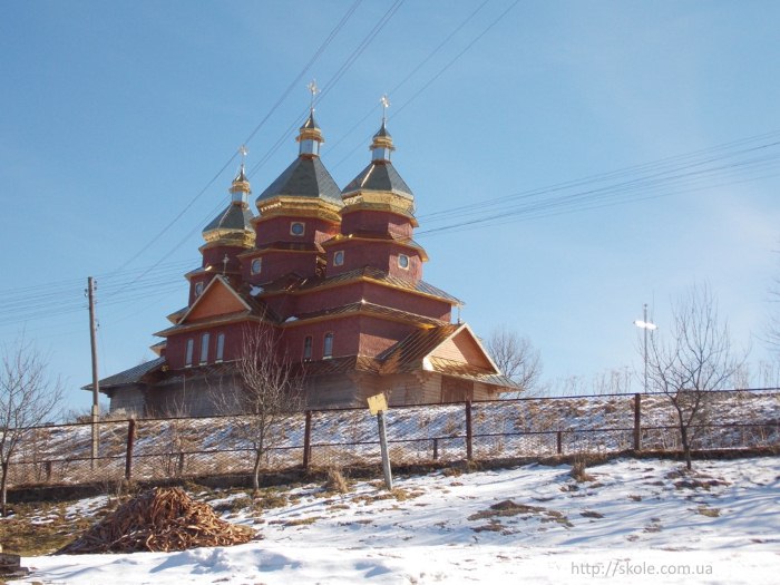
- The wooden Church of the Assumption of the Blessed Virgin Mary (1858/1845) with a bell tower (1862). The temple was built on the site of a burned church and today is a monument of Boyko wooden architecture. The three-story log church is built on a stone foundation.
- It is the oldest and largest maple tree in Ukraine (over 300 years old, over 5 m in diameter and 15 m high).
Tukholka village council (03251) 3-21-22.
Mountain Search and Rescue Service of Slavske village, 10 I. Franko str. +38 (03251) 4-21-02, +38 (097) 493-44-12.
There is a secondary school in the village.
There is a legend that has long been alive among the people there.
Tukhlia was attacked by the Tatars. They burned down the village and slaughtered everyone they could find. There was a big battle with them. Then some of the Tukhlya residents stayed in the old place, and three of them left. They walked through the mountains and forests and came here. They built a hut in the forest. And when winter came, they built a hut for all three of them. And they lived for three years. They lived in the Horishne end of the village, in Khashchokh. After three years, they wanted to build a house. Yeden crossed the stream, found a flat spot, and built a house there. The other two helped him because they were very happy to share everything.
At first, they lived on what they took from their storerooms of rye and oats. And then they started farming themselves. They knew how to grind grain. They would find a large stone and use a smaller one to grind the grain into flour. They knew how to make it. But there was no clay close enough to make pottery. So they came up with this idea: they made a wooden hylitya, spread out the ohyna, baked the stone until it was red, and then threw it into that vessel of water, added flour, and then boiled it, and that's how they cooked chyre. They made wooden bowls and spoons for the chyre.
The second one was built a little higher. We started thinking about cattle. All three of us decided to go see what was happening in Tukhly. We came to the woods, and there people were still farming in their places. They asked the Tukhly people for a cow. They gave them some, and they brought them here. They grazed in the log cabin during the summer, and in the winter they cut the grass (they didn't have scythes yet) and dried it.
They built the village downwards and named it Tukholka because they came from Tukhla.
It is said that Ivan Rosiv, Maksym Shmyhelskyi, and Petro Balandovych settled in the village first.
Що відвідати
Пам’ятки, музеї та цікаві місця поруч з Tukholka.
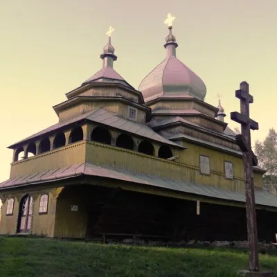 ЦеркваЦерква Успіння Богородиці, ТухолькаТухолькаменше 1 км від центруДерев'яна церква збудована у 1858 р. (за іншими даними у 1845 р.) поблизу дороги до села Климець, на невисокому хребті.
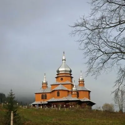 АрхітектураБогоявленська церква, ОрявчикОрявчик8,9 км від центруПід час відпочинку в селі Орявчик ви матимете можливість побачити чудові історичні пам'ятки архітектури, серед яких особливе місце займає Богоявленська церква з...
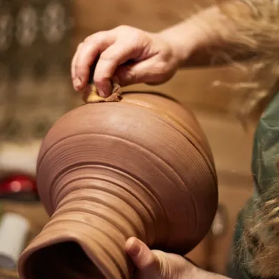 Ремесла й майстер-класиГончарня і кінні прогулянки «4 сезони», СлавськеСлавське11 км від центруКотеджний комплекс «4 сезони» у Славському відомий не лише дерев’яними будиночками, а й двома заняттями, які легко перетворюють звичайний відпочинок у горах на щось...
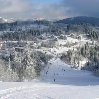 ПриродаУрочище ТисовецьТисовець11 км від центруНа перший погляд, урочище Тисовець - це звичайне равнинное простір, оточений Карпатськими горами. Але насправді - це один з найбільших гірничо-лижних курортів на...
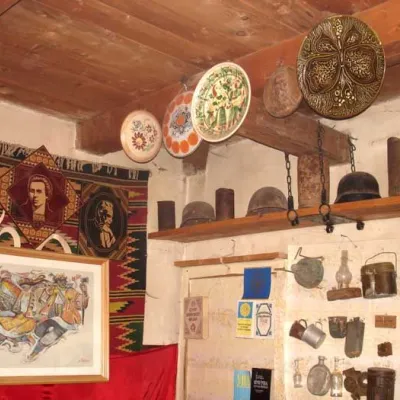 МузейМузей визвольної боротьби Юрія Микольського, СлавськеСлавське13 км від центруЦікавий туристичний об’єкт, який не залежить від пори року, наявності або відсутності снігу, знаходиться у Славському на вулиці Січових Стрільців, 2 - карпатський...
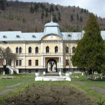 АрхітектураПалац Гредлів, СколеСколе22 км від центруЗахоплює своєю сакральною архітектурою Палац Гредлів. В парку зараз зростають рідкісні види дерев, що перебувають під особливою охороною, зокрема: гінго дволопатеве,...
Крафт поруч
Усі крафтові місця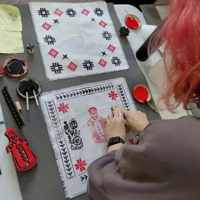 Ремесла й майстер-класиМайстер-клас «Бойківська вибійка на тканині», СлавськеСлавське12 км від центруМайстер-клас «Бойківська вибійка на тканині» проводить майстриня Наталія Горбонос-Акастьолова в Центрі бойківської культури при готелі «Karpaty.Slavsko».
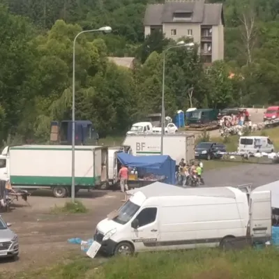 Ринки й ярмаркиП'ятничний ринок, СлавськеСлавське12 км від центруП'ятничний ринок у Славському — справжній гірський базар Бойківщини, куди щотижня з'їжджаються продавці й покупці з навколишніх сіл Сколівських Бескидів.
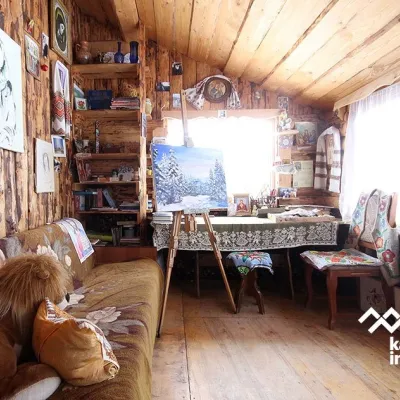 Ремесла й майстер-класиХудожня галерея «Вікторія», СлавськеСлавське12 км від центруСлавська художня галерея «Вікторія» — невелика родинна галерея-майстерня, де мистецтво живе не за склом, а в домашній атмосфері дерев’яної садиби.
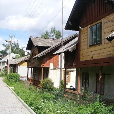 Етнотури та гідиЕкскурсії «Барви Карпат», СлавськеСлавське12 км від центру«Барви Карпат» — невеликий місцевий організатор екскурсій зі Славського, одного з найвідоміших курортів Сколівських Бескидів.
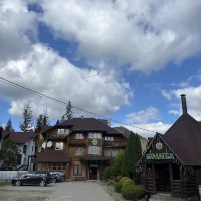 Колиби й гуцульська кухняКолиба «Смерекова хата», СлавськеСлавське13 км від центруКолиба «Смерекова хата» — етноресторан однойменного готельного комплексу на в’їзді до Славського, однієї з найвідоміших гірських місцевостей Бойківщини.
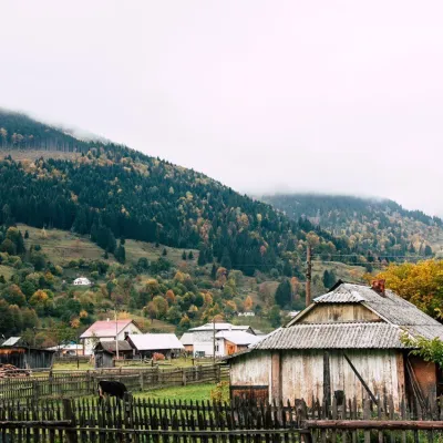 Сироварні та полониниСироварня Біласовиці, БіласовицяБіласовиця17 км від центруСироварня Біласовиці — невелика родинна сироварня в закарпатському селі Біласовиця, що лежить на висоті близько 600 метрів над рівнем моря біля підніжжя Пікуя.
Де зупинитися
Готелі, садиби й котеджі в Tukholka та околицях.
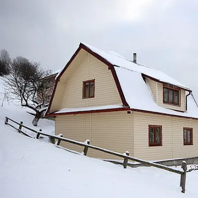 СадибаСадиба "КАРПАТСЬКЕ ДЖЕРЕЛО - ПЛАЙ" ТухолькаТухолькаменше 1 км від центруСаунаМангалКухняПоруч: церква Успіння Богородиці 900 мг. Тростян 8,0 км
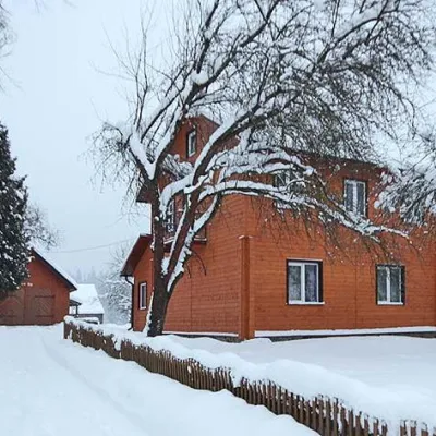 СадибаСадиба "Гірська соната" ТухолькаТухолькаменше 1 км від центруСаунаWi‑FiТрансферПоруч: церква Успіння Богородиці 900 мг. Тростян 8,0 км
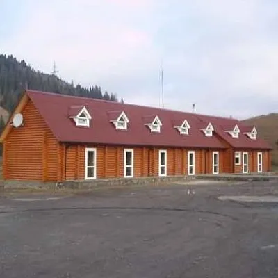 ГотельГотель "Форест" (DREAM FOREST) ТухолькаТухолькаменше 1 км від центруСаунаСніданокМангалПоруч: церква Успіння Богородиці 900 мг. Тростян 8,0 км
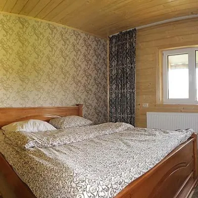 Котедж"Будиночок На Щастя" ТухолькаТухолькаменше 1 км від центруСаунаМангалКухняПоруч: церква Успіння Богородиці 900 мг. Тростян 8,0 км
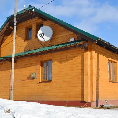 СадибаСадиба "Ласочка" ТухолькаТухолькаменше 1 км від центруБасейнСаунаМангалПоруч: церква Успіння Богородиці 100 мг. Тростян 8,4 км
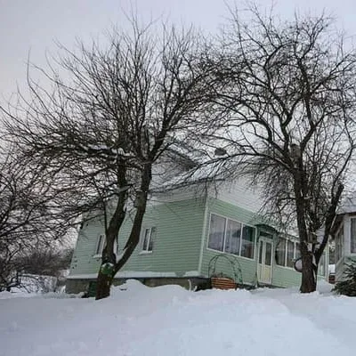 ГотельКарпати кличутьПлай2,5 км від центруСадиба "Карпати кличуть" представляє собою двоповерховий будинок в якому можна відпочити як з сім'єю, так і в компанії друзів або дружному робочому колективі.Поруч: церква Успіння Богородиці 3,4 кмБогоявленська церква 7,2 кмвід 1 100 грн за ніч
Маршрути поруч
Всі маршрути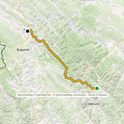 СкладнийБагатоденнийМаркований№505 Тухля ТуркаПрофіль висоти530–1 184 м56,9 кмнабір 1 686 м7,7 км від центру
 СкладнийДводеннийс. Тухля до смт. Славськечерез г. МаківкаПрофіль висоти521–1 090 м23,2 кмнабір 1 063 м≈ 8 год ходу8,4 км від центру
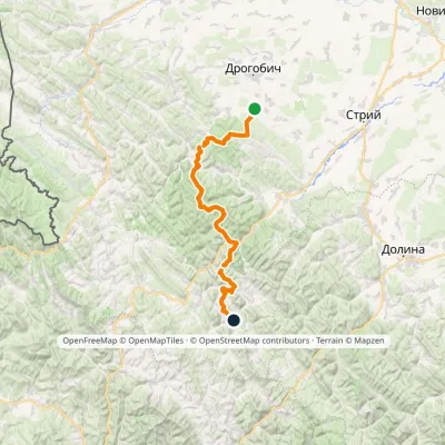 СкладнийБагатоденнийМаркований№504 Трускавець СлавськоПрофіль висоти349–1 168 м88,5 кмнабір 3 915 м8,6 км від центру
Вершини поруч
Всі вершини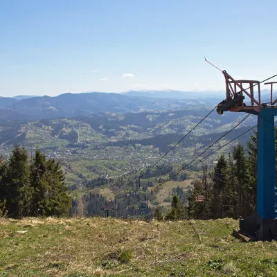 ВершинаГора ТростянСлавськевисота 1 232 м · масив Сколівські Бескиди8 км від центруТростян — вершина в масиві Сколівських Бескидів, у Львівській області, на захід від селища Славське. Це одна з найвідоміших гір Львівщини: на її схилах розташований...
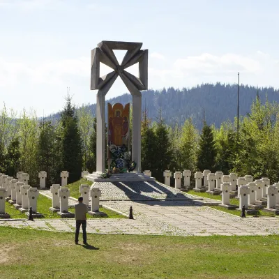 ВершинаГора МаківкаСлавськевисота 958 м9,7 км від центру1 маршрут на вершинуМаківка — гора у Високому Бескиді приблизно за 8 км на північ від смт Славське Львівської області. Її висоту зазвичай подають як 958 м; у даних OpenStreetMap для...
 ВершинаГора ЯвірникВерхнячкависота 1 120 м · масив Боржава12 км від центру16 маршрутів на вершинуЯвірник Великий (1120) - гора, яка розташована на межі Львівської та Закарпатської областей. Чи є там популярні маршрути, ще не знаємо.
