Vinogradov
Vynohradiv (until 1946 - Sevliush, Syvliush) is a city of district significance in the Zakarpattia region. Vynohradiv is the administrative center of a large agricultural district, connected by a network of railways and highways to other cities in the region. The proximity to the border with Hungary and Romania (no more than 15-20 kilometers) facilitates close contacts with foreign investors.
The city is located in the southern part of the Zakarpattia region, under the inner volcanic belt of the Eastern Carpathians, in the Zakarpattia lowland, where the Tisa divides this belt into western and eastern parts. The town is located on the right bank of the Tysa River at the foot of the Black Mountain (570 m above sea level), which was once an active volcano before the advent of man; its shape, extinct craters and scattered large stones - volcanic bombs - are evidence of this.
The distance to the regional center (the city of Uzhhorod) is 108 km, to the border with Hungary - 16 km, to Romania - 10 km, to Slovakia - 80 km, to Poland - 110 km.
Modern Vynohradiv fully deserves its name. The slopes of Chorna Hora are covered with vineyards, orchards give peaches, apricots and wine berries every summer, and the city's alleys and streets are planted with sakura, chestnuts and magnolias. The luxurious and generous nature has long attracted both settlers and tourists.
The name of the city directly alludes to another wealth of the region: grapes and wine. Many tourists dream of visiting the old wine cellars on the southern slopes of Chorna Hora of the Vinohradiv winery. Here, in the 350-meter-long underground corridors, the heady gold of Sevliush is stored in oak barrels .
Architectural objects:
- Ugochansky Kankiv Castle, 13th century, in the city of Vynohradiv, which once controlled the salt route along the Tisza. Now it is in ruins. Learn more about the castle on the website at the link "Vynohradiv Castle".
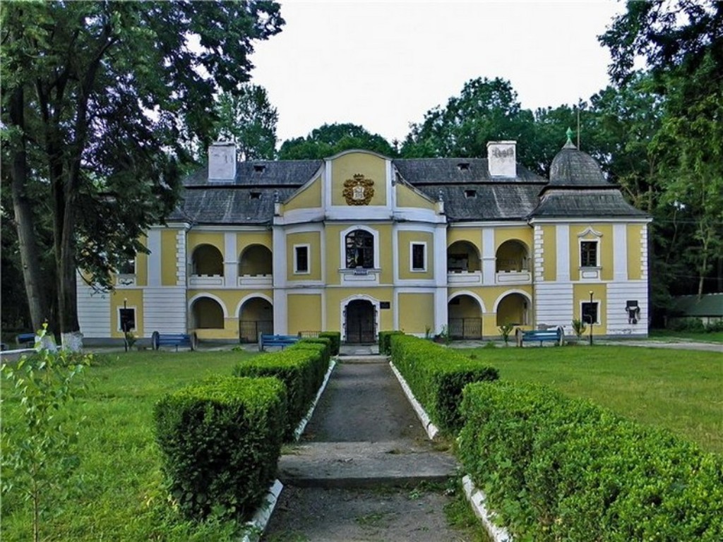
- Park and palace of the Pereni family, 16-18th centuries. Formerly part of the city fortifications, later rebuilt into a residential residence, now the education department.
- Church of the Ascension, 13th century. In historical times, in addition to its spiritual mission, it served as a defense tower, and its bell tower as a watchtower.
- Franciscan monastery, known since 1516. The Franciscan chapel in the monastery wall.
- Nyalab Castle in the village of Korolevo. The first riddle about the castle appeared in Hungarian chronicles in 1279. For more details, see the link "Royal Nyalab Castle".
- Greek Catholic Church in Vynohradiv (1796)
- The building of the former synagogue, Vynohradiv (XIX century).
- Wooden church in the village of Novoselytsia, 1669
- TheReformed church of the village of Shalanky was built by the Roman Catholic community in the fourteenth century and is one of the oldest in Transcarpathia. A congress of rebellious smokers led by Ferenc Rákóczi II in 1711 during the liberation war against the Habsburgs took place on the territory of the church.
- Greek Catholic Church of St. Michael the Archangel, 1790, Velyki Komyaty village
- Church of St. Peter and Paul, 1797, village of Tekovo
- The salt warehouse or Salt House in the village of Vylok, the main historical building of the fifteenth century. Salt has been the strategic raw material of our region for as long as civilization has existed here. From the mines of Solotvyno, it was transported to Europe by carts on roads and boats on the wayward Tisza River. The "salt route" was guarded by a number of castles and fortifications, which today are mostly ruins.
- Church of St. Helen, 1788, Vylok village
Sculptures:
- A fountain monument with a virgin girl crushing grapes with her feet in the center of Vynohradiv.
- Monument to a winemaker, Vynohradiv
- Monument to a bicycle, Vynohradiv
- Monument to Turul, between the village of Vylok and the village of Tisobiken (1906)
- monument to the pig and the doctor in the village of Botar
- sculpture of the guardian angel of the city, installed in front of the city council building
- St. Francis Chapel, in front of the Franciscan monastery in Vynohradiv.
- The memorial sign "Royal Tetra-Gospel".
A walk through Vynohradiv should start in its center, where the majestic Ascension Church of the XV-XVI centuries is located in the park between Myru and Shevchenko streets. In the XVI century, the church was at the epicenter of the confrontation between Protestants and Catholics. The temple passed from hand to hand and was repeatedly destroyed until it was finally taken over by the Catholics in 1690. Later, the church was destroyed again, this time by fire, when in August 1717, the Crimean Tatars captured Vynohradiv for two days. Subsequently, in 1748, at the expense of Bishop Eger Barkoczi, the church was rebuilt and handed over to the Catholic community of the city. A bas-relief of the bishop's coat of arms has been preserved on the church's facade. Another reconstruction of the church took place in 1889. The architecture of the church combines elements of Romanesque and Gothic styles with a predominance of the latter.
Continue your walk along the square in the city center to the monument to Soviet soldiers. On the left is the building of the district administration. In front of it is the symbol of the Vynohradiv district, a bronze figure of a guardian angel holding the coat of arms of the Ugochansky comitat. It is a Spanish-shaped shield with a bunch of grapes and a fish on top, an oak branch with an acorn and a crayfish below. In the center is a lion - the family coat of arms of the feudal lords of Pereni. Then you should move in the same direction and you can see the Church of the Assumption of the Blessed Virgin Mary, which was built in 1815.
The tour should be continued to the ruins of the Kankov Castle. To do this, turn left at the intersection, and after a hundred meters - right, to Kotsiubynskoho Street, which leads to the walls of the fortress. From the top of the castle, you can enjoy a magical view of the city and the Tisza valley.


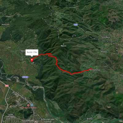
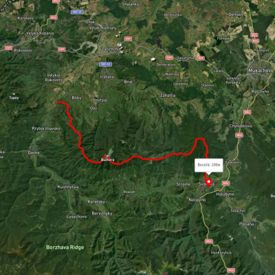
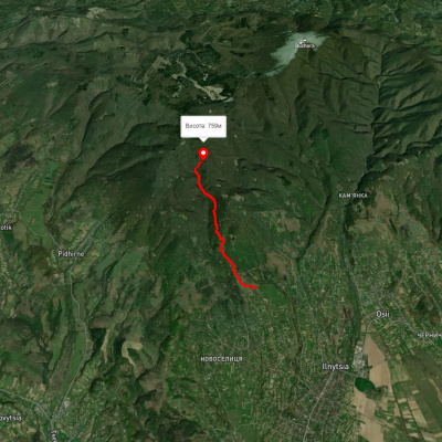
Які туристичні (пішохідні) маршрути проходять через/біля Vinogradov?
Пропонуємо пройти такі туристичні (пішохідні) маршрути через/біля Vinogradov: Шлях Пинті, с. Луково, через г. Бужора до м. Свалява, Новоселиця – Смерековий камінь, Підгірне – Чорне багно - Купінкувате, с. Кушниця, через Полонину Кук, г. Широкий Верх, г. Жид-Магура, г. Великий Верх, г. Плай до смт. Воловець, с. Керечки, через г. Стій, г. Великий Верх, г. Гемба, г. Жид-Магура до с. Ричка