Voronenko
The village of Voronenko is located at an altitude of 850 - 950 m above sea level in the Polyanitska amalgamated community of Nadvirna district, Ivano-Frankivsk region, which is located in southwestern Ukraine. This picturesque village is surrounded by vast mountain ranges, making it an ideal place for lovers of outdoor activities and nature.
The history of Voronenka begins with the construction of the Church of the Nativity of the Virgin Mary in 1600, which was completed in 1605. Later, this church was transferred to Vorokhta, which still exists today.
If you like outdoor activities, the village of Voronenko offers many opportunities for you. Here you can go hiking, cycling and horseback riding, as well as enjoy walks in the mountains and forests.
On the southern outskirts of the village, under the Kukul ridge, the Parajin stream, a tributary of the Prut river, originates. On the southwestern outskirts of the village, the Prutets stream, a tributary of the Prut river, has its source.
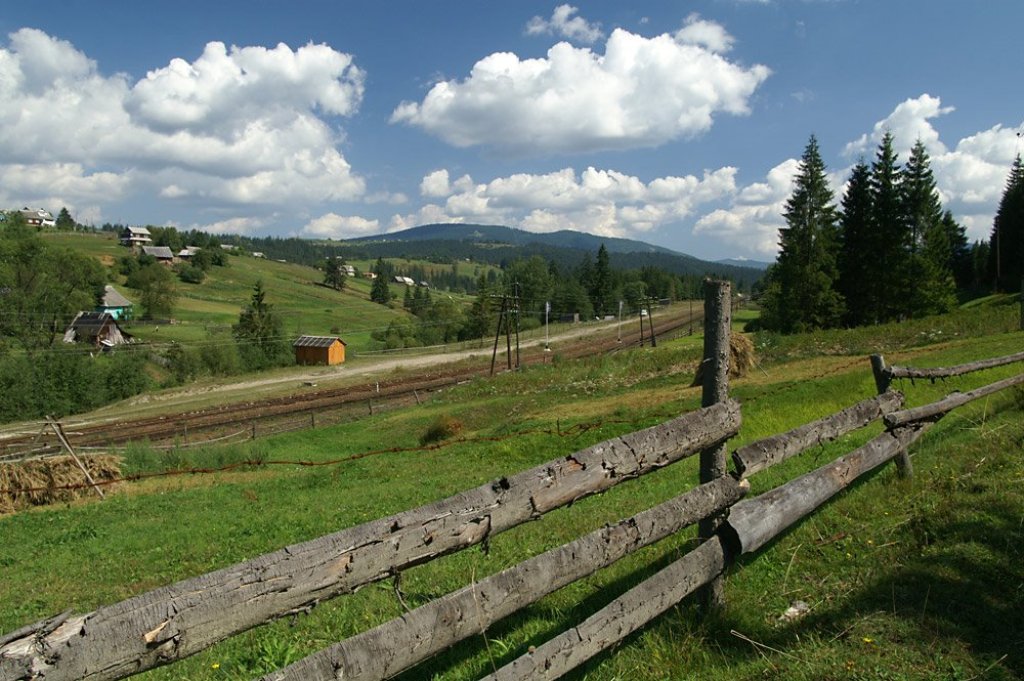
The Voronenko railway station is located in the village, the last one in Ivano-Frankivsk region before the railway tunnel to Zakarpattia.
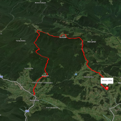
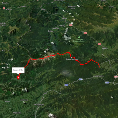
Hiking routes from the village Voronenko
There are many hiking routes from Voronenko village that allow you to enjoy the beauty of nature and conquer the peaks. Here are some popular routes that you can take starting from Voronenko:
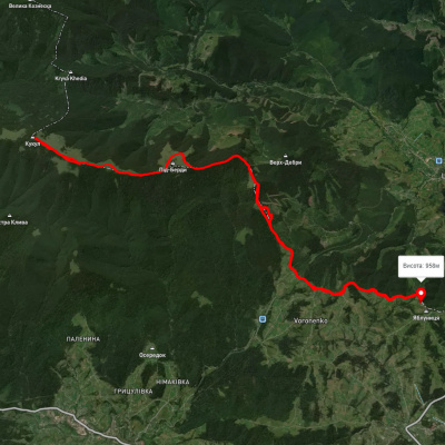
с. Voronenko village, via Kukul town. Kukul to Kryvopillia village
с. Voronenko village, via Mt. Kukul, Hoverla, Pip Ivan Chornohirsky to Iltsi village
с. Voronenko village, via Mt. Kukul, Mt. Hoverla, Mt. Pip Ivan Chornohirsky to the village of Zelene
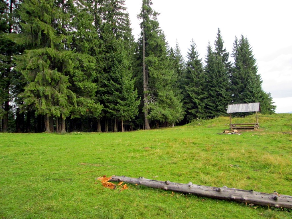
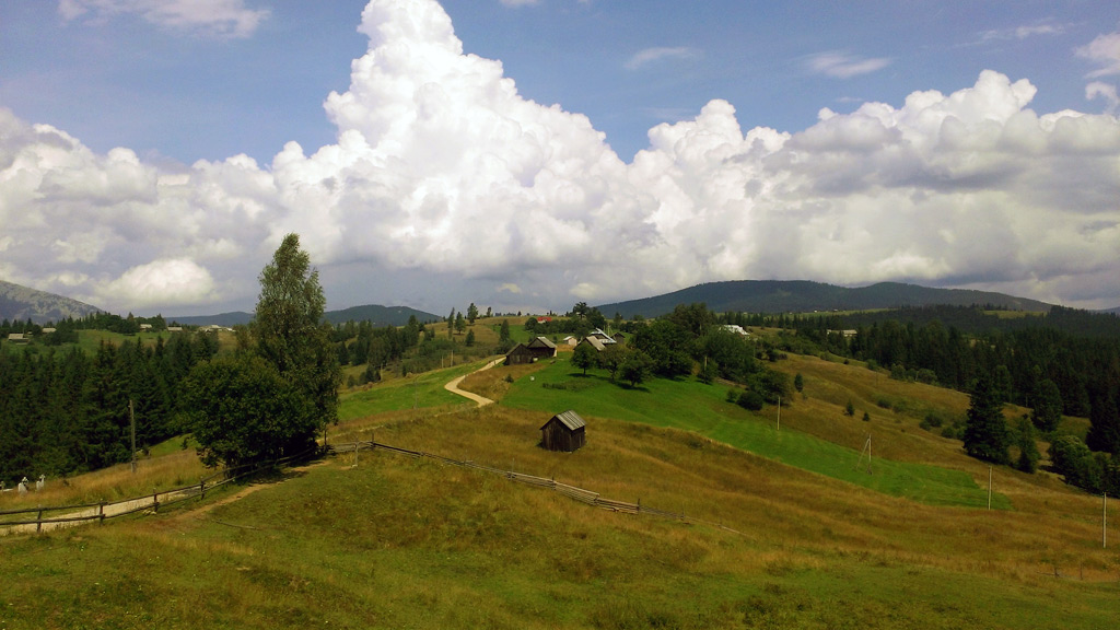
The most popular route to Mount Kukul begins in the village of Voronenko, which is located near Vorokhta. It is considered the easiest because of the smooth elevation and short distance - about 12 kilometers. The first tract on your way is the Prypir tract. This place is well suited for the pass, because there is a place to rest: a table and benches under cover. Moving on, you will come across the Bukovyna meadow, where there are huts, a good place for tents, and a spring where you can replenish your drinking water. However, most tourists know this meadow because of the swing attached to the tall trees. Then the route will lead you to the Hryhorivka meadow. From here you can perfectly see the famous Carpathian two-thousanders - Mount Petros and Hoverla. After that, climbing up, you will come across the Serednya meadow, where there are also a couple of Hutsul huts. And further along the route, after a small rise, you will reach the Kukul ridge. The highest point of the ridge is Mount Kukul.
How to get there?
Voronenko village can be reached by train from Lviv to Rakhiv or by bus from Ivano-Frankivsk to Verkhovyna.
Getting there by car is faster and more convenient. Get to Ivano-Frankivsk and then take the H-09 road to the village of Vorokhta. There, follow the sign to the village of Voronenko and drive about 5 kilometers further.


Які туристичні (пішохідні) маршрути проходять через/біля Voronenko?
Пропонуємо пройти такі туристичні (пішохідні) маршрути через/біля Voronenko: с. Вороненко – г. Кукул – с. Вороненко, смт. Ворохта, через г. Кукул до с. Яблуниця, с. Вороненко, через г. Кукул, г. Говерла, г. Піп Іван Чорногірський до с. Зелене, с. Вороненко, через г. Кукул до с. Стаїще, с. Микуличин, через г. Хорде, г. Пожижевська, г. Говерла, г. Кукул до с. Вороненко, с. Вороненко - пол. Озірна